So my friend Miguel and I set out before dawn to drive into Yellowstone National Park from Cody. We had planned to spend several nights camping, and had only a basic sketch of our plans, aside from our first outing.
Yellowstone
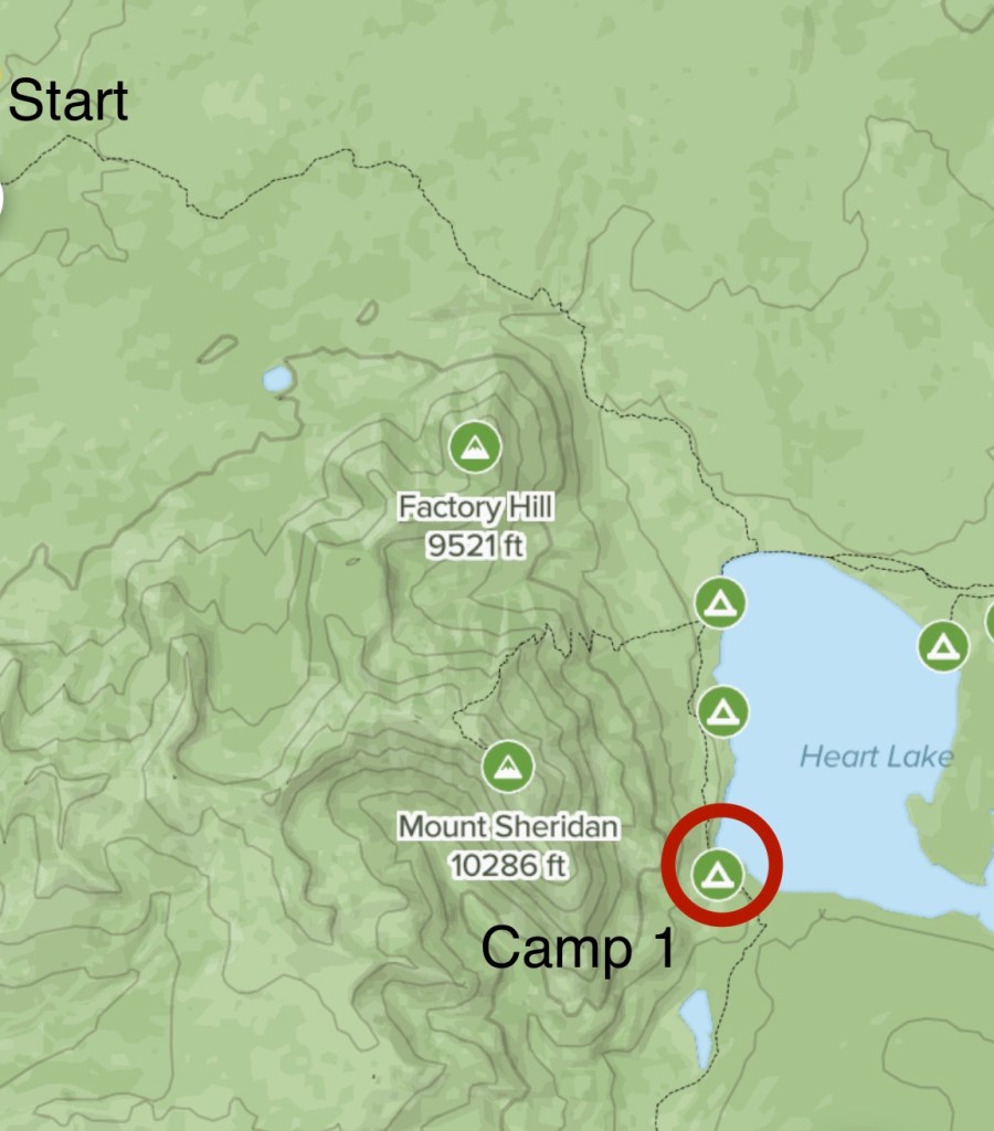
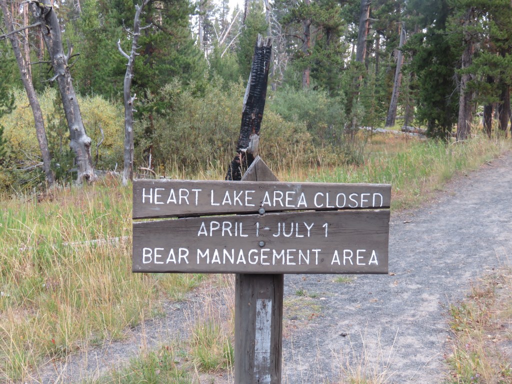
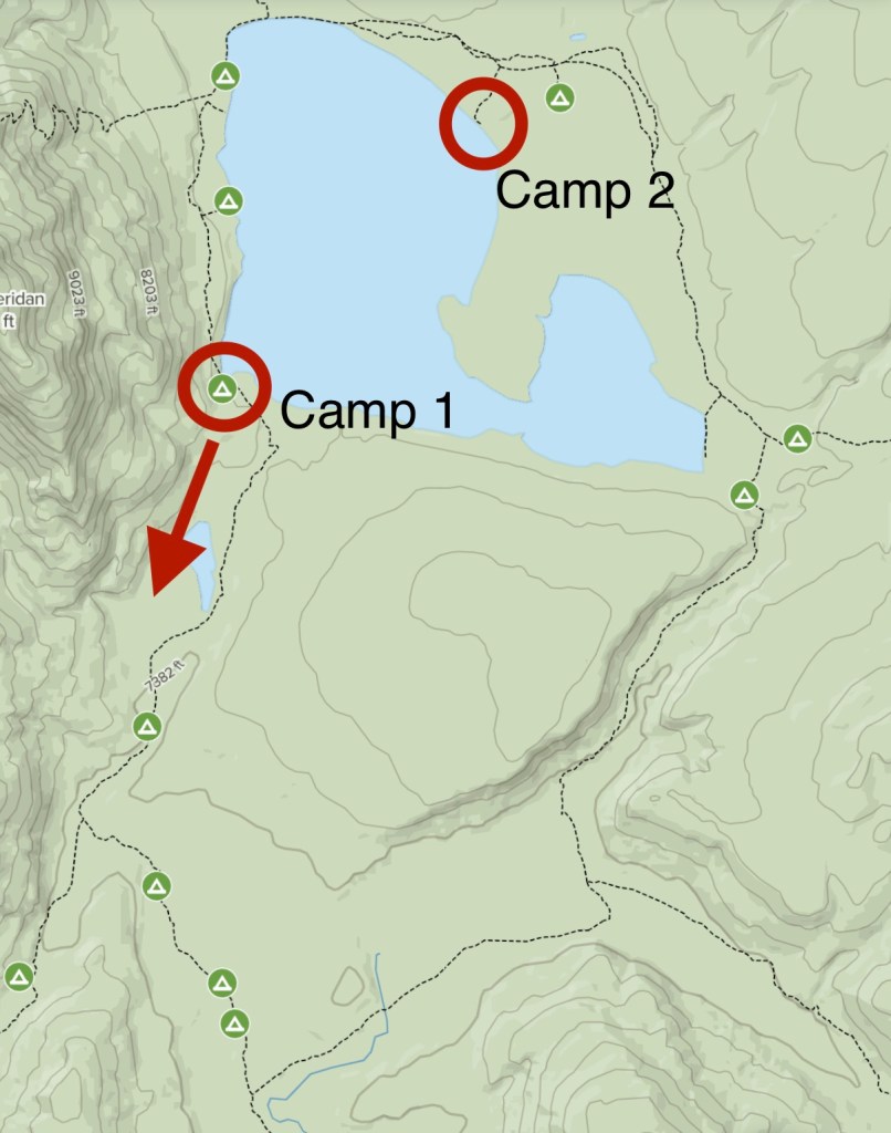
We planned to hike out to Heart Lake, in the southeastern part of Yellowstone, complete a wide circle around the lake, and then hike back out to the trailhead, over three days.
To camp in the backcountry in Yellowstone, you need to call (or go to the office in-person, when there isn’t a pandemic) for a permit no earlier than two days before your trip, for a very affordable $3 per person per night. We had secured permits for two campsites, on either side of the lake.
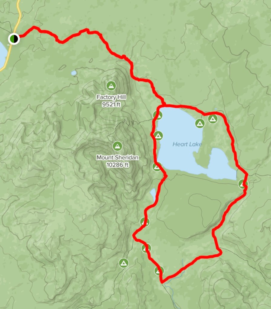
We initially planned to drive in through the northeast entrance to Yellowstone – my favorite area – and circle all the way around before getting to the trailhead. However, a wildfire near Shoshone Lake intermittently closed the only road connecting the north and south of the park, so we decided to take the shorter way in, through the east entrance, and set out hiking early.
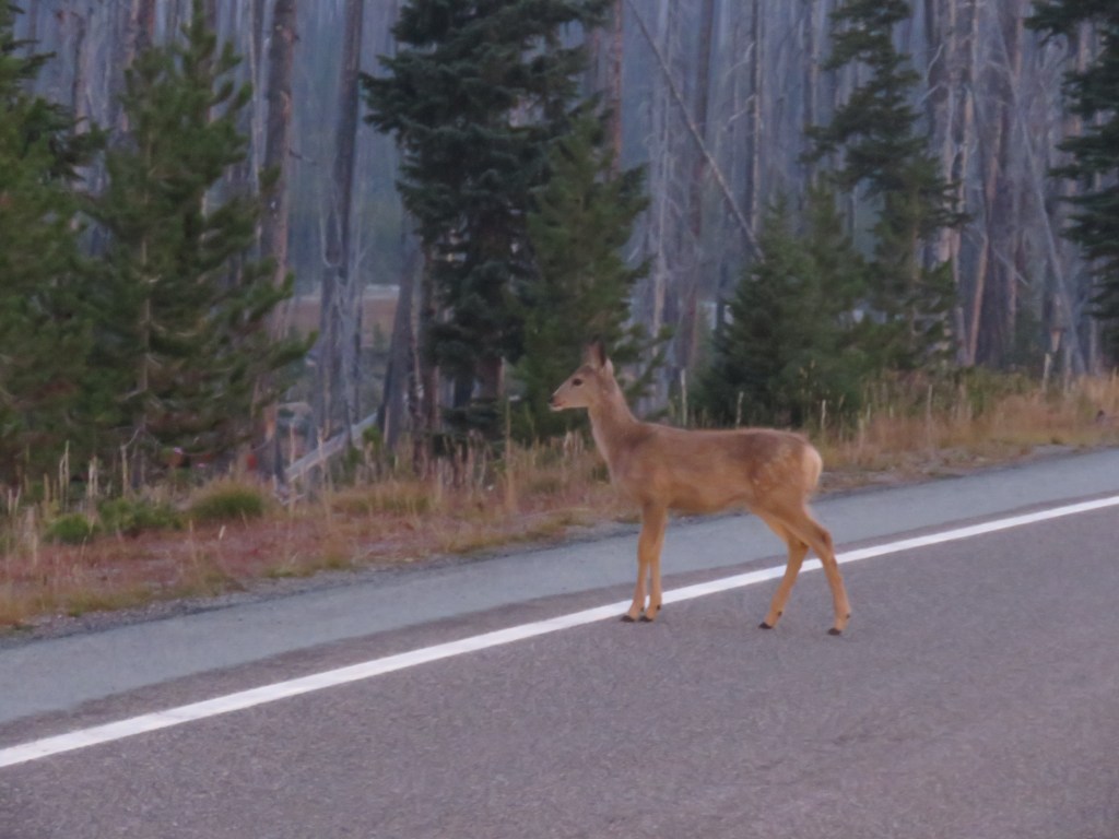
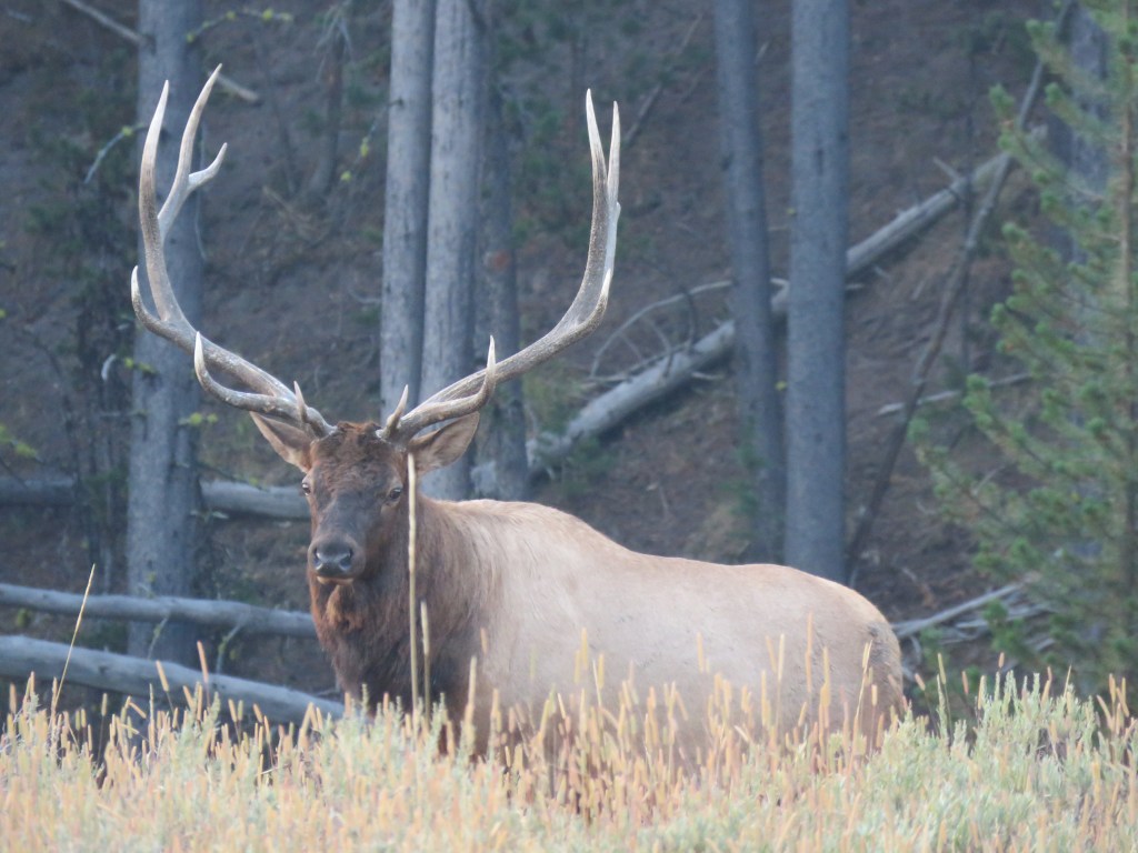
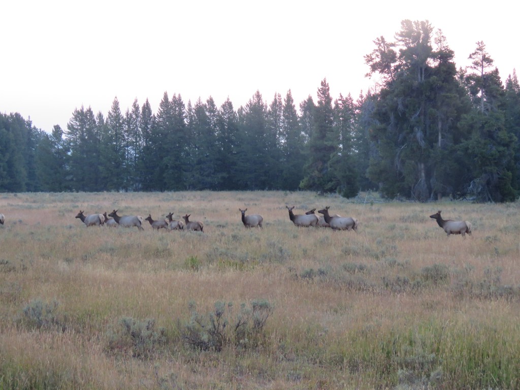
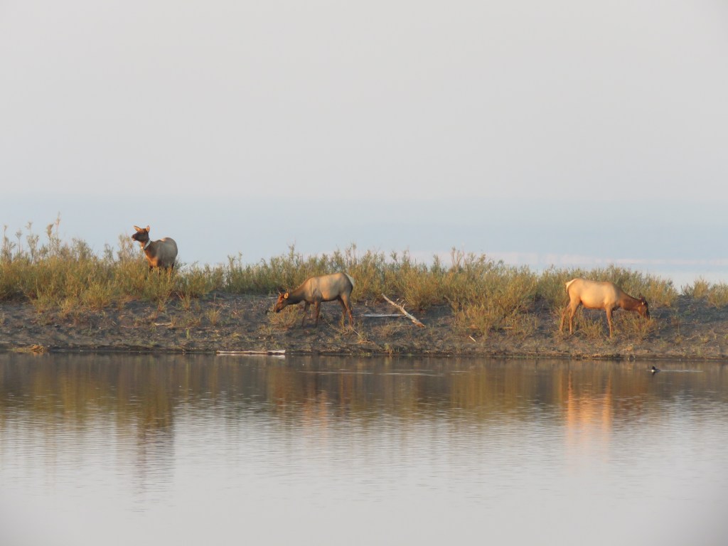
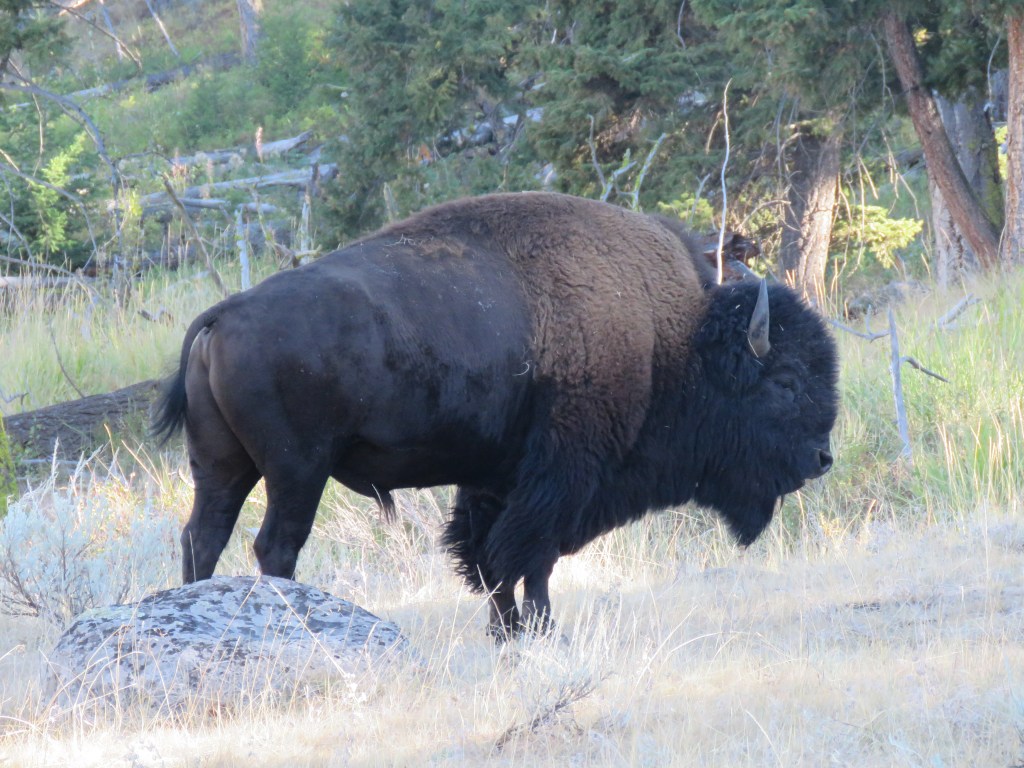
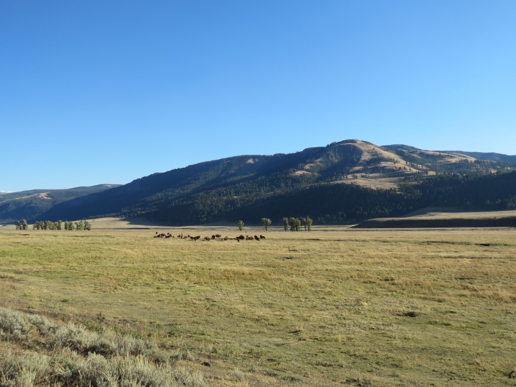
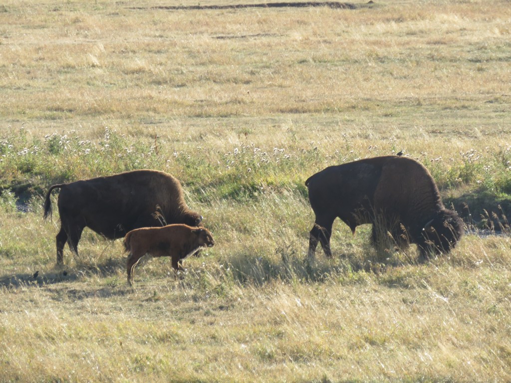
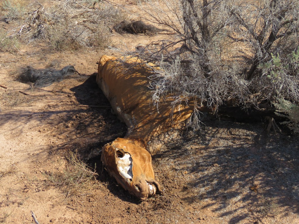
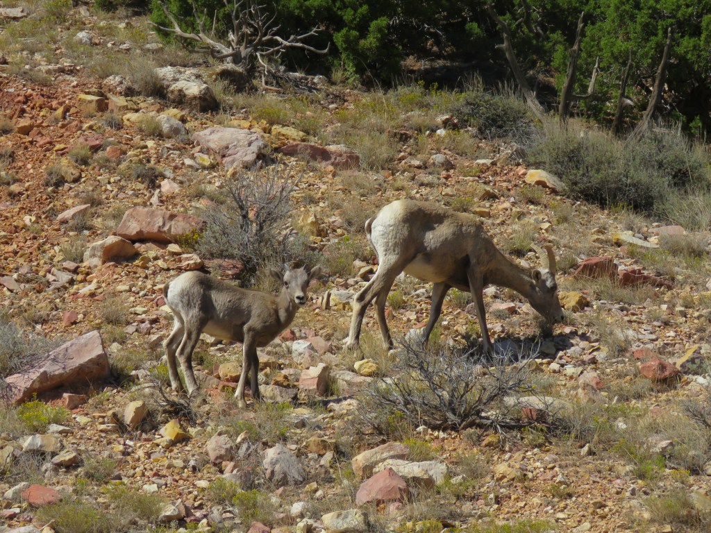
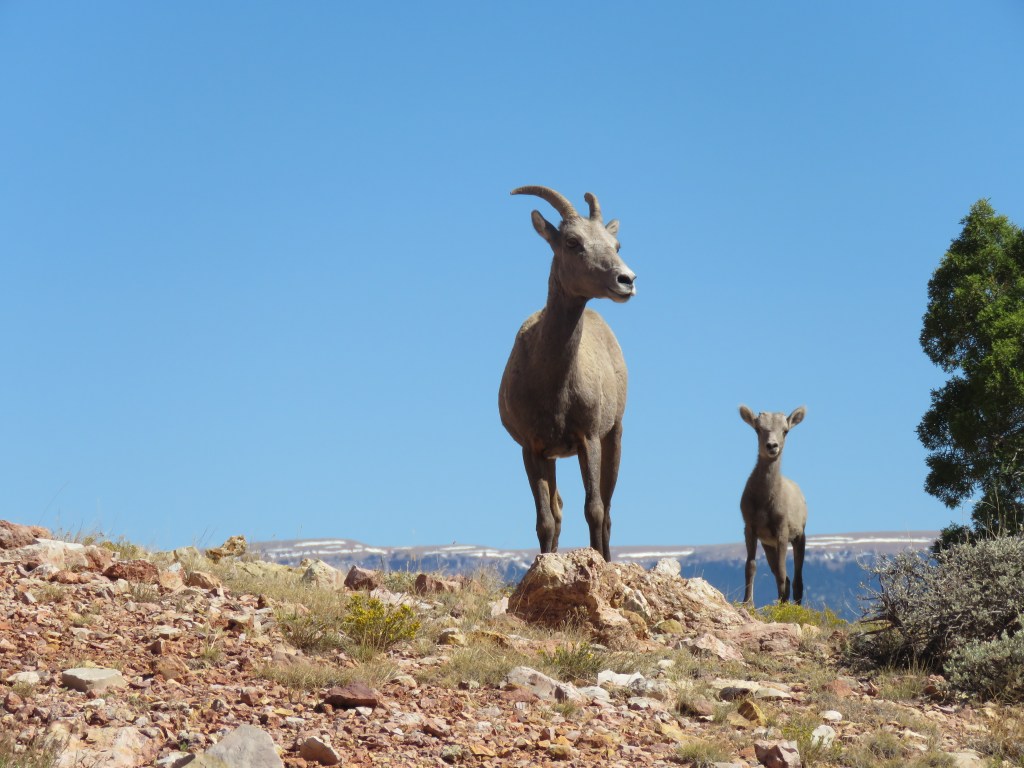
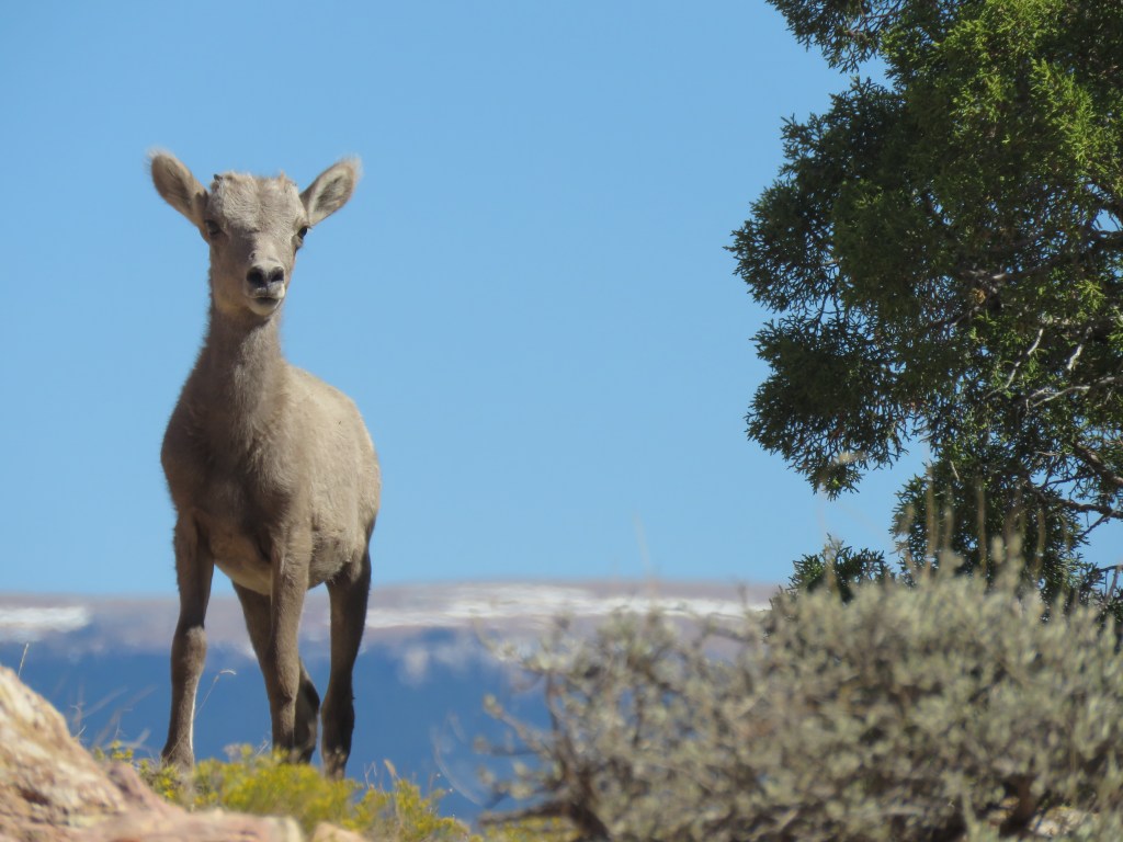
We ran into some wildlife on the way around Yellowstone Lake.

We reached the trailhead, and after getting our gear situated, we set out around 8:45am.

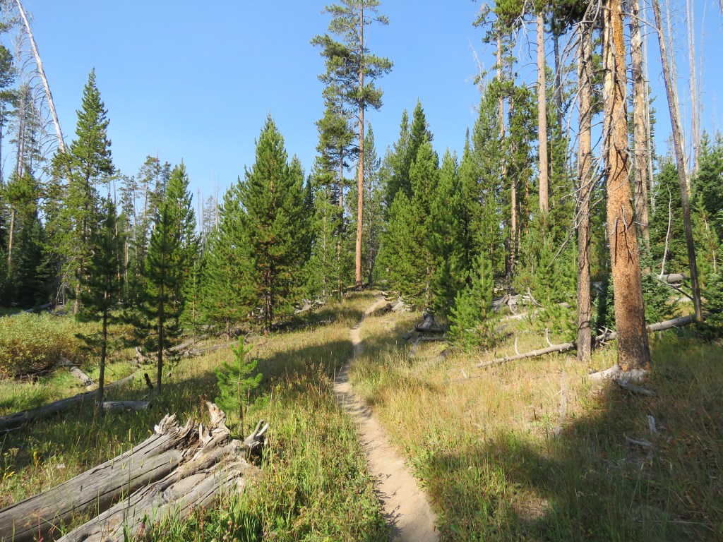
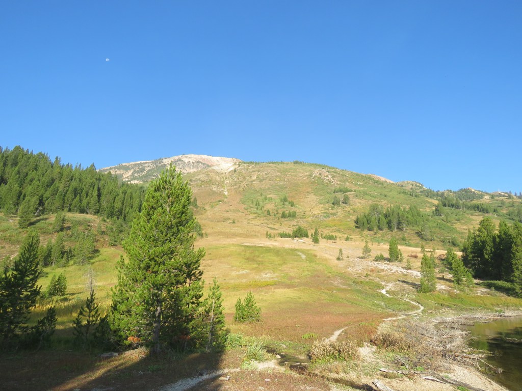
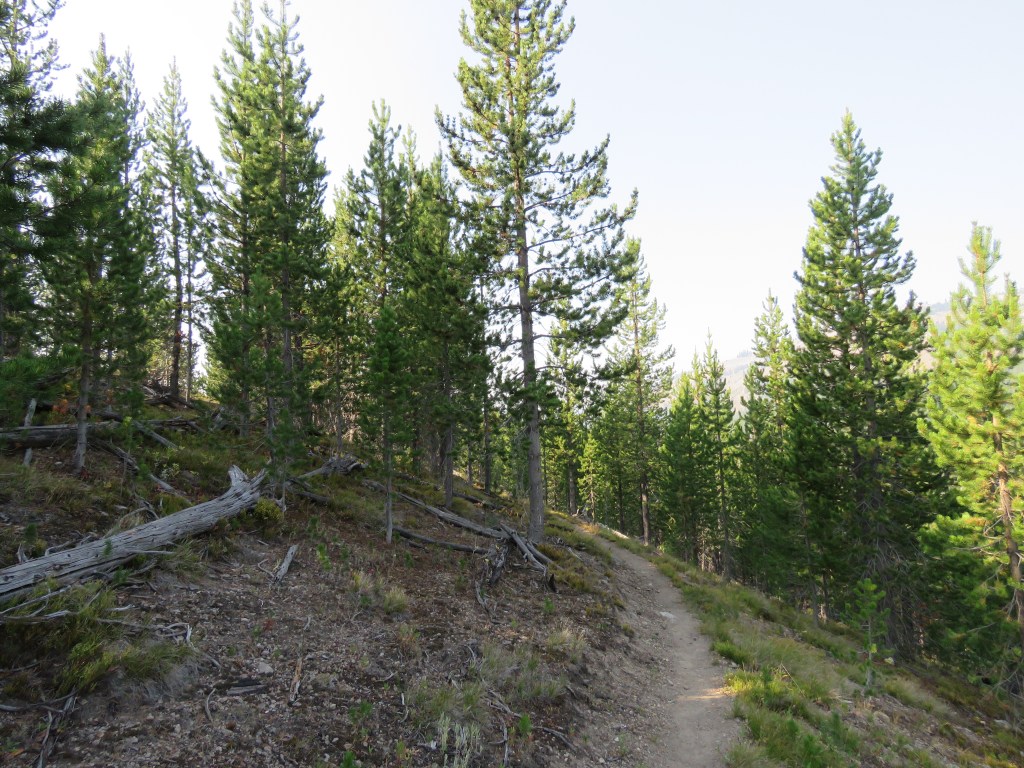
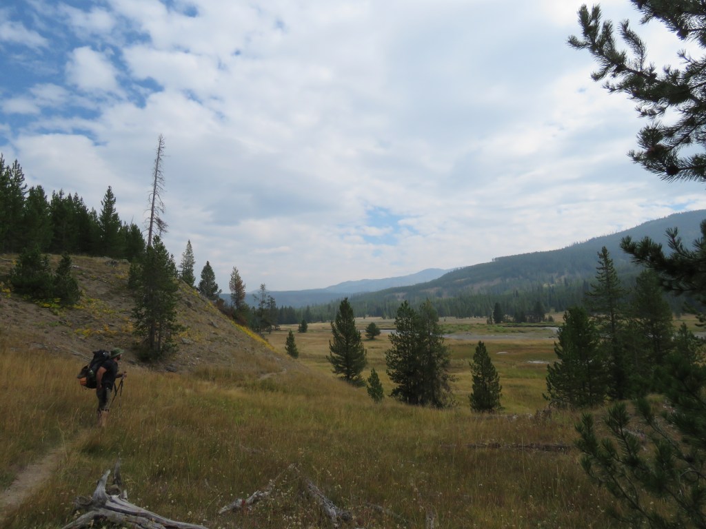
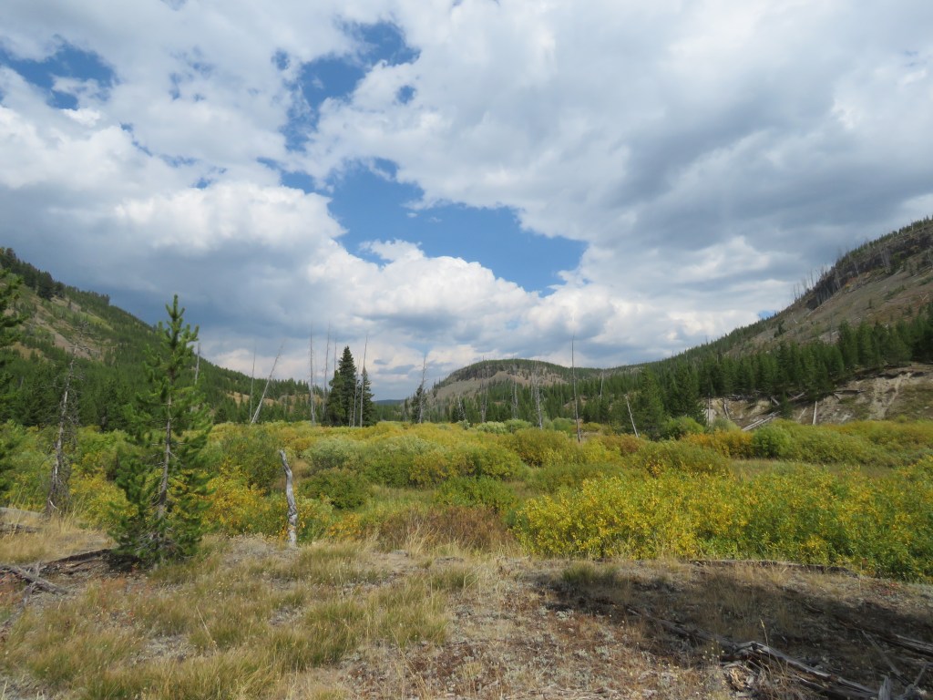
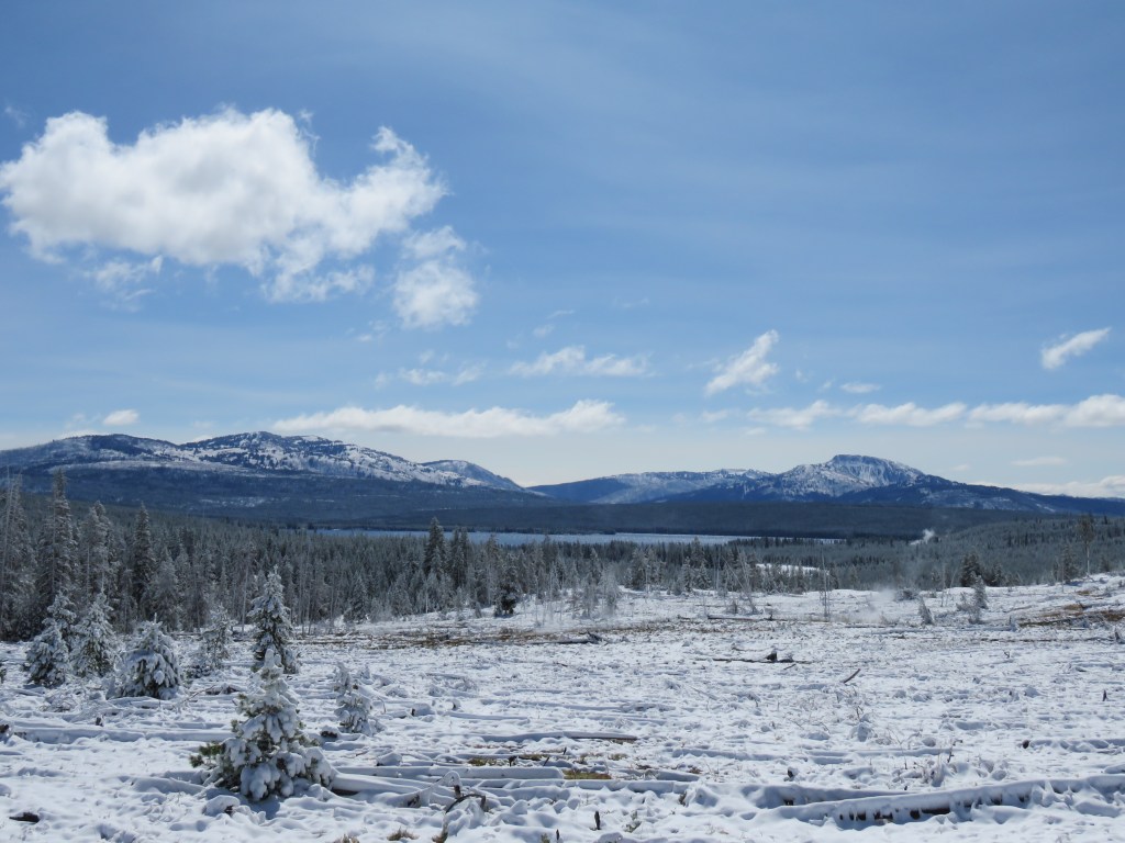
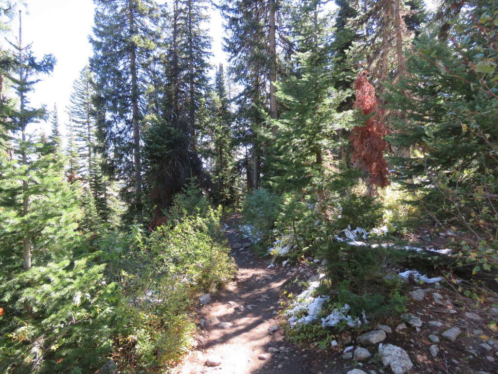
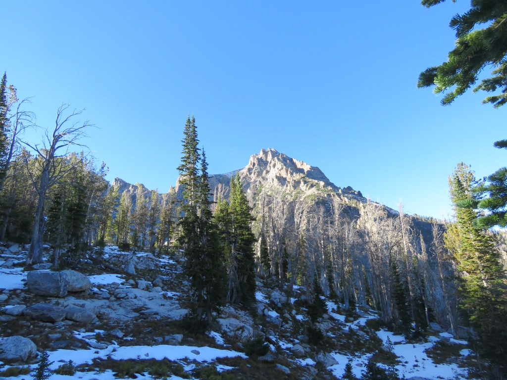
The walk through the forest revealed a history of wildfires, with large portions populated by young pine trees, and others with cleared areas and burned out trees from years ago.
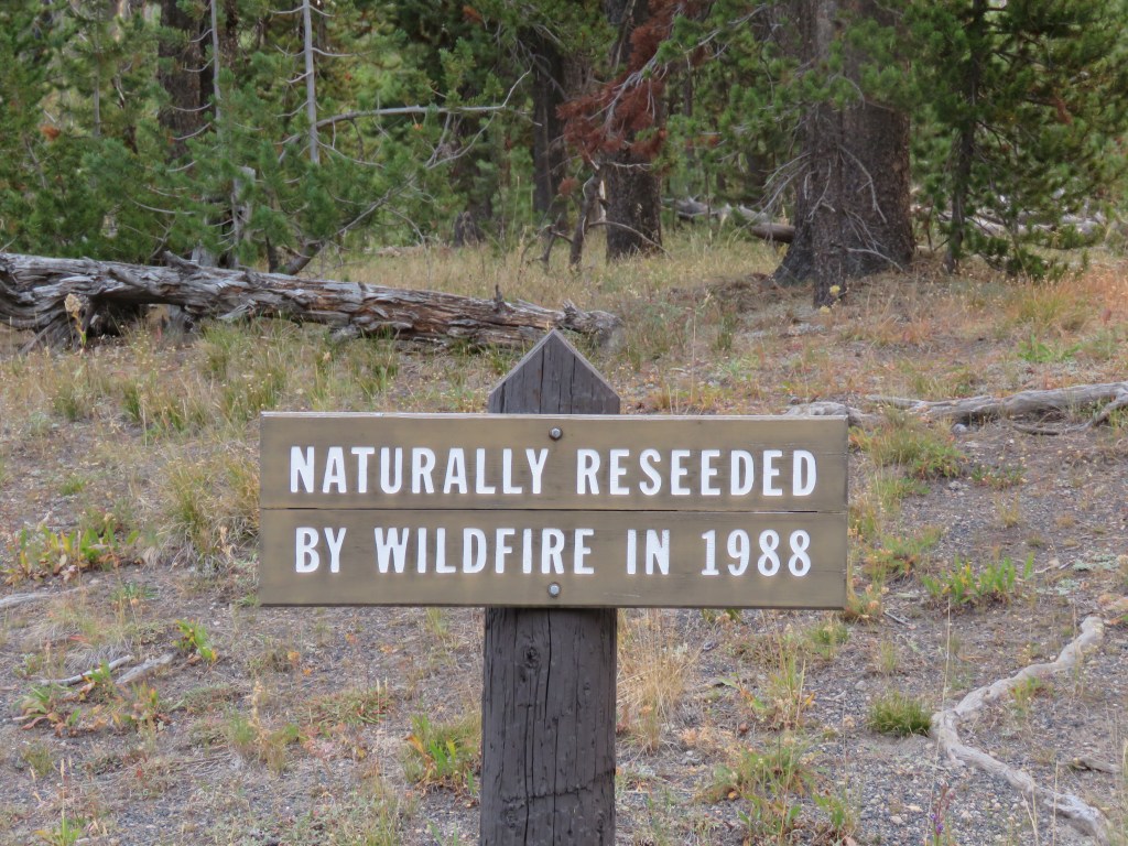
In 1988, wildfires affected about 800,000 acres of forest – about 36% of Yellowstone – and closed the park for the first time since its establishment in 1872. The Snake River Complex Fire burned large areas of forest surrounding Heart Lake.


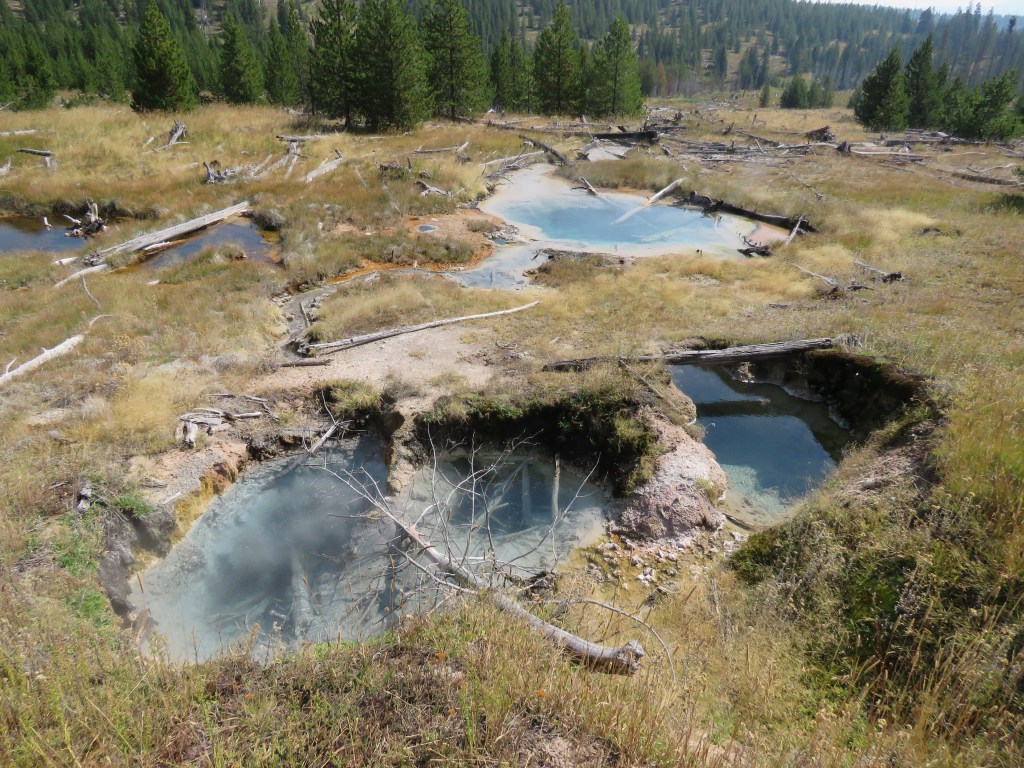
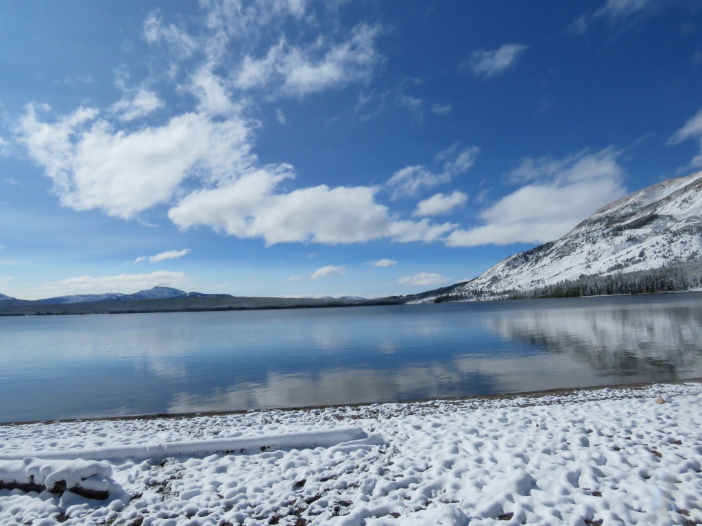
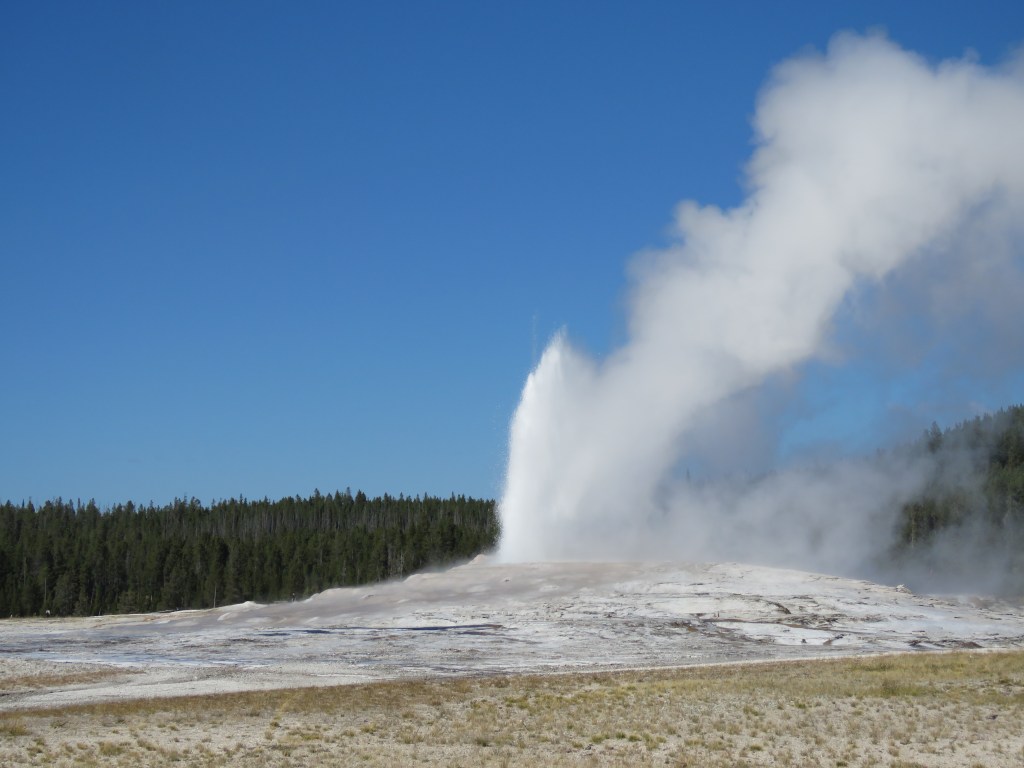
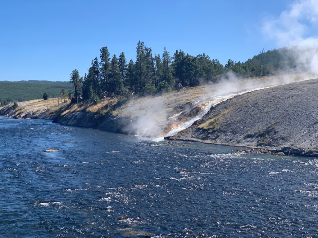
As we approached the lake, we came across geothermal features, including hot springs bubbling up along the trail. In multiple places, boiling water would spill out and flow into spring-fed streams that led into Heart Lake.
At about 7.5 miles, we reached the ranger cabin on the edge of the lake. The volunteer ranger, Richard, popped out of the cabin to chat with us about where we were headed. He shared some tips, including advising us about a stream where we could find cold water along the route. He told us there had been bear spottings not far from our campsite.

As we ran low on water, we found the stream fed by a spring coming out of Mount Sheridan right where the ranger said it would be. It was nice and cold!

Not too far further, Miguel spotted something up on the hillside. We were surprised to see a coyote slink up into the trees trying to get away from us – before I could get a picture.

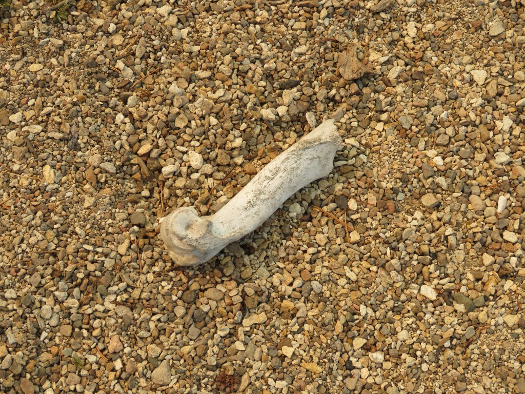
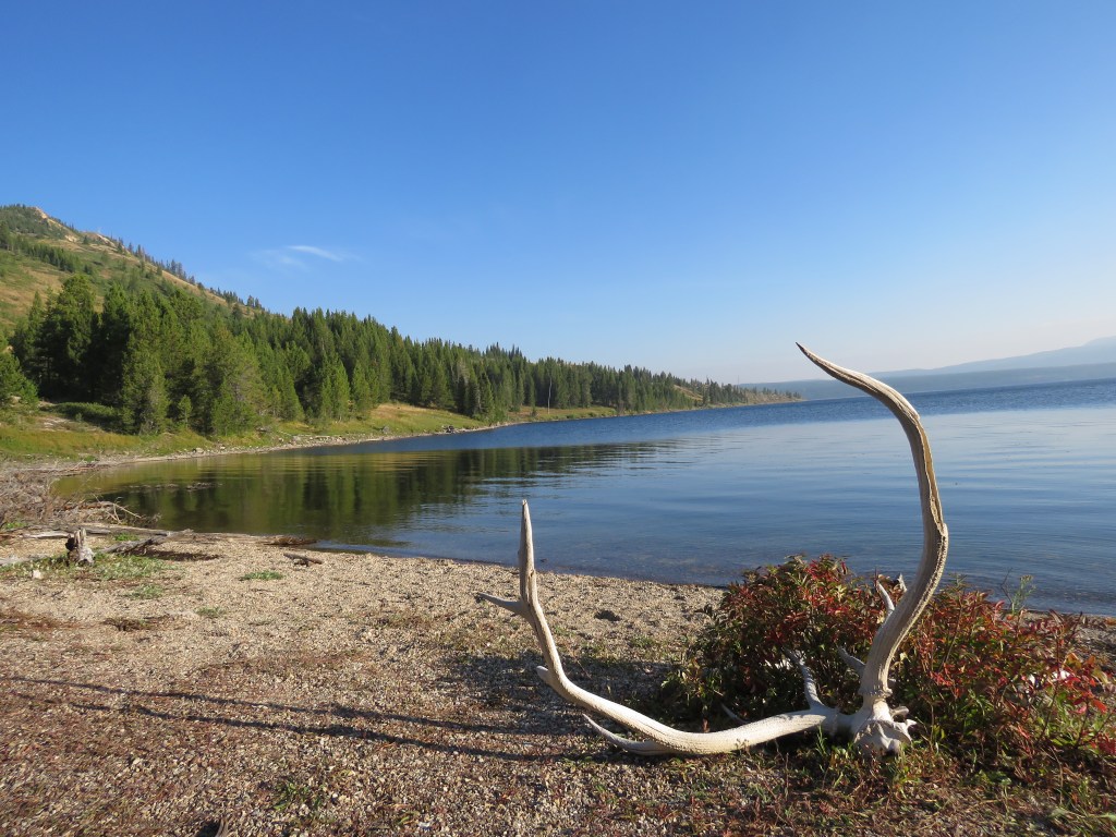
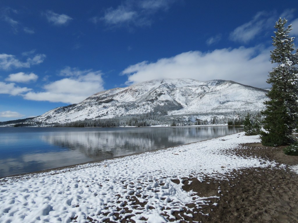
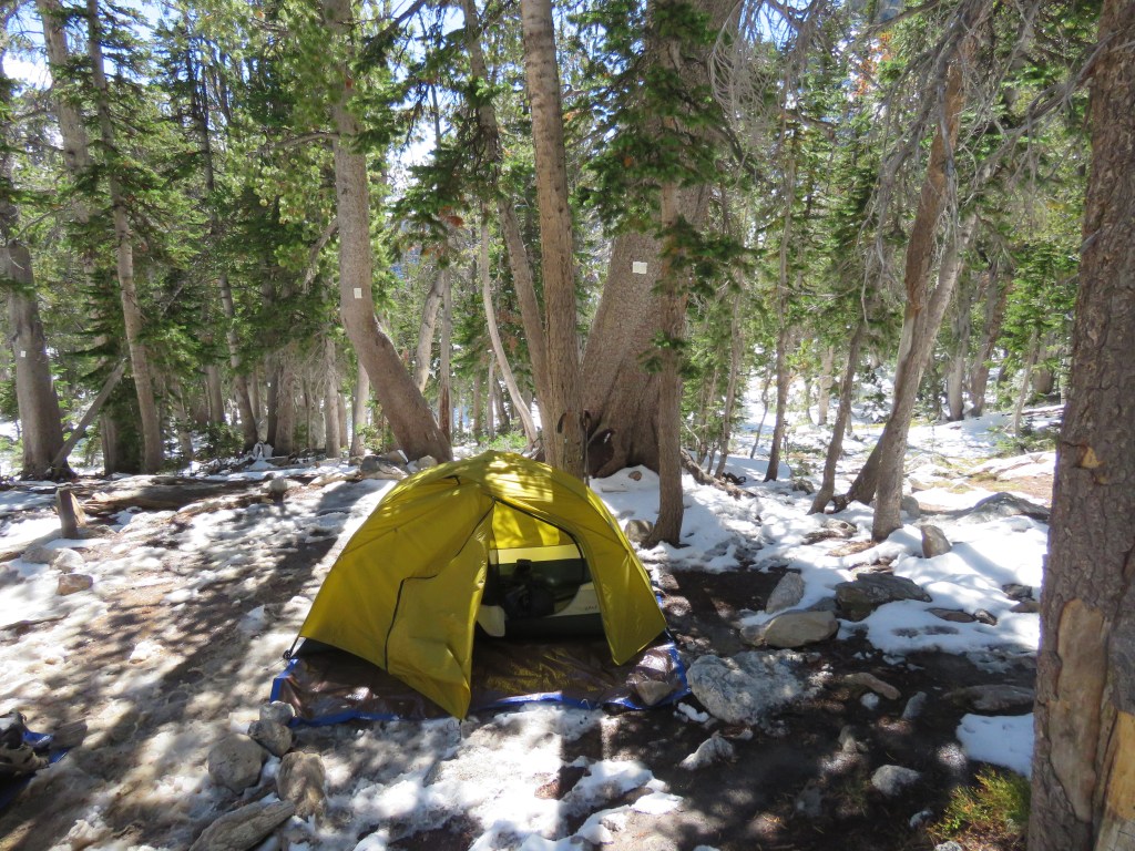
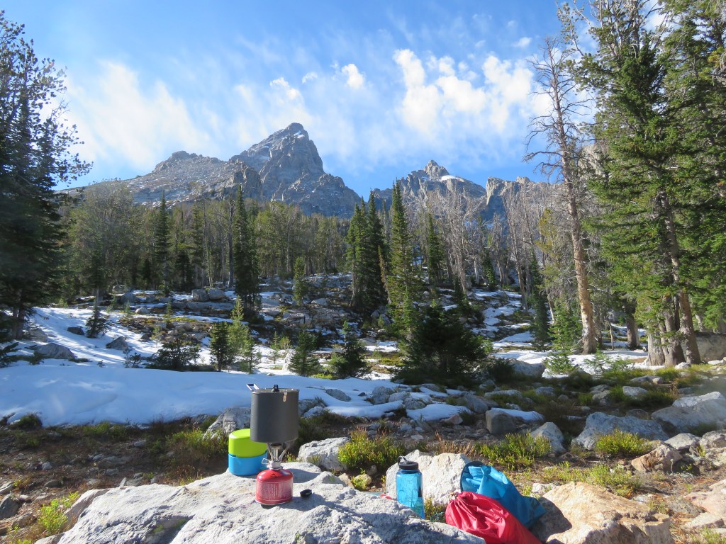
After almost 10 miles of hiking for the day, we came upon a sign for our campsite near a small beach. It was a beautiful area at the base of a treeless hillside.

On the beach was a full set of elk antlers, as well as another elk antler and a large bone of some kind. We found multiple other elk antlers in the area – It must be a popular place for them to shed.

We set up camp and hung our bear bags. The backcountry campsites in Yellowstone consist of a central location where there is a pole for hanging food and scented objects out of the reach of bears, and sometimes a fire ring. The goal is to keep all food and cooking in this central area, and then find a place to camp at least 300 feet away. Due to the high fire risk, no fires were allowed.

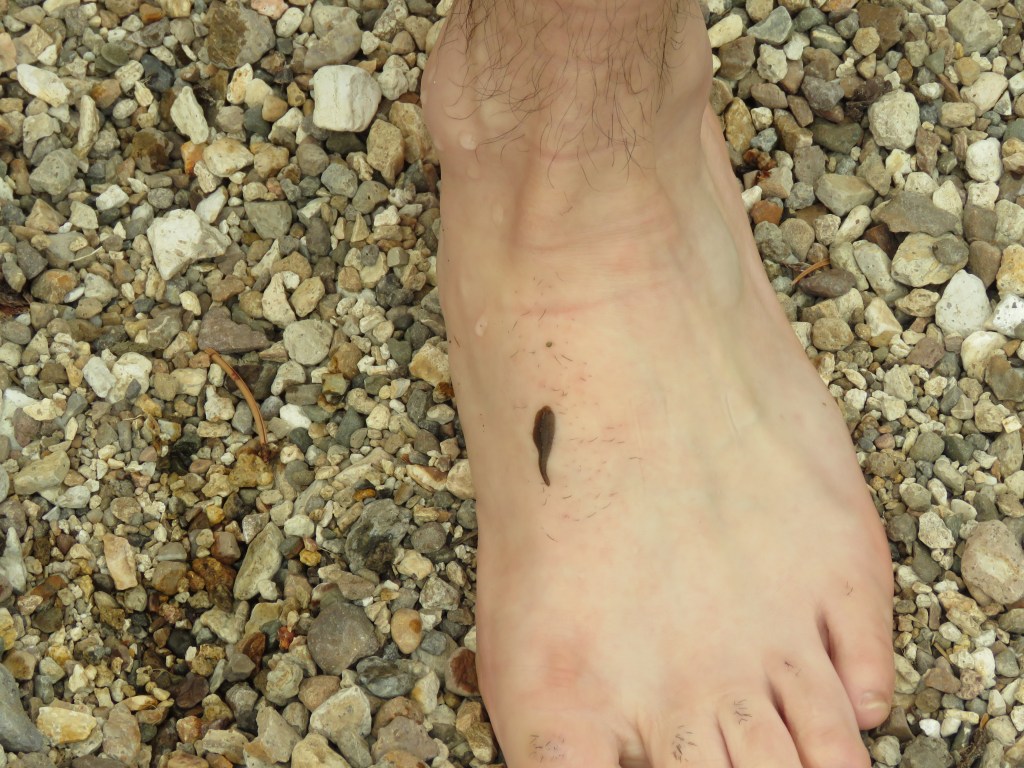
Miguel decided it would be a good idea to take a dip in the lake, despite the cautions about leeches from Ranger Richard. And what do you know? – there were leeches …
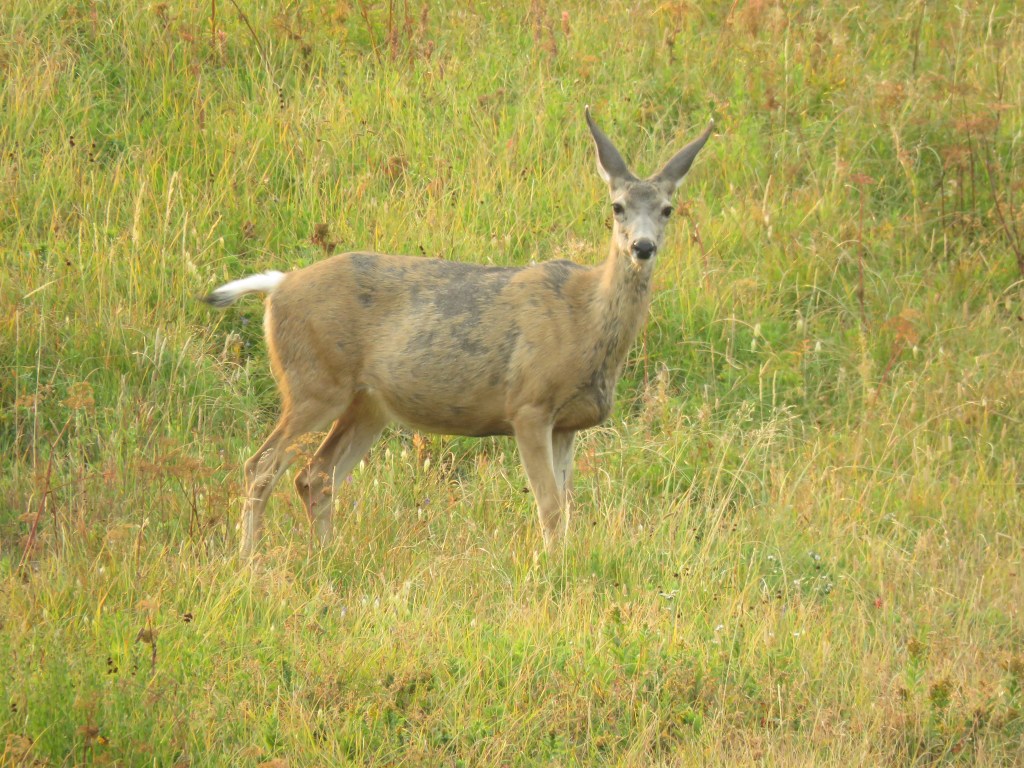
After dinner, we sat down by the water quietly, enjoying the lake and keeping an eye on the hillside for wildlife. I didn’t think there was much chance of anything coming near, with us in the area. But to my surprise, a female mule deer came wandering across the field, completely oblivious to our presence. I never imagined an animal could be so paranoid about nearby threats, yet have no apparent awareness that we were right there watching her.


We went to sleep very early – by 7pm and before the sun set.
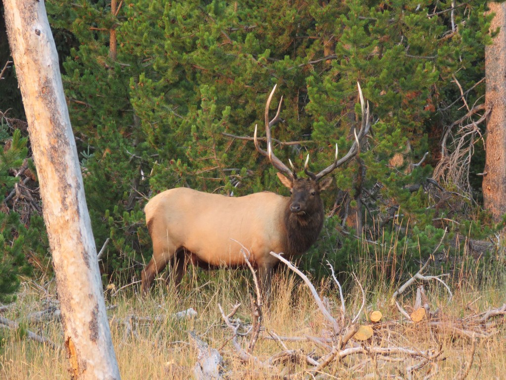
At around 6am, I awoke to a loud bugle of a bull elk, not too far off. I reluctantly got out of my comfy sleeping bag and walked down to the beach, but could not find any elk. However, not much later, as Miguel got up, we heard a howl coming from the hillside. We ran down to get a look, and even though we couldn’t locate the source, there was one coyote howling and another few responding with yipping and yapping. They seemed to be enjoying the morning.
By the time we made breakfast and got ready to go, it was 8:45am again before we set off. It was to be a long day, with a little less than 14 miles to hike.
According to the weather forecast, the temperature was expected to drop dramatically and it was supposed to rain, or even snow. However, the sky was clear and it was warm. I muttered some derogatory comments about weather people as we marched.
Everywhere we went looked exactly like a scene where one would expect to see a bear. But, while we saw a lot of bear scratchings on tree trunks, and some bear scat, we did not see any bears. I’m certain we walked by quite a few, comfortably watching us from a distance.


We got to our first river crossing, which was not deep, but we could not get across without fording. We came prepared with sandals/water shoes to make crossings easy (unlike my last adventure, where I had bruises on my feet for a week). Because the map showed more river crossings to come, we kept our sandals on for a while as we hiked.

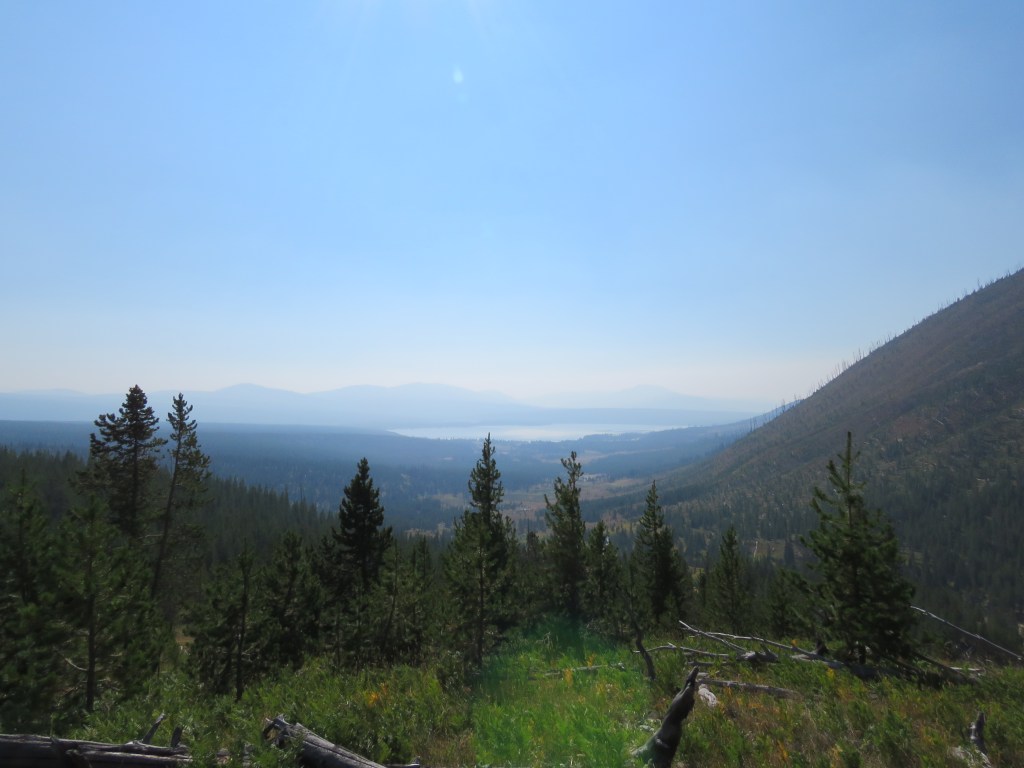
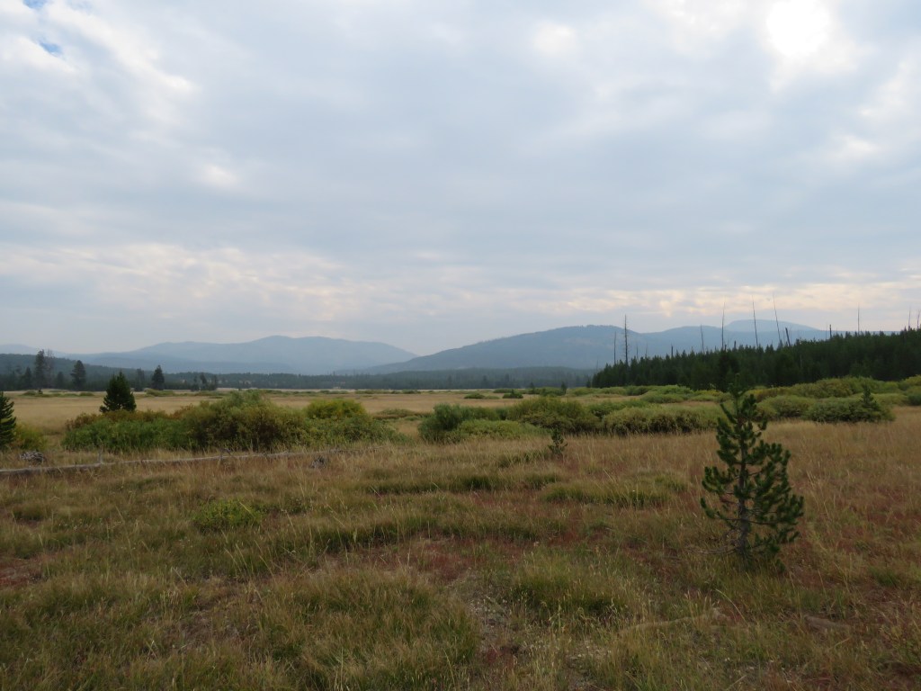
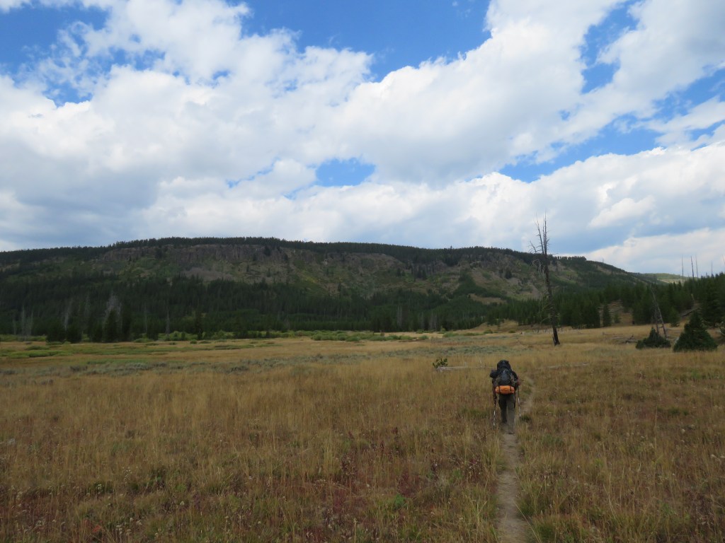
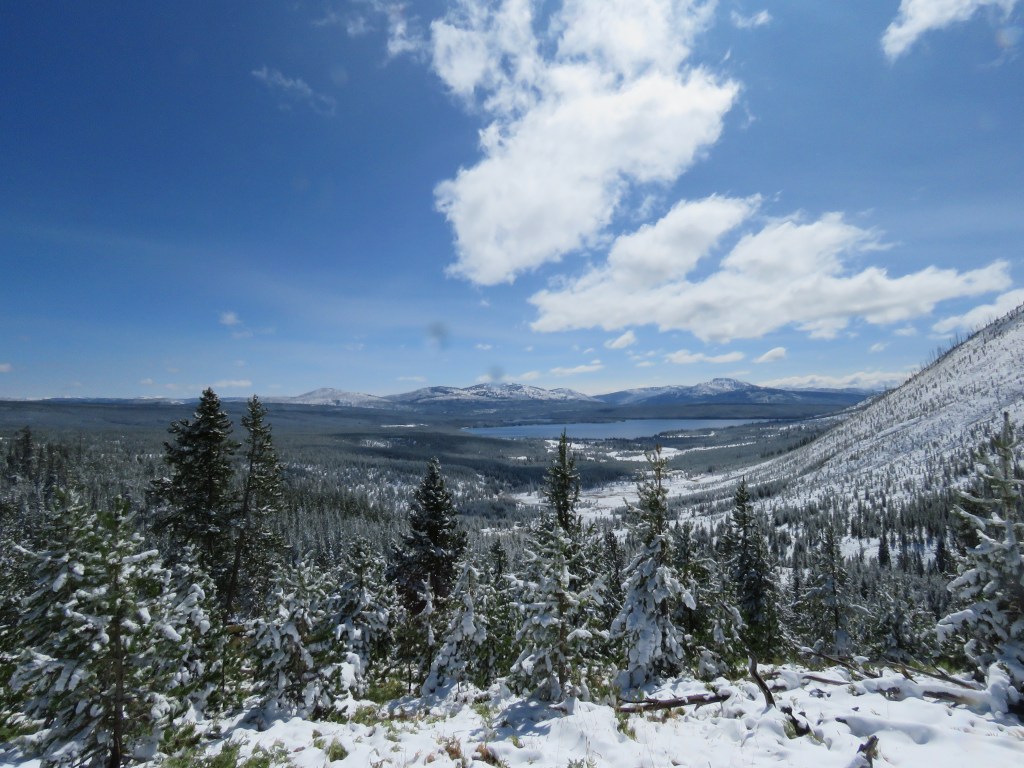
The southern part of the Heart Lake area is beautiful, with lots of wide open meadows and rivers. There were several creeks and rivers we had to cross; some we found could be crossed by jumping rocks or stepping across fallen trees, but a few had to be forded.


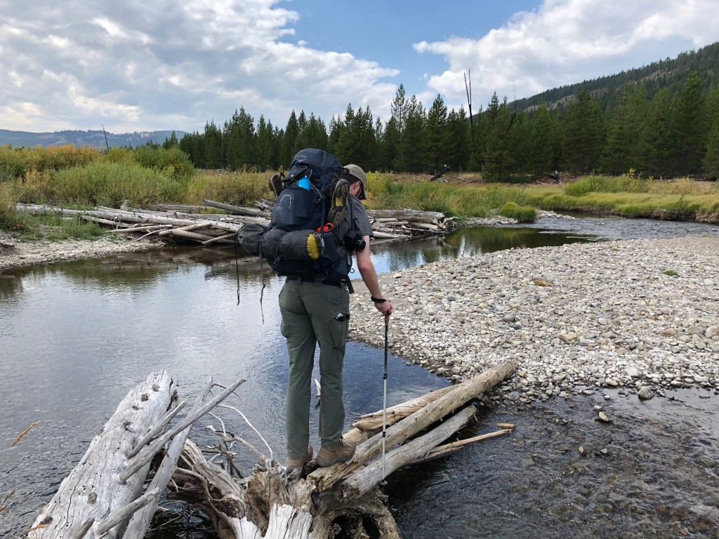
The most serious crossing was the Snake River, which required us to walk in knee-deep water, but the current was not very strong.
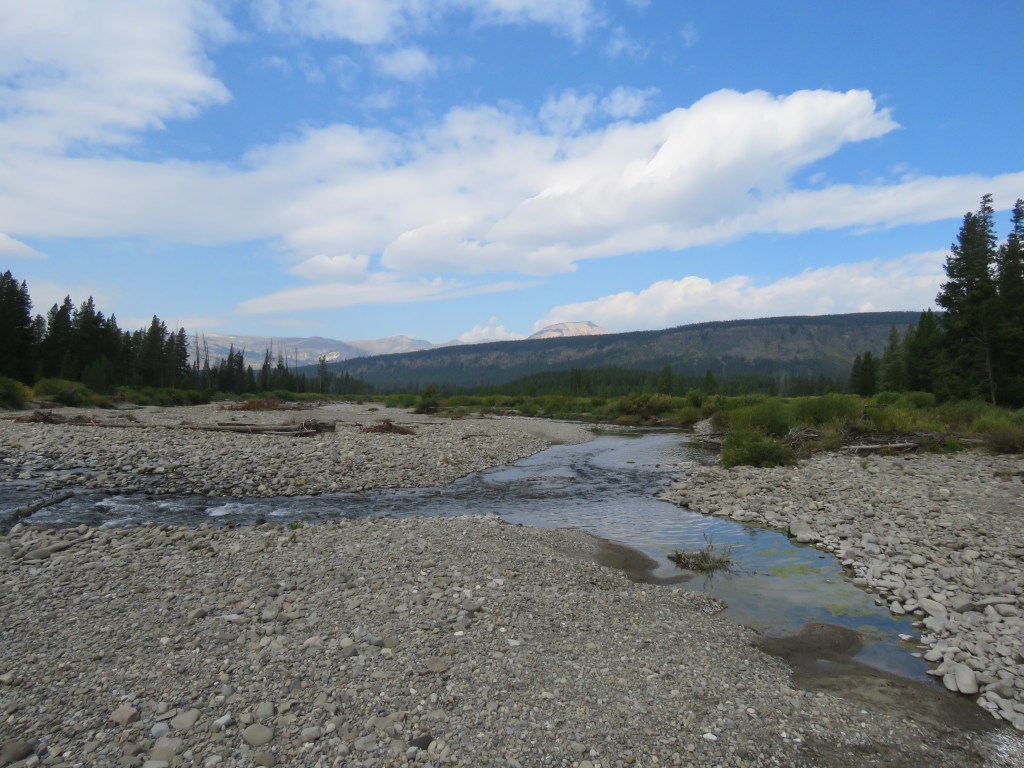
This was right near the headwaters of the Snake River. Here, it was a small river that can be quickly walked through. However, the Snake River becomes one of the largest rivers in the western United States, running well over 1,000 miles, eventually emptying into the Columbia River not far from the Pacific Ocean. The first Europeans to view the Snake River were Lewis and Clark’s expedition in 1805, and the headwaters were explored not long after by John Colter, a former member of their expedition (who was the first white American/European to explore Yellowstone and the Bighorn basin).
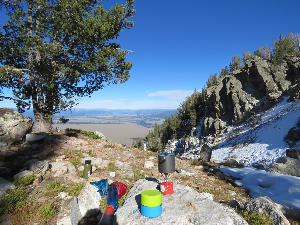
We took a long break on the other side. It was afternoon, and it was getting very hot. I reluctantly put on sunscreen, as I was getting a little burned being out in the open fields. I couldn’t believe how wrong the weather forecast was!


As we continued marching on, we could see some clouds start to roll in. It started to get a little cooler. An hour later, the temperature had dropped quite a bit and it was getting cold. Then the rain started. We stopped to don our rain jackets and put our rain covers on our packs. It was only drizzling and was not too bad.
Another hour later, and it was downright freezing. The rain had become steady and cold, turning to ice as it reached the ground. I couldn’t believe how fast the weather changed.
As we reached another river crossing, I had no patience for taking off my boots and fording. I just wanted to get to the campsite! There were rocks to hop until about 4/5 of the way across, but then no options. I didn’t want to go back, and decided to rely on my boot waterproofing. I jumped in the water and scrambled as quick as I could the last 10 feet to the opposite bank. Luckily, only a little water sloshed over the tops and into my boots.
Then I watched to see what Miguel would do. He also apparently did not want to change his shoes, but started trying to find a better route up river. But as he was almost across, he slipped into the freezing water, walking the rest of the way. His boots were completely soaked through, and he was not pleased.
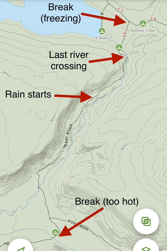
The weather was really getting bad, so we continued on as fast as we could. Then, it started snowing … I just could not believe it. I powered on as fast as I could, desperate to get warm and dry.
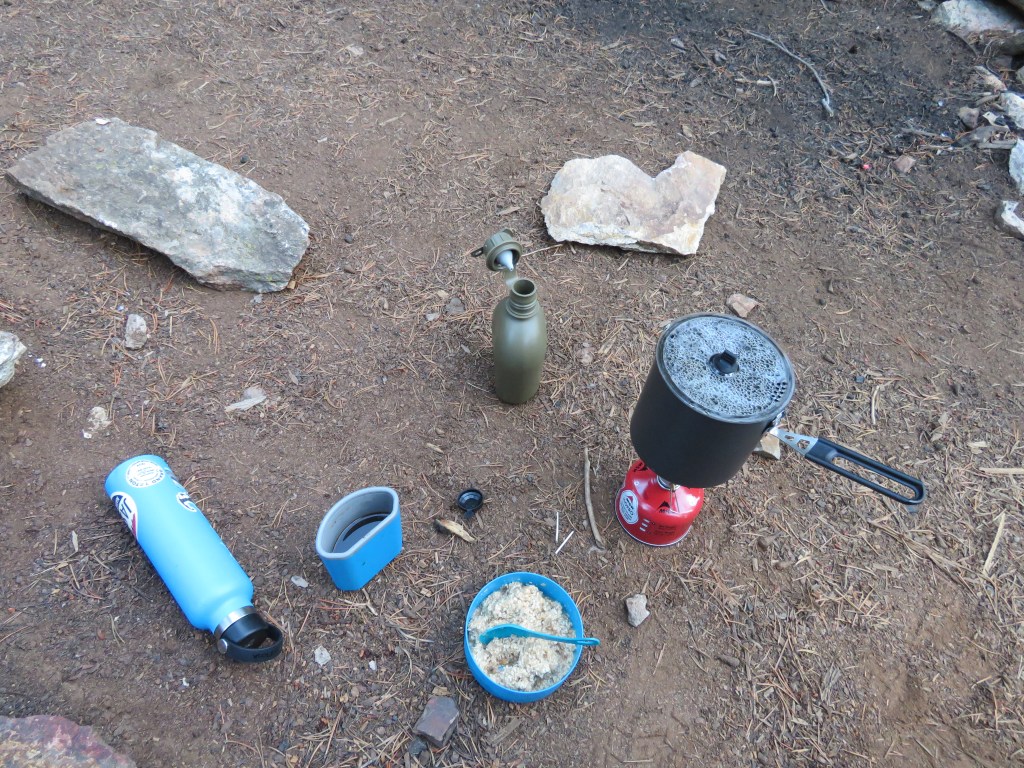
After we finally approached the campsite, I saw something. I looked up through the steady snow, and there was a very large female mule deer less than twenty feet away, just staring wide-eyed at me. I was so cold, wet, and tired, all I could do is stare back. I didn’t have the energy to pull out my camera, so we just stood there watching each other for a bit, until Miguel came up and we left the deer behind to find a place to set up our tents. We squeezed them in amongst thick trees to protect us from the wind. We attempted to start cooking dinner, but upon finding my matches all wet, and with numb fingers, I just lost interest. We instead grabbed a couple bars and got into our tents for the night, exhausted and cold.
I was so tired, I just did not feel like eating. However, I remembered that I had two bars in my pocket and I knew I should not keep them in the tent or they might serve as an attraction for bears. There was no chance I was getting out of my tent. So I sat there, leaned over, very slowly choking down a clif bar and fig bar. Wonderful dinner.
By 5am it was extremely cold. The temperature might have dropped over 50 degrees from the afternoon before – at least it felt like it. I could tell my tent was covered with snow, as the top and sides were depressed toward me with the weight. Everything felt wet, and water starting dripping onto my forehead. Eventually, I worked up the courage to climb out of the tent.
It is clear that weather people are right, and I am wrong. They are smart, and I am dumb.

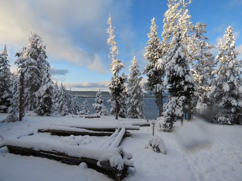

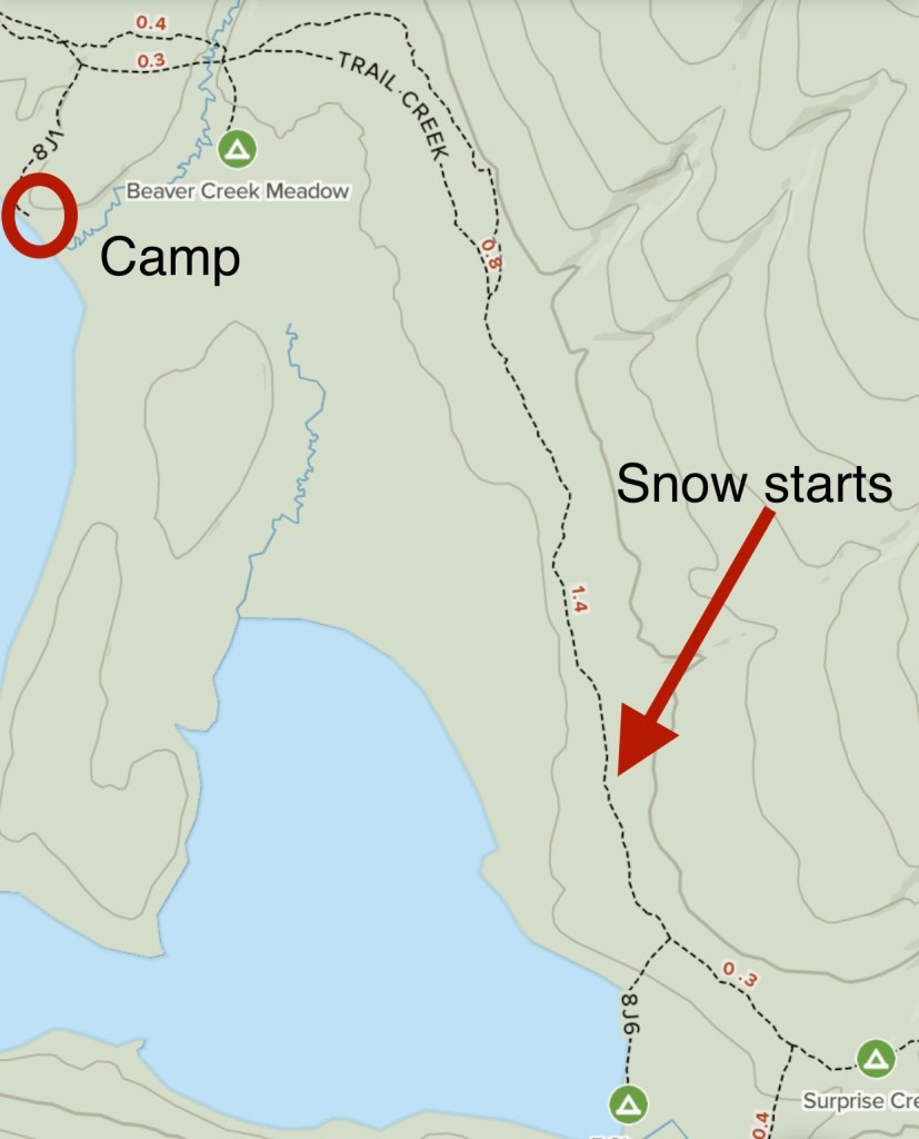
The temperature was in the low 20s, and there was 4 or 5 inches of snow on the ground. By the way, it was September 8th. Three days earlier when I picked up Miguel from the airport, it was well over 100 degrees in Billings.
Our bear bags were frozen on top of the bear pole. Even after mine was untied, I had to yank it a bunch to get it dislodged from the ice. Miguel’s was another story. When he hung it, it had wrapped around the pole several times, making it impossible to pull down. The bag hung about 20-some feet up, leaving us few options. We needed to find a long stick to help dislodge it, but with the snow, it was tough to find a good stick on the ground. I ended up using my trusty tomahawk to cut down a small tree, strip it of its branches, and turn it into a long pole. We eventually were able to use it to push the bag back around the pole multiple times, and recover all of Miguel’s food.
After breakfast, we set off, trudging through the snow back toward the trailhead. Miguel’s boots were frozen solid.


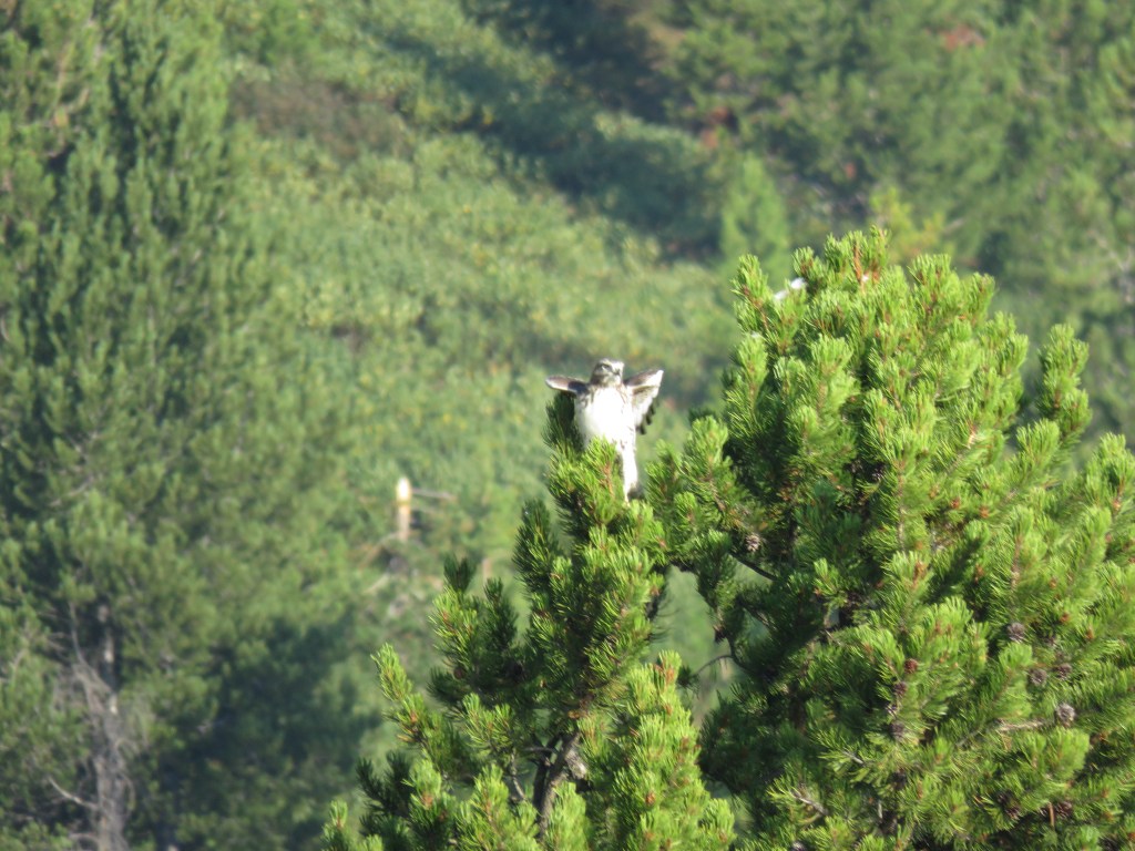
At one point, we spotted a couple of owls having a hooting party, which was catered with some kind of small woodland creature.


After over 33 total miles, we finally made it back to the trailhead, very pleased to have made it.
Intermission
After our Yellowstone hike was complete, we moved on to Grand Teton.

We anticipated we might need some flexibility, so we didn’t have any set plans. Luckily. We decided that given the late time of day, and the fact that 100% of our clothes and gear were wet and dirty, we would splurge on a hotel room for the night in Jackson.
As it turned out, there were zero hotel rooms available anywhere, and the closest reasonably-priced place we could find was across the mountains in Idaho. We decided that it would be worth the trip, and after enjoying a nice dinner and a couple of beers, we took the very scenic drive over the pass into Idaho. It was absolutely the right call, and we were able to dry out our gear (spread all across the room), do laundry, take hot showers, and enjoy soft, warm beds.
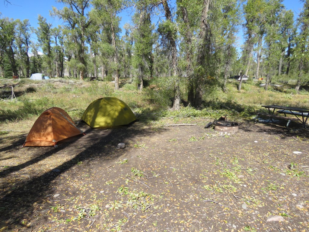
With all the time needed to straighten out our gear and ourselves, we were running behind the following day. Grand Teton National Park has strict limitations on backcountry camping, and you need to show up in person the morning of the day before the night you want to camp in order to get a permit. Of course, all of the most sought-after spots are taken first thing, and we didn’t make it to the permit office until 11am. Nothing was available for that night, and none of our top requests were available the following night. This left us at the mercy of the employee to just present to us anything that was available.
Ironically, he advised that Surprise Lake was open. He told us it was only a 4.5 mile hike each way, but with over 3000 feet of elevation gain. We were up for it, so we got a permit ($35 vs. Yellowstone’s $3).
Since we had no ability to camp in the backcountry that night, we stayed at one of the National Park campgrounds, Gros Ventre. I had stayed there for a couple nights a few months earlier, and knew it was a great spot. However, the storm that gave us snow in Yellowstone apparently brought severe winds to the valley, and there were a lot of trees and brush down. We were able to find a great campsite though.
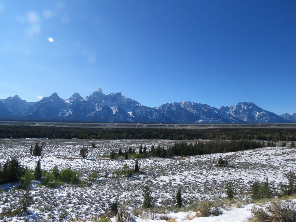
Grand Teton
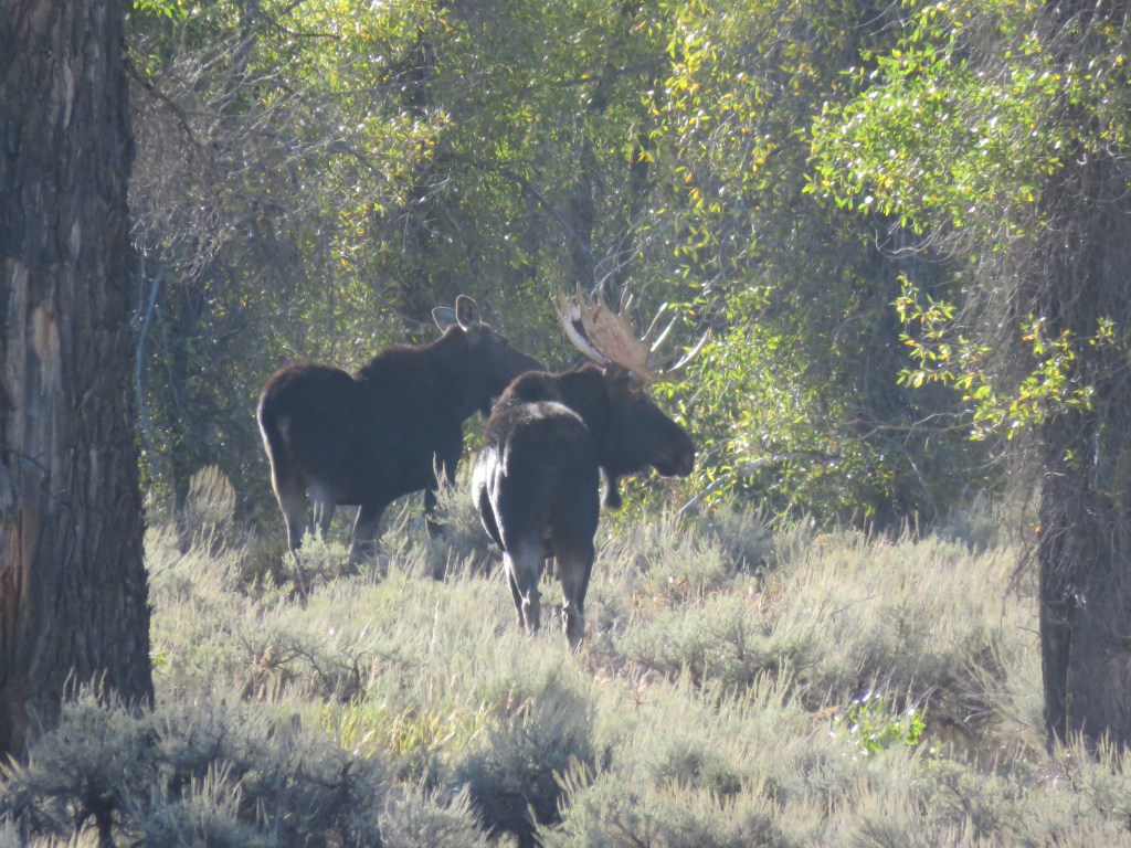
Early the next morning, we set out to the trailhead for our next adventure. On the way, next to the Gros Ventre River, we spotted some mythical beasts!
While I have travelled a decent amount in “moose country,” the first time in my life I had ever seen a moose was a few months before this, maybe 1,000 feet further up this same river.

The Lupine Meadows trailhead was packed with day hikers. It was clear this trail was extremely popular. However, we saw few others who intended to camp up in the mountains.
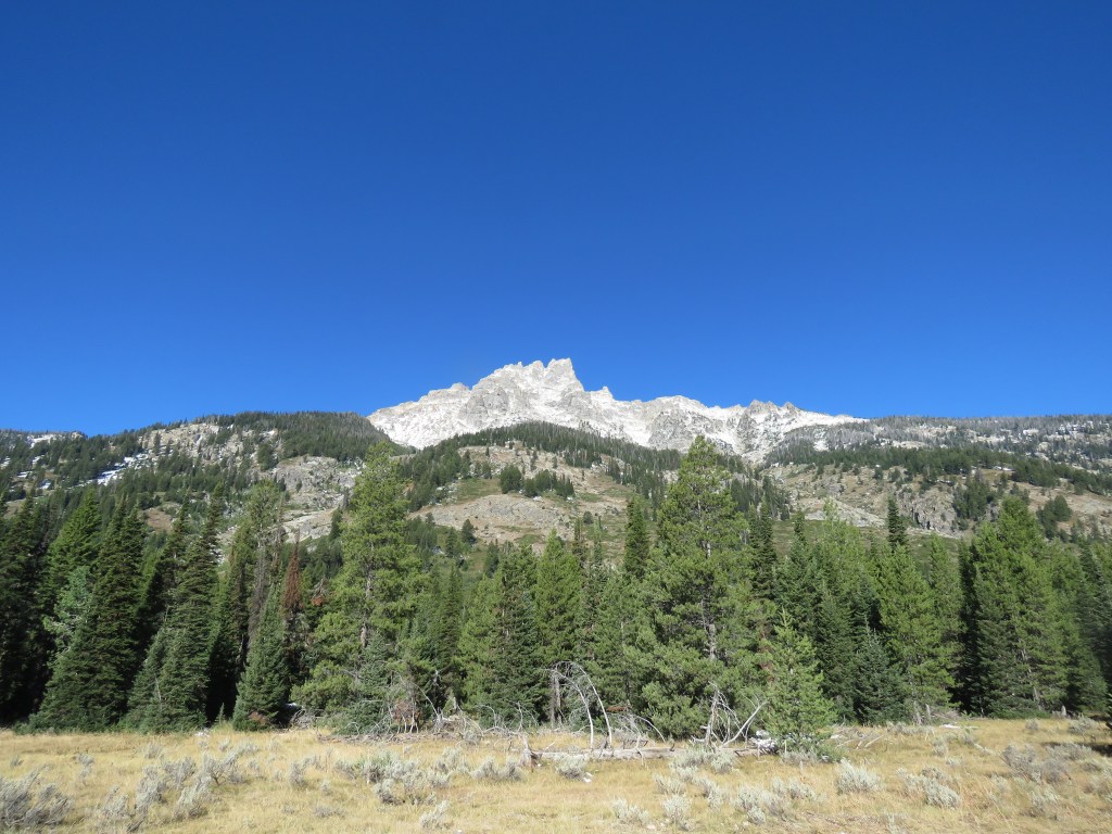
The trail got steep quickly, leading to many switchbacks up the side of the mountain, under the shadow of Grand Teton.


As we gained elevation, the trails got pretty snowy and muddy.
It was pretty tough hiking, gaining a lot of elevation. We took our time though, and reached Surprise Lake after about 4.5 miles.
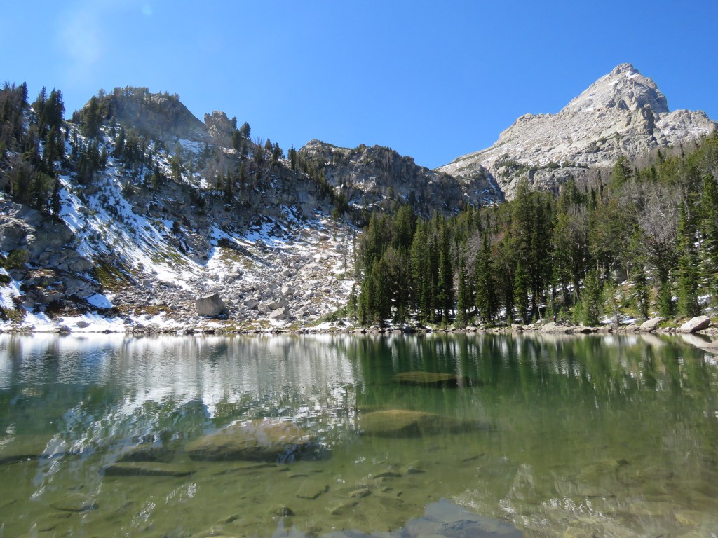
After a rest, we hiked a quarter of a mile further to Amphitheater Lake.
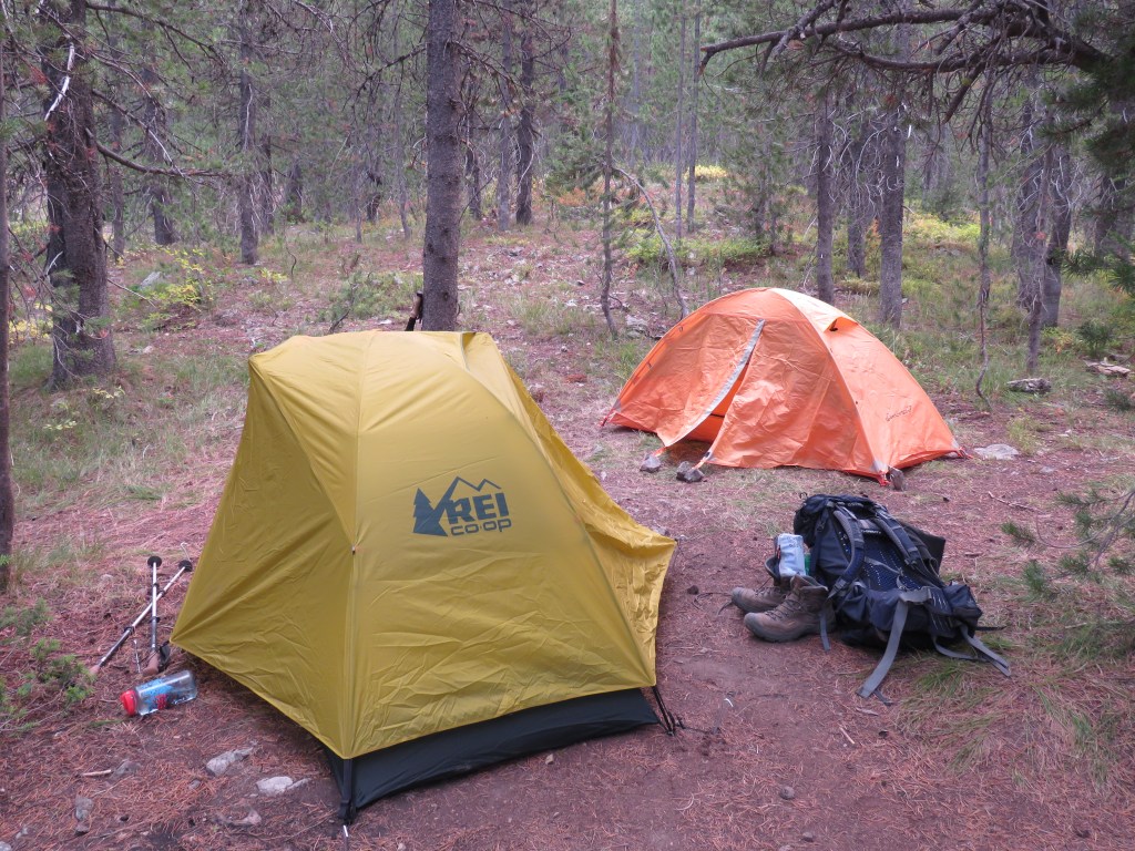
We found a place to set up camp. The ground was pretty muddy from the rapidly melting snow, but luckily we had taken advice from a ranger and brought tarps to put under our tents to keep them dry. We also used my tomahawk to cut up and clear all the snow and ice under our tents, so they weren’t ice cubes.

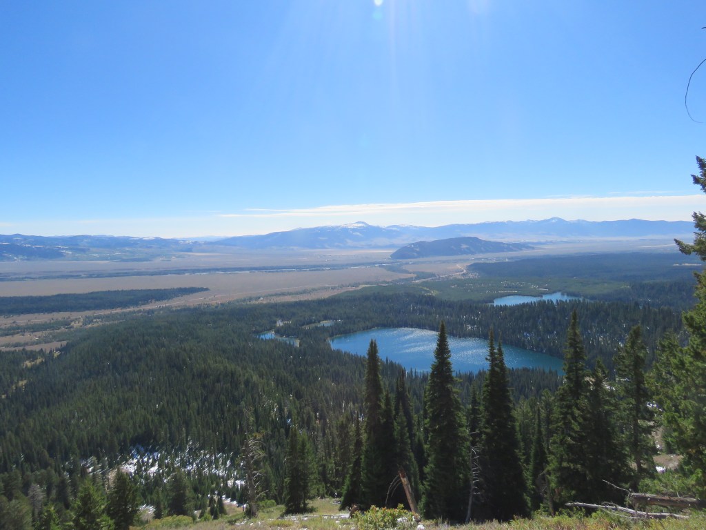
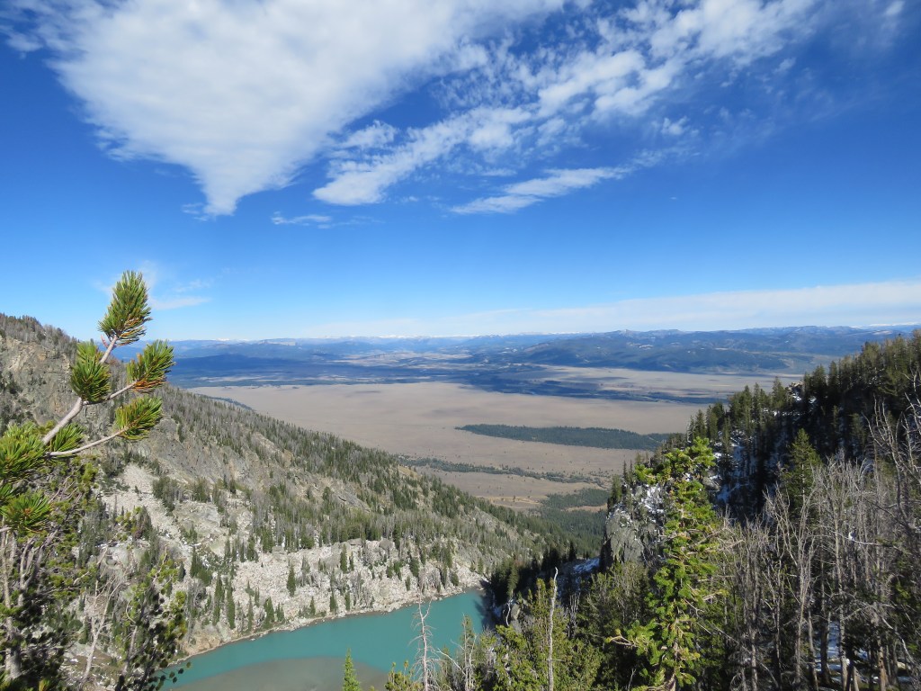
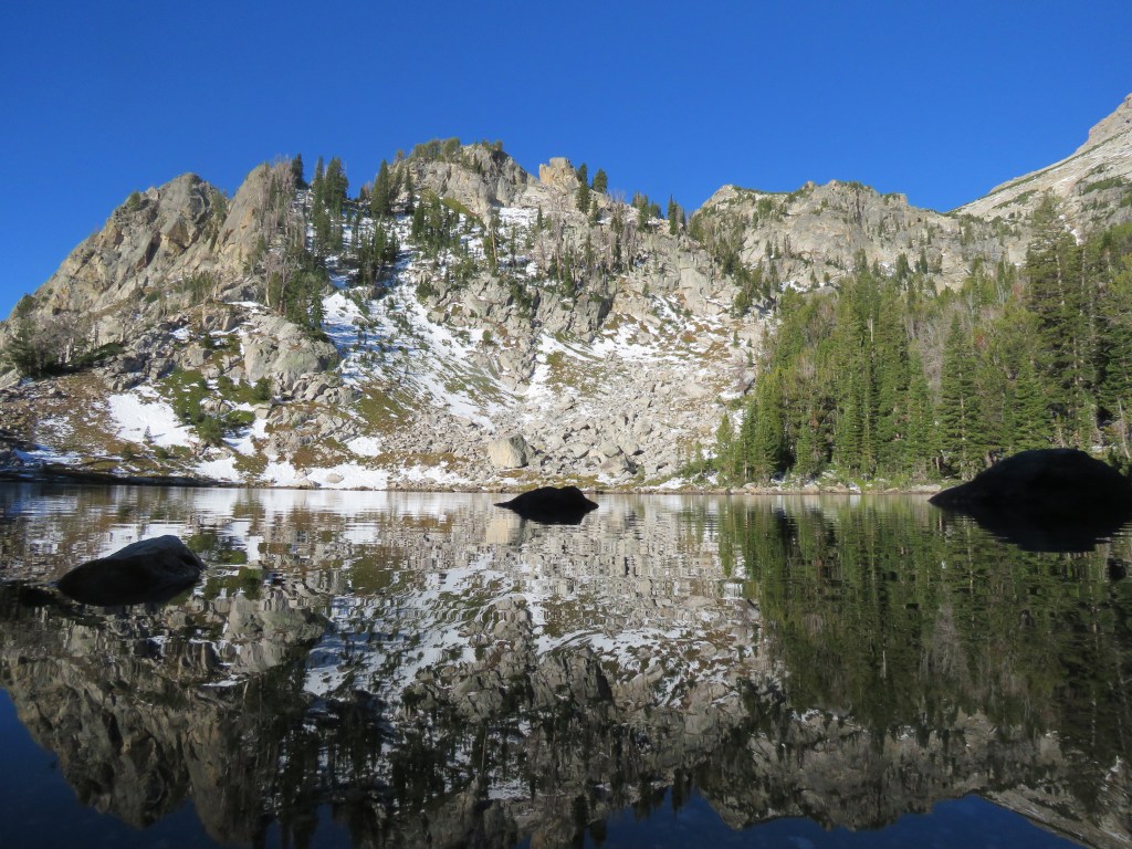
A short walk up to the top of a ridge revealed an incredible view.
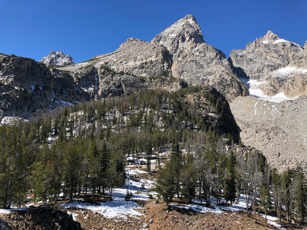

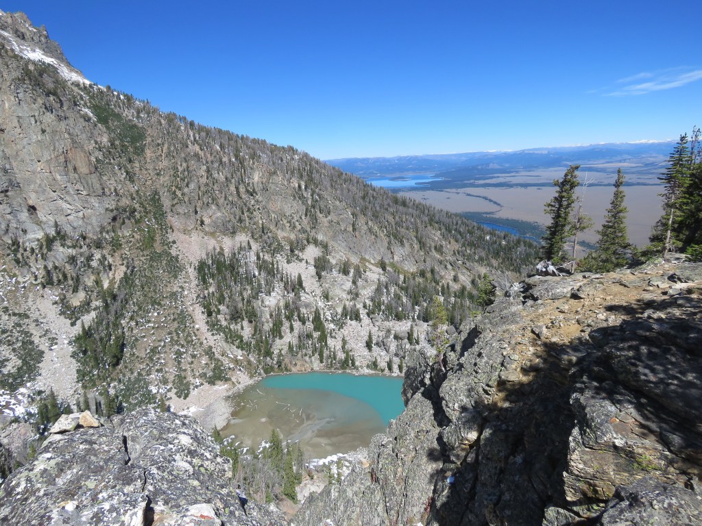
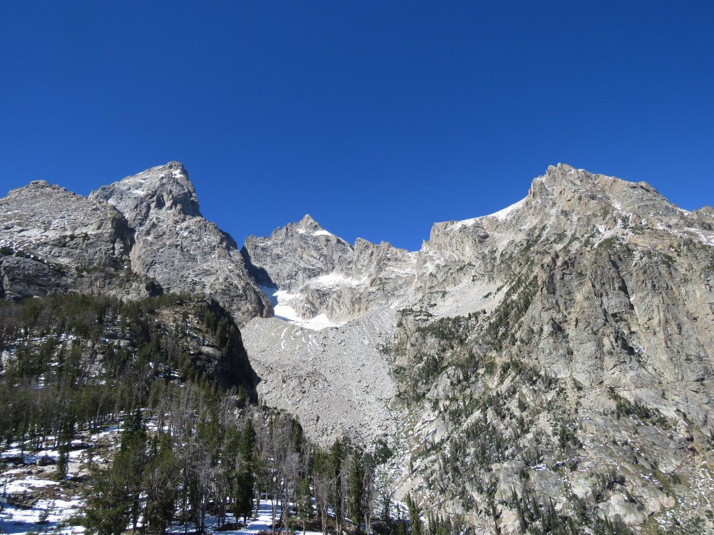
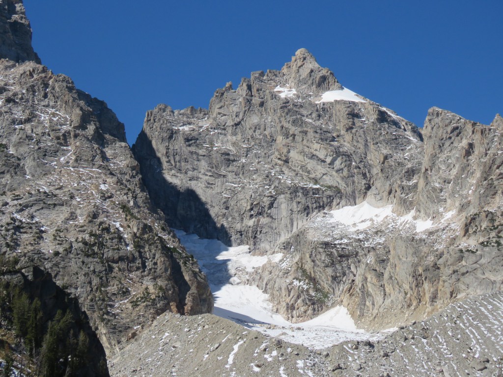
You can see Teton Glacier, which has been rapidly shrinking. The moraine at the edge is the extent of its former reach.

It was just a stunning place to spend time. What was crazy is that not very far away down the hill, probably hundreds of people per day hike up to Surprise and Amphitheater Lakes, and have no idea that if you continue off the trail less than a quarter of a mile, you have these amazing views of both the valley and the peaks. Zero people were up there with us.
We had an incredible view for dinner!
We went to sleep early, prepared for a very cold night. Cold, it was, especially right before the sun came up the next morning. It was incredible to camp at almost 10,000 feet above sea level.
When we awoke, we enjoyed some breakfast, refilled our water from the lake, and it was time to hike all the way down the mountain. We made excellent time getting down.
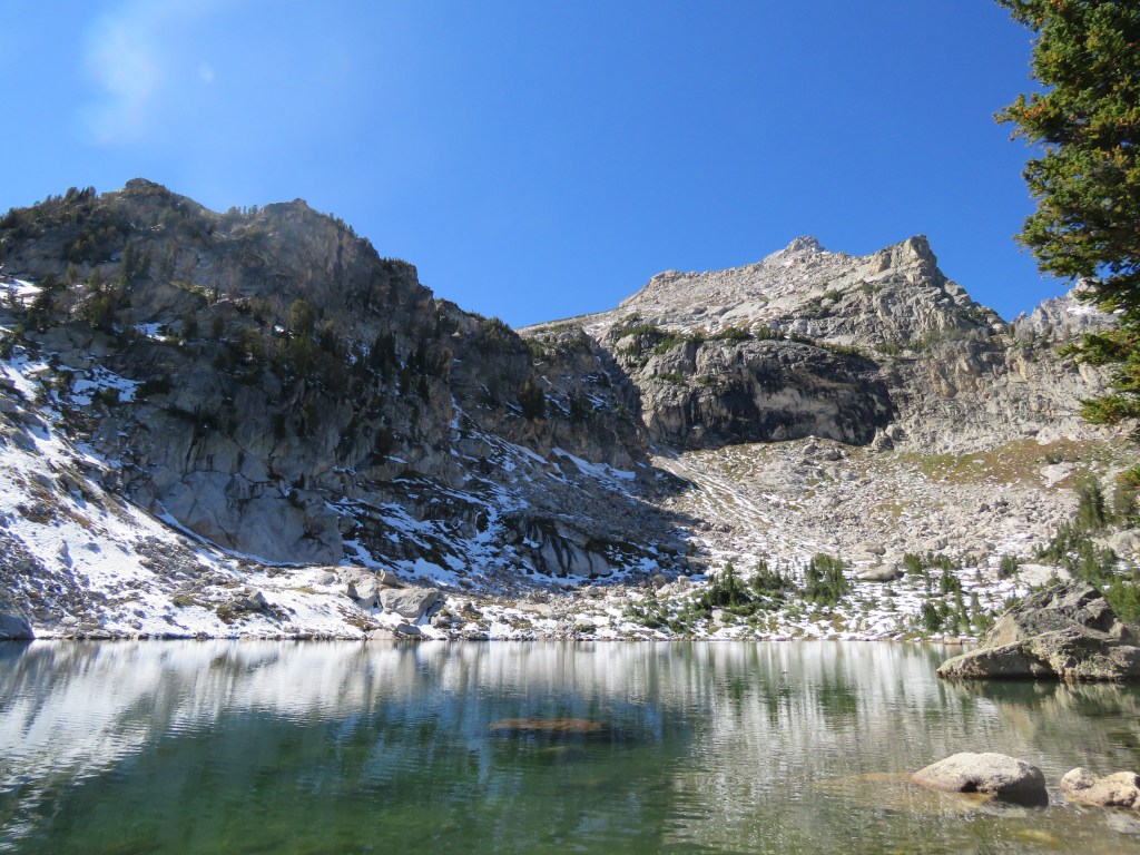
Another fascinating thing about this hike is that it seemed everyone was trying to go to Delta Lake, a small lake nearby at a lower elevation (pictured above). However, there were no signs for it and the trail was very easy to miss, even if one was looking. As I told most people who asked “Do you know how to get to Delta Lake?” the real question is why don’t you hike another mile or so to the top? (By the way, if you are looking for a date, hang out at the bars in Jackson with a sign that says “I know how to get to Delta Lake.”)
THE RETURN
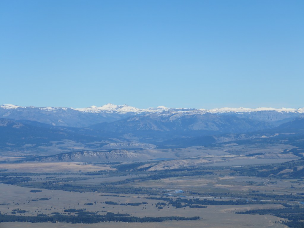
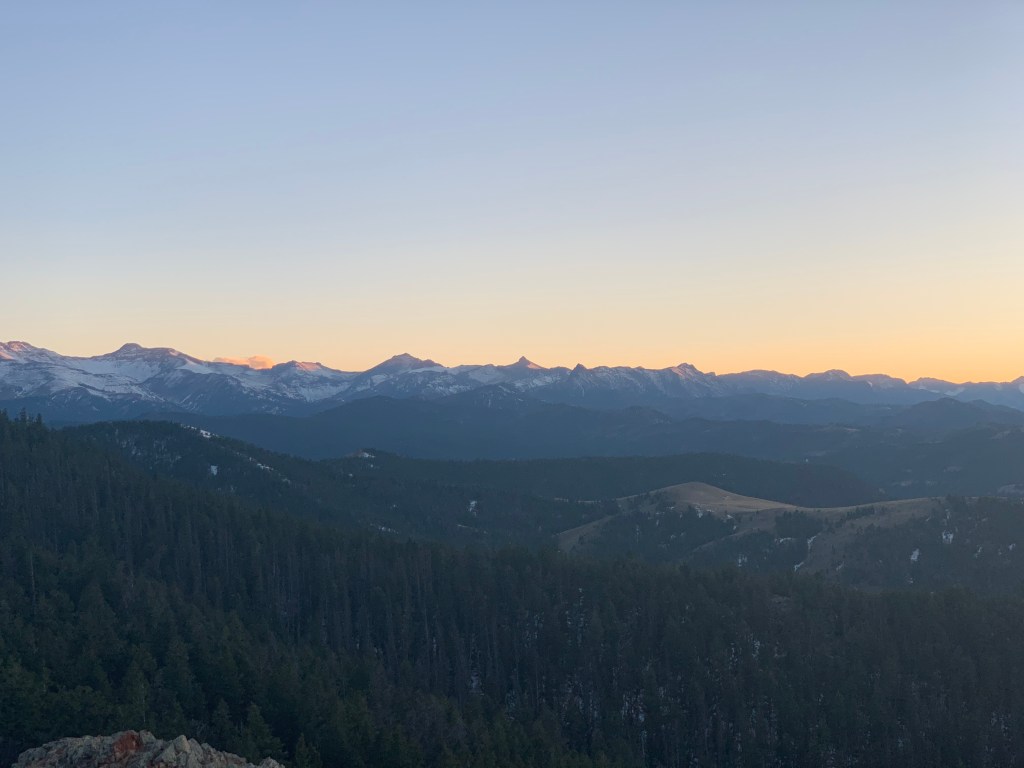
Because we had to shorten our initial drive through Yellowstone due to the road closure, we decided to drive back through Yellowstone, the long way (with the road now open), playing tourist and stopping along the way to take in the sights from the comfort of fresh clothes and our truck.


We exited the northeast entrance, down the Beartooth Highway and Chief Joseph Scenic Byway, getting over Dead Indian Pass as the sun set.
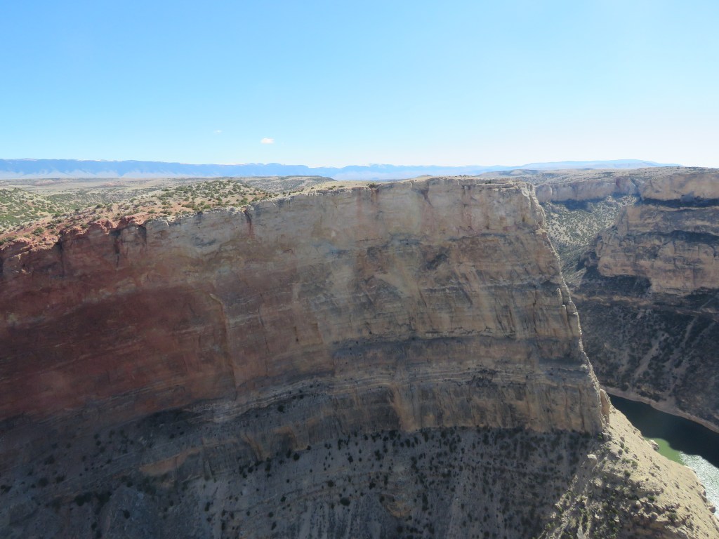
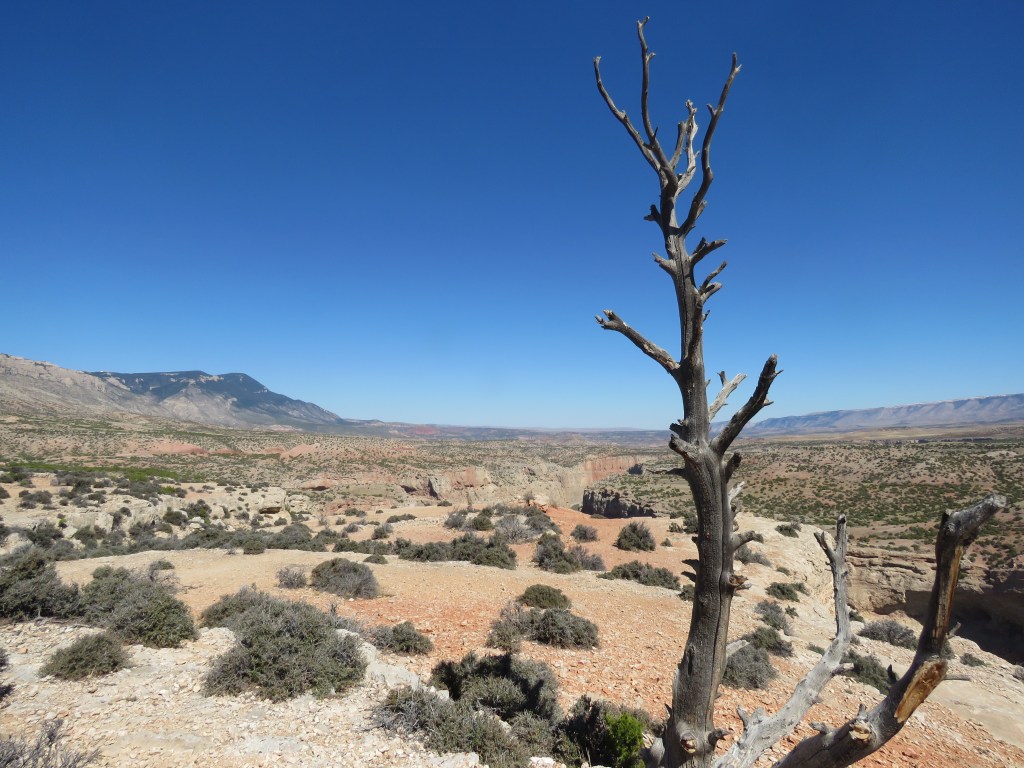
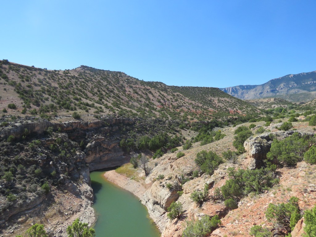
Big Horn Canyon
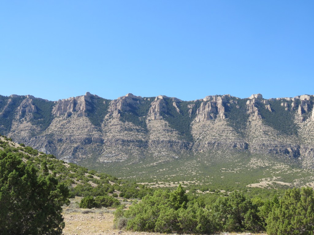
After sleeping in warm, comfy beds and getting clean, the next day we went on a jaunt out to Big Horn Canyon National Recreation Area. Big Horn Canyon is profoundly underrated, and I was reminded that it may be my favorite place in Wyoming. And because it isn’t called a “national park,” no one is there.


We saw wildlife!

There is a herd of wild horses that lives on and around the adjacent Pryor Mountains, some of which come down into the Bighorn Canyon NRA.


We saw culture!

This region was long-used by native tribes, and there is a large area with remnants of where they lived and operated at certain times. When they set up their lodges, they would put rocks around the bottoms to hold them in place, and when they moved on, they left the rocks in rings, and re-used them from year to year. You can still see these circles of rocks – teepee rings.

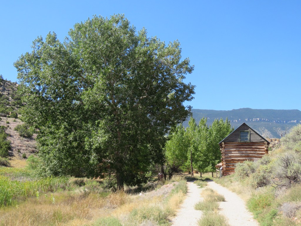
There are a few old, abandoned ranches that you can take short hikes to – all with really interesting background stories and involving colorful historical characters.


That concluded our adventure for this time! Such an amazing part of the country – will be back soon!
BONUS: McCollough Peaks

