“The proper function of man is to live, not to exist. I shall not waste my days in trying to prolong them. I shall use my time.” – Jack London
The road is freedom. On the road, I have everything I need and don’t want for more. I have one source of light, one dish, one eating utensil, a knife, food, and a couple of sets of clothes. I bring enough to get by. A cooler is an unnecessary luxury, but easy to have. Out west or up north, at least, you can always find a place to pull over or sleep outside. There is nothing better than taking care of all my needs myself. And realizing how few needs I really have in the first place. And how easy they are to meet. There is nothing to worry about other than meeting those needs. With those needs met, there is a sole remaining purpose – whatever adventure is at hand.
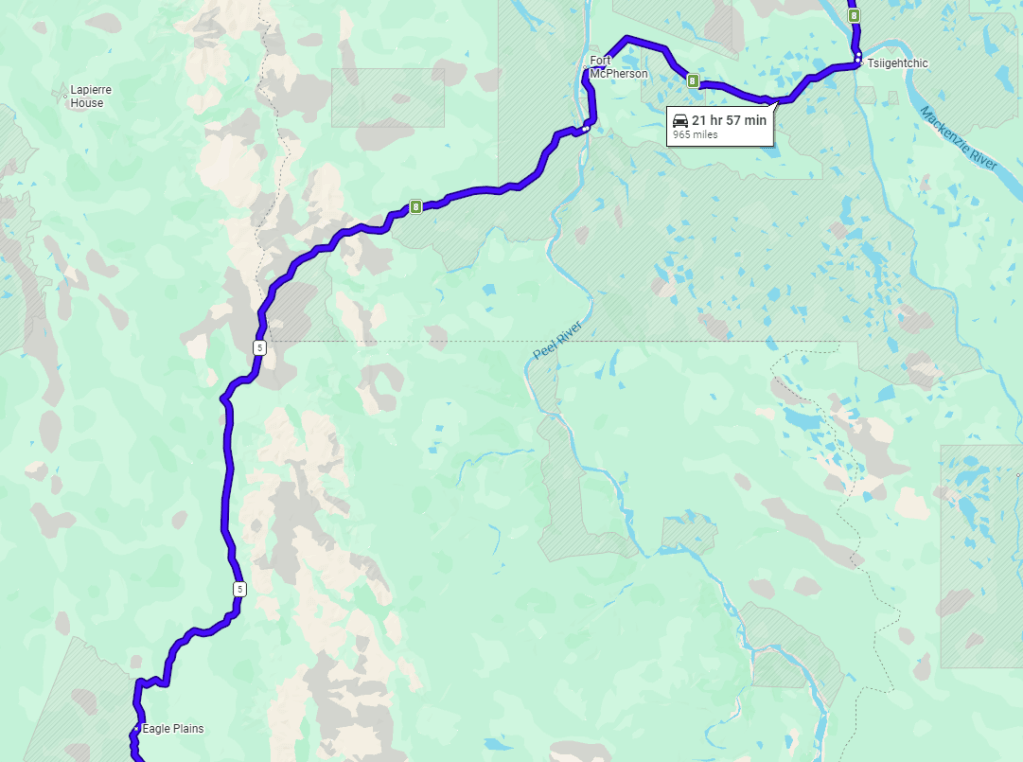
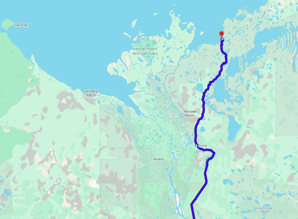
The following pages tell the tale of just such an adventure – an epic journey to the furthest point north on the great North American continent. At least, the furthest accessible by motor vehicle. Ten days took us 2,425 miles, across a vast array of landscapes, two countries, four states, provinces, or territories, and from ocean to ocean. With our essential needs met, our daily focus was simply to get closer to the Arctic Ocean than the day before.
Prelude
“The best teacher is experience and not through someone’s distorted point of view.” – Jack Kerouac
Miguel asked me at one point: Where did I hear about the Dempster Highway? At the time, I didn’t even remember. I had spent a few years reading books, doing research, watching videos, and studying the route to the Arctic Ocean. Where did I get the idea in the first place? Thinking back, I believe the first time I heard of the Dempster Highway was by reading a book written by my inspiration, Adam Shoalts, a modern-day explorer of the Canadian Wilderness, Beyond the Trees. In this book, Shoalts gets dropped off along the Dempster at the Arctic Circle, and canoes and treks (with canoe) about 4,000km across the Canadian Arctic to Hudson Bay. Around the same time, I read another book in which its author traverses the route of a fur trader and early explorer of Western Canada, Alexander Mackenzie, who in 1789, in searching for the mythical Northwest Passage connecting the Atlantic to the Pacific Ocean, found that his best hope – the river that now bears his name – instead took him north to the Arctic Ocean. His travels brought him along much the same route we were set to take, with the MacKenzie River ending right at our destination point near the modern town of Tuktoyaktuk, Northwest Territories. Upon discovering that the river did not connect to the Pacific Ocean but that its waters only flowed into a northern icy wasteland, he dubbed the river “Disappointment River.”
Our trip initially started to come together in late 2022, with the plan to go the first week of September 2023. Life demands (work …) got in the way, and we ended up taking an alternate trip to northern Arizona and southern Utah that October instead. This adventure took us about 1,400 miles through the American Southwest, including stops at seven National Parks (Grand Canyon, Zion, Bryce Canyon, Capitol Reef, Arches, Canyonlands, Petrified Forest), with five nights sleeping in tents in the wilderness (OK, one was at a KOA next to the interstate). It was a fitting shakedown trip to prepare us for the adventure to come.
Our serious planning began in January 2025, with us booking flights in early February.
We planned to drive to the Arctic Ocean in the summer of 2025, from July 26 to August 6. The dates were chosen for the ideal weather and road conditions and to avoid the surge in blood-sucking insects that comes in early summer. I also had to coordinate the dates with my family’s annual summer visit to Wyoming. (I ended up putting this trip in the middle of the Wyoming trip and traveled to and from there.)
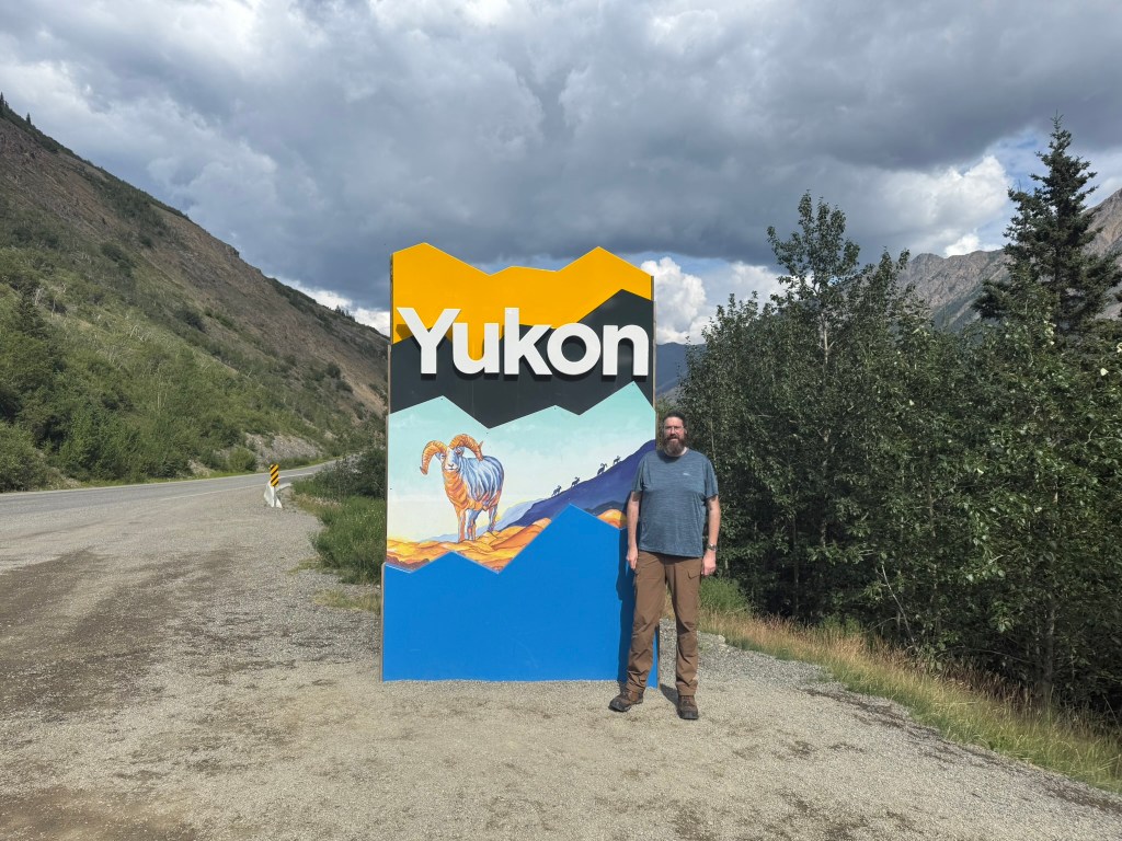
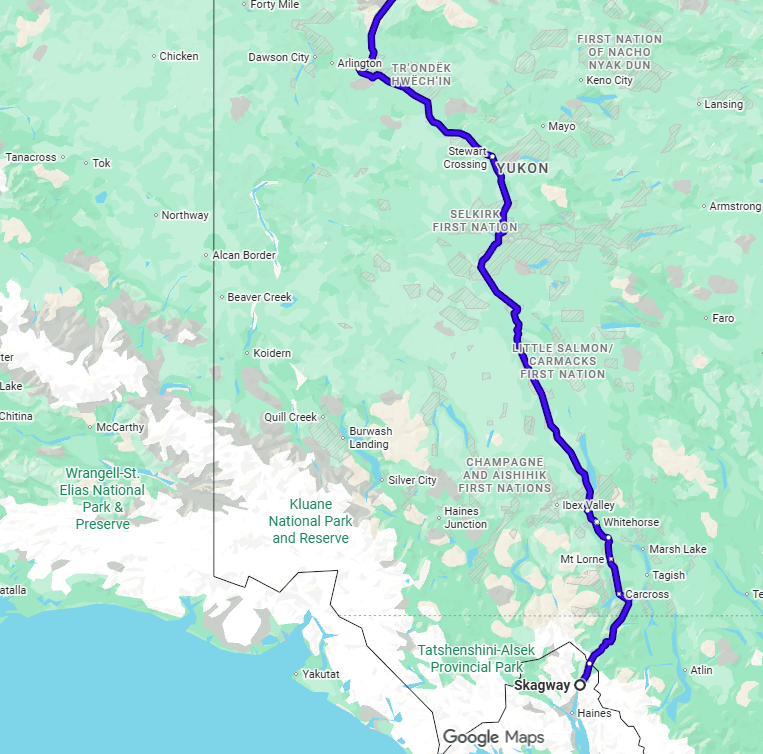
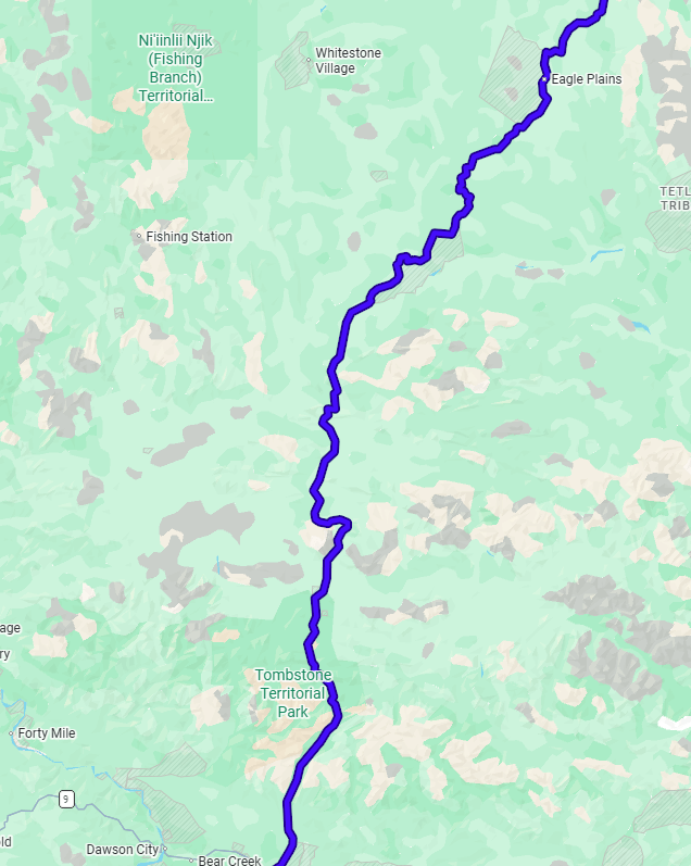
The base for our journey was to be Whitehorse, Yukon Territory. We contemplated a launch from Anchorage, Alaska, but that would have required a far longer drive to the start of the Dempster Highway and would have added more time as well as serious distraction from the primary goal of the trip – to drive from Dawson City, Yukon, to Tuktoyaktuk, Northwest Territories, and cast our eyes upon the gray waters of the Arctic.
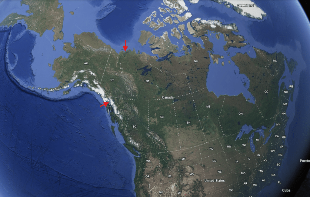
[The bottom arrow is where we were set to begin our journey in Skagway, AK, and the top arrow is our destination of Tuk, NWT.]
Miguel flew from Boston, Massachusetts, to Whitehorse, via Montreal and Vancouver. I flew from Billings, Montana, through Denver, joining him in Vancouver for the final leg north.
For as much planning as I had done, we had very little set in stone. The extent of our plan was to fly into Whitehorse, stay in a hotel that night, drive to Skagway, Alaska, the following morning, and then return to our hotel in Whitehorse 11 days later. The only other arrangement we made was to book a campsite in Tombstone Territorial Park, 45 miles up the Dempster, on the third night of the trip, only because we did not want to miss out on staying in that area, which I read was stunning. The rest was entirely open to our whims.
Initially, we planned to rent an SUV and camp each night in tents. The more we thought about it, however, we decided to upgrade to a truck with a camper. We easily could have made the tents work, but we thought the camper would give us more flexibility on the road, with us not having to plan camping spots fit for tents and instead giving us the option to simply pull over to sleep, as needed. In addition, having the camper would give us the flexibility to stay out of the rain and wind as well as avoid the worst of the biting insects. If our tents and gear got rain-soaked, particularly for multiple days, it would make for some challenges in getting dried out. Also, I knew the winds up there could get fierce, and there could be circumstances in which tents would not be ideal. In fact, it would have been very difficult to spend the night on the shore of the Arctic Ocean in tents due to the high winds. Our choice of the camper turned out to be a great one, although if we had only tents, we would have been just fine.
For me, a serious downside to the camper was that I would be deprived of the opportunity to sleep outside. Sleeping outside is a meaningful experience for me. It’s incredible to go to sleep outside and wake up and still be outside. Watching the sun set over the horizon and then waking up to see it rise on the whole other side of the sky. And the sun didn’t move at all! We sat as tiny specks on our giant planet as it spun all the way around bringing us back to the sun again.
We decided we would bring our tents anyway. That way, we could still camp outside when and if we wanted to. We were also unsure of exactly how much space there would be in the camper, so giving us the option to spread out, with one or both of us outside in a tent, could be beneficial.
Gear
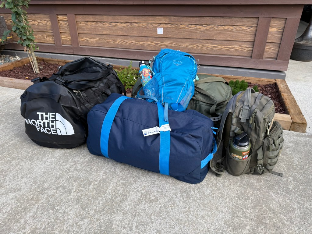
I tried to pack as little as possible, but being so far from home and resources, I did want to be prepared. It was a great experience to have to determine what was needed and what was really not necessary. The following is a list of everything I brought. All of my gear was packed in two 90-liter duffel bags and my small day pack.
| Gear | Clothes/Personal |
| Tent (one-person) | Boots |
| Sleeping pad | Hiking Socks (x 4) |
| Sleeping bag (0 degree) | Wool hat* |
| Inflatable pillow | Gloves (x 2)** |
| Bug head net | Sandal shoes |
| Emergency blanket* | Hiking pants (x 2)** |
| Headlamp | Underwear (x 4) |
| Flashlight* | T-Shirts (x 4) |
| Lantern* | Fleece sweaters (x 2)** |
| Phone charger | Down jacket* |
| Knife (fixed blade) | Rain jacket |
| Knife (Swiss Army) | Base layer bottoms and top |
| Camping Towel* | Warm-up pants* |
| Plate | Shorts |
| Bowl | Book (Moby Dick) |
| Spork | Journal |
| Mug | Pens |
| Day backpack | Toiletries |
| Binoculars* | Toothbrush |
| Water bottles (2) | |
| Grill grate | |
| Hatchet | |
| Butane backpacking stove | |
| Small pot | |
| Small pan (Miguel brought) | |
| Matches* | *Items I never used |
| Zippo lighter | **I only used one |
Day 1: Arrival (July 26, 2025)
“The world’s big and I want to have a good look at it before it gets dark.” – John Muir
I packed the night before. I had to wake up at 3:15am MT. My wife was kind enough to wake up with me and drive me the hour and 45 minutes from Cody, Wyoming, to the airport in Billings, Montana. We left Cody at 3:45am to catch my 7am flight. I made it with plenty of time to spare. It struck me as funny that on the other side of the country, Miguel was on his way to the airport in Boston, with both airports being called Logan International Airport and both being located on Interstate 90, over 2,000 miles apart.
A Tale of Two Logans
The Logan Airports are named for very different Logans. Boston’s airport takes the name of Edward Lawrence Logan, who served in the Spanish-American War and World War I, and was a member of the Massachusetts Legislature and a judge in Boston. The Logan in Billings is Dick Logan, the former manager of the airport, in that role since the founding of the airport in 1928 until his death in 1957. (Later, I’ll mention yet another Logan, Mount Logan, the highest point in Canada, named after Canadian geologist William Edmond Logan.)
My flight got into Denver just a little late, and I had a seven-hour layover. I spent most of this time working, trying desperately to finish some last-minute projects (and letting the panic of actually not working for a week and a half get the best of me). My flight to Vancouver took off late, and I arrived there about 7:30pm PT. I’ve never been to Vancouver, but after seeing the incredible scenery out the window on our descent, it looks like I place I must visit someday.
Miguel alerted me to an experience he had in which the customs people in Montreal gave him a hard time about where he was going and why. Apparently, he told them he was going to the Arctic Circle and just driving around, which gave them pause. I guess that is not a common answer to the question “What brings you to Canada, eh?” It was probably also a red flag that Miguel and I were in Montreal only two weeks earlier. So, as I approached customs, I was well-prepared to give them reasonable answers to their questions of me. However, after handing them my passport, they asked me no questions at all and waived me through.
While I was waiting for Miguel to arrive, I had dinner and a local beer (while I took out my laptop and worked yet more …). Miguel arrived and we were reunited at the gate.
As we waited to board our flight to Whitehorse, a guy started talking to us after overhearing our conversation about whether there was any reason we might need a Starlink for internet (there wasn’t). It turns out that this guy – in his mid/late 20s – was from Dawson City and was returning home from Ukraine after fighting in the Ukrainian army for a year and a half. He was Canadian, but of Ukrainian background, and after serving for several years in the Canadian military, he volunteered to fight in an international unit defending Ukraine from the Russian invasion. He fought alongside soldiers from all over the world, including the US, Brazil, Denmark, and Canada. He left Ukraine after being injured – some kind of leg or back injury (he was limping badly) and breathing in something (I believe from an explosion of some kind; he was coughing frequently). When I asked him how things were going over there, he responded despondently “pretty bad.” He showed us some pictures of him in Ukraine. He also told us about a pack of wolves that lived south of Dawson (in Carmacks), told us about hunting bears, and discussed the gold mining economy of Dawson that still endures. He also warned us that the road from Whitehorse to Dawson was in really bad shape and to always slow down when there are cones on the side of the road – and boy was he right!
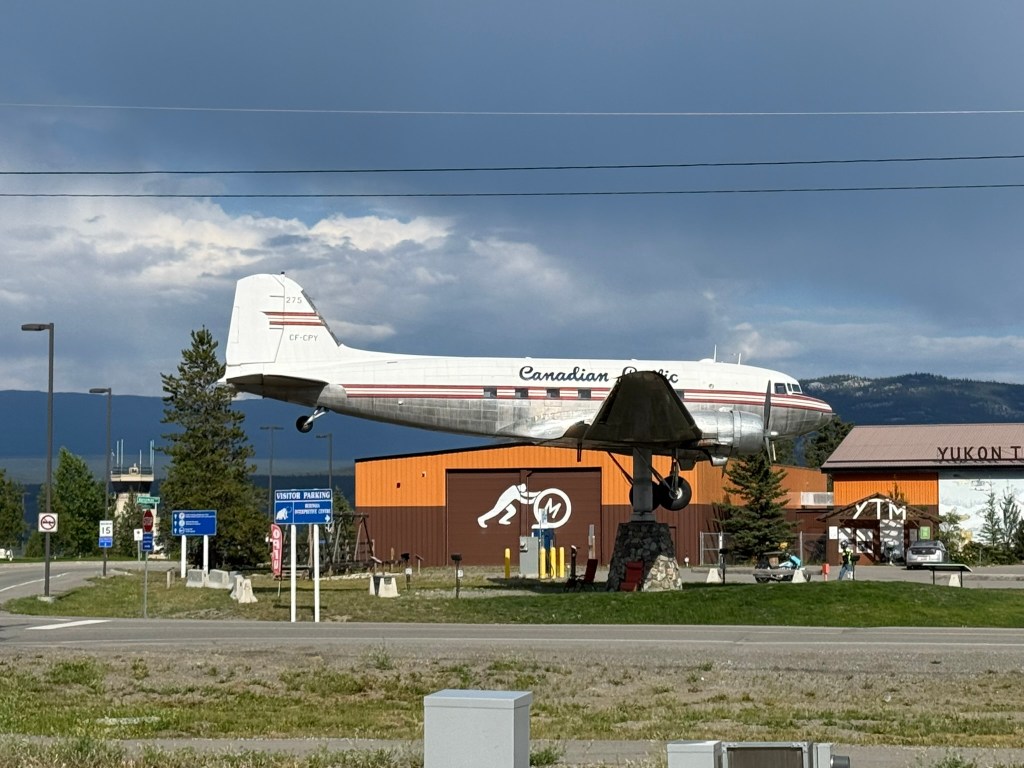
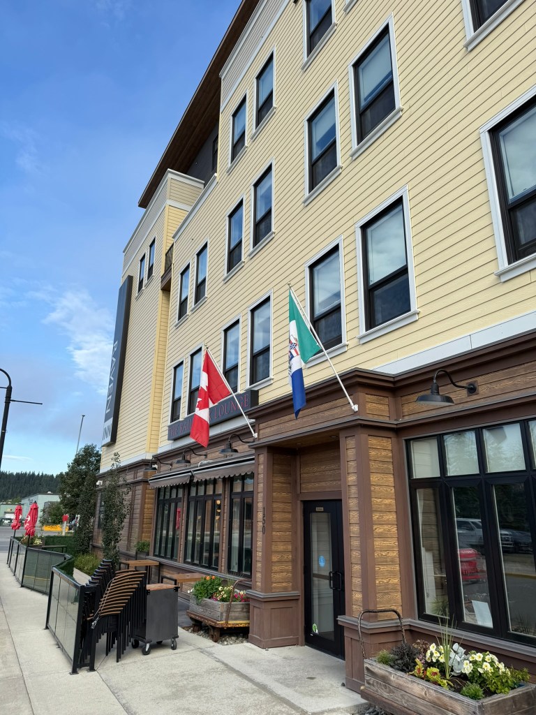
We landed in Whitehorse at midnight and got a taxi to our hotel – the Raven Inn. When we told the driver where we were staying, he was impressed and remarked that it was the newest in town and really nice. (It was indeed a fine hotel, for what it was.) The taxi driver also pointed out a full-sized DC-3 plane up on a pedestal outside the airport. He told us the plane had broken a record. We figured it was the first to complete some sort of arctic route or something, but he said it was the only plane that was also a weathervane – it turned on its stand and pointed in the direction of the wind. This seemed hard to believe at the time, and by the end of the trip we passed this plane many times, and it always seemed to be pointed in the same direction. We aren’t sure if this is true, he was trying to pull on over on us, or he believed it was true and someone pulled one over on him. The driver also claimed to be a big Boston sports fan when he found out where we were from. He used to be a long-haul trucker and claimed to have been to every city in the US. He also told us about the “smallest desert in the world” in Carcross (short for Caribou Crossing) that we should visit.
It was so satisfying to get to the room and into a soft bed. I fell right to sleep, at about 1am after a very long day.
Day 2: Departure (July 28, 2025)
“What is that feeling when you’re driving away from people and they recede on the plain till you see their specks dispersing? – It’s the too-huge world vaulting us, and it’s good-bye. But we lean forward to the next crazy venture beneath the skies.” – Jack Kerouac
We got up early and had breakfast at the hotel restaurant – the Railwork Lounge. It was good, and I was very grateful for some coffee. According to their menu, their sourdough waffles are made with sourdough starter from someone in the Gold Rush – 125 years ago! (We didn’t have any …)
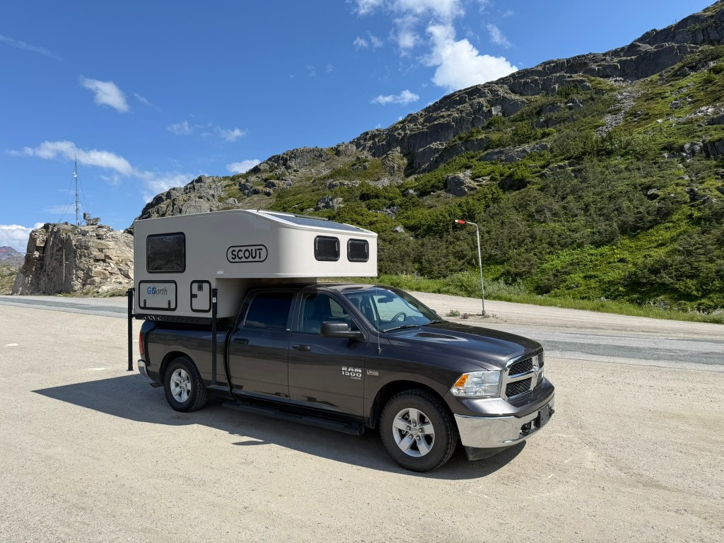
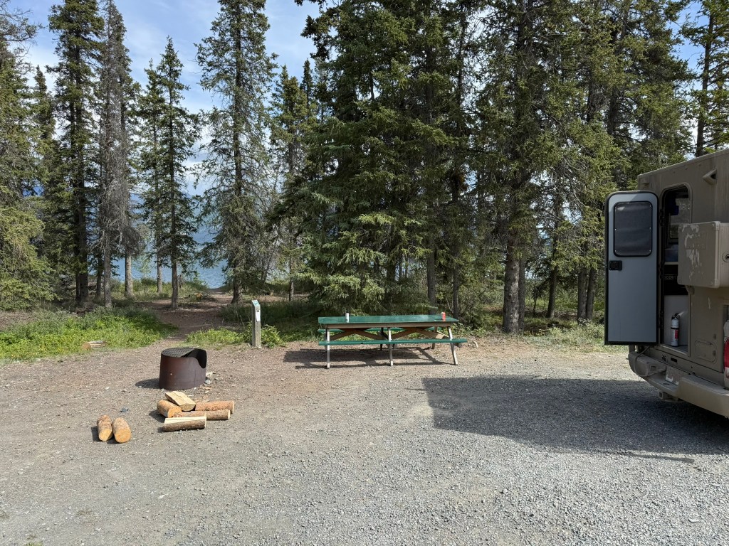
After breakfast, the van arrived from the camper rental place, GoNorth. Mike helped us and took us to pick up our vehicle. He gave us some pointers on the Dempster Highway. The clear message was to go slow and take your time to avoid flat tires, specifically, to stay under 40mph. Mike is from Switzerland and moved to the Yukon about three years earlier.
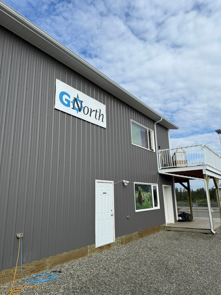
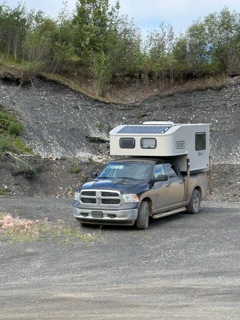
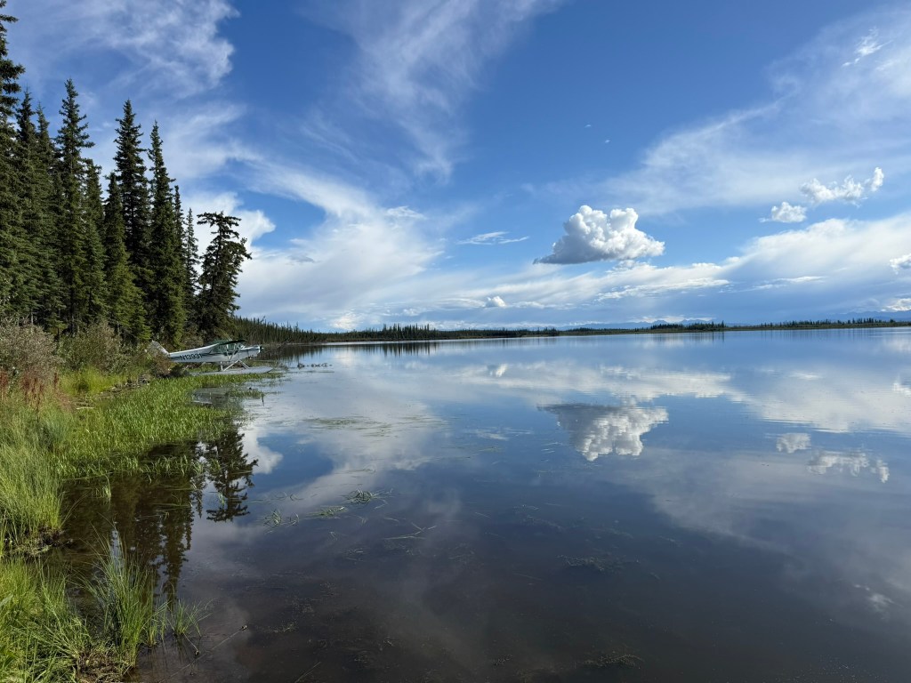
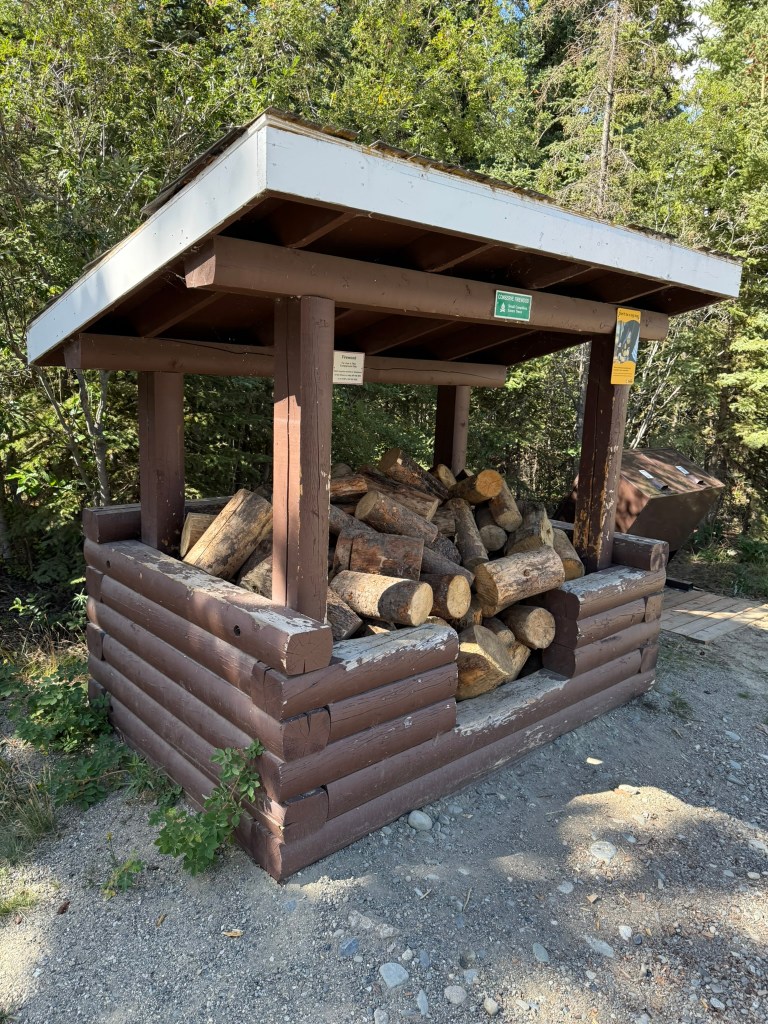
When we arrived at the rental place, Mike passed us off to a woman, Beatrice, to get us set up. She also had an accent, and we quickly realized they were married. She told us that they had visited one time and saw that GoNorth was hiring. It was the perfect opportunity for them, so they applied, and now they manage the location. We got checked in and reviewed the camper. She couldn’t believe that we didn’t pay for the “convenience package,” which included everything from blankets and bedding to cooking and eating supplies. We had really everything we needed, except folding chairs. While in the Southwest, we had bought cheap folding chairs at Wal-Mart, and by the end of the trip I had broken mine (I exceeded the weight limit) and the other we left out at the last campground for someone to take (along with our cooler we also bought at Wal-Mart – the MVP of that trip). Beatrice ended up letting us have two chairs for free, as well as some free bear spray (that was really not necessary). All of the campers they rent go by names, and ours was named “Sage.” She became a true member of the team.
First, we went to the store to get supplies. We bought plenty of food and water for at least three days. The store was oddly out of ice, so we had to get it elsewhere. We loaded up Sage and headed out!
By the way, we decided that – as we had done during our Southwest trip – we would rotate driving each day, which is a fantastic system. It allows you to enjoy driving while also enjoying staring at the scenery and always having a break from driving. Miguel drove this first day.
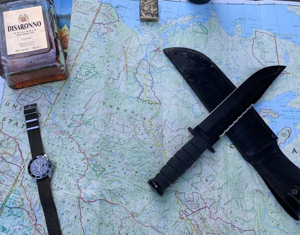
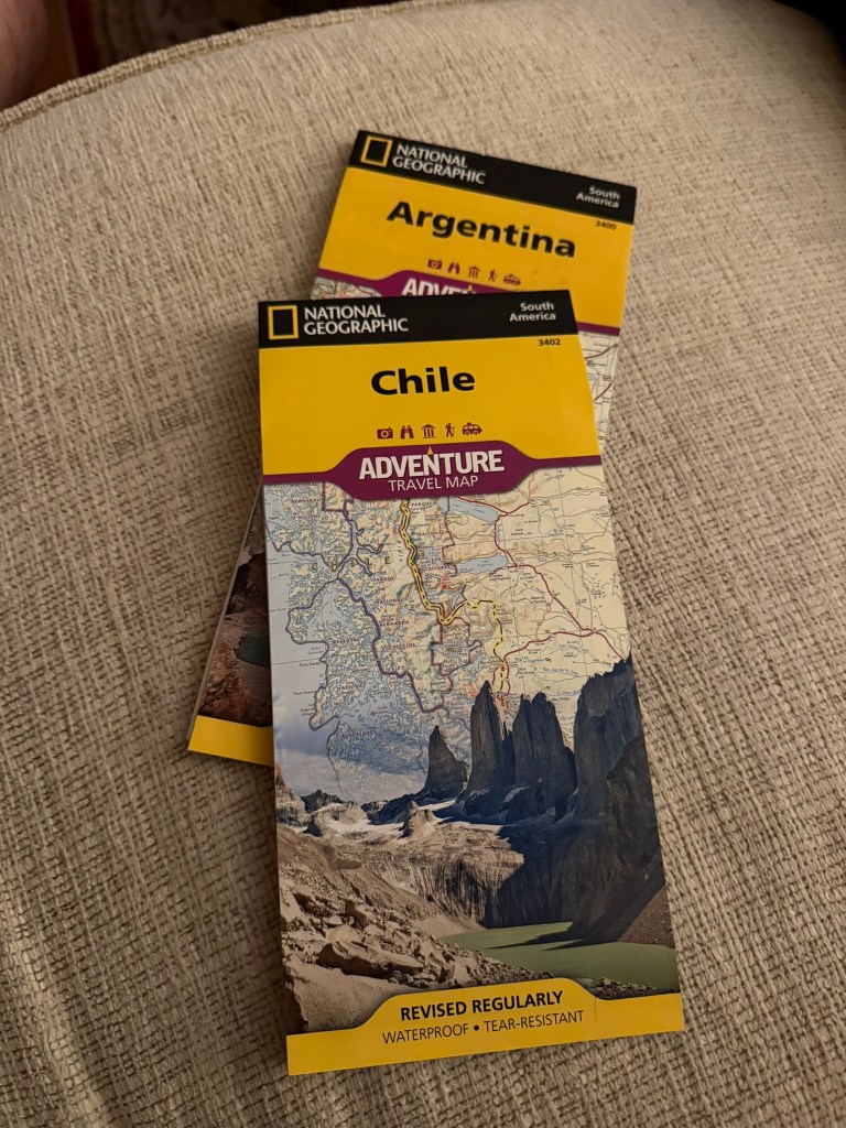
As in the Southwest, and as we have done on every other adventure, we used exclusively paper maps for all navigation and never used GPS. And, as always, I was the primary navigator. For this trip, I used a National Geographic Adventure Map of Western Canada. It included all of the areas we travelled in, including the parts of Alaska we visited.
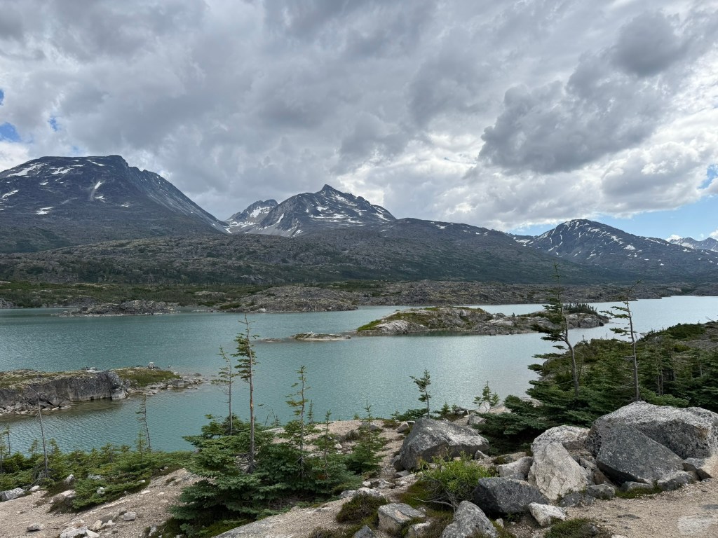
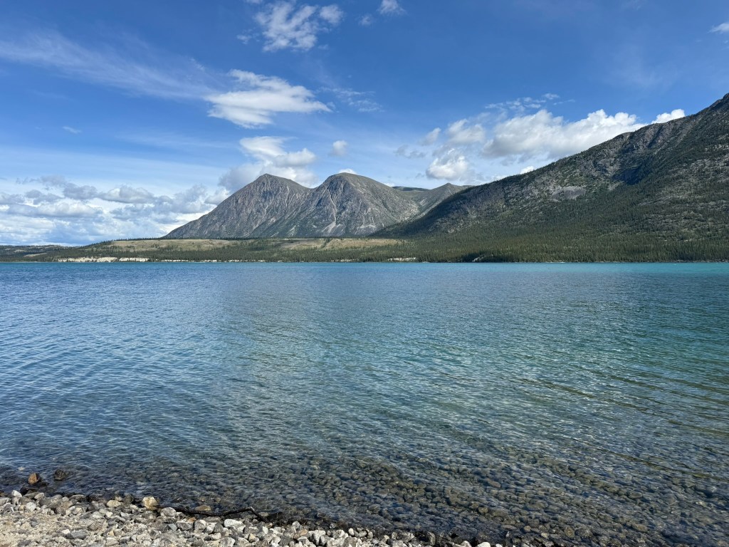
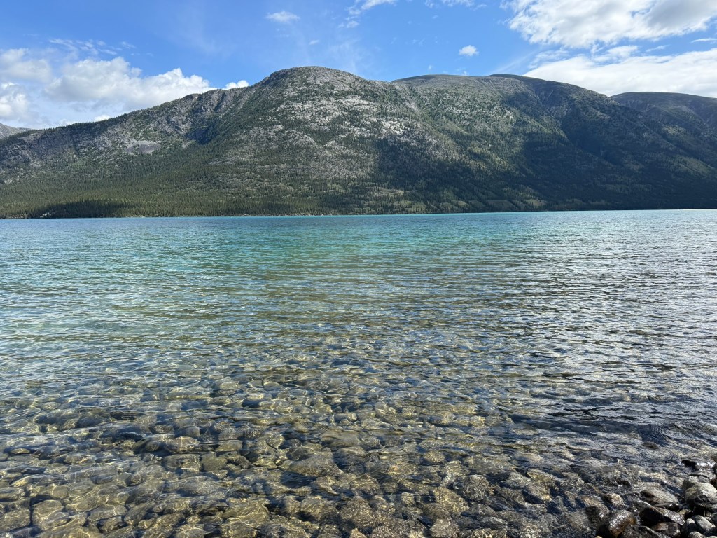
Instead of driving north, we headed south. We decided that we would drive to Alaska first, and begin our mission northward from the shore of the Pacific Ocean. We’d also never been to Alaska and thought it would be our best chance to do so on the trip (which wasn’t the case). The elevation increased significantly as we got closer to the coast. After about an hour, we were driving at a high elevation across a plateau with incredible scenery – crystal blue mountain lakes nestled among the Rocky Mountains. Until then, the best sites my eyes have seen were the fjords of Norway or the Canadian Rockies, but this was up there.
We crossed through British Columbia briefly before reaching Alaska. (We didn’t realize at first, but Alaska, even though we were south, was an hour behind the Yukon.)
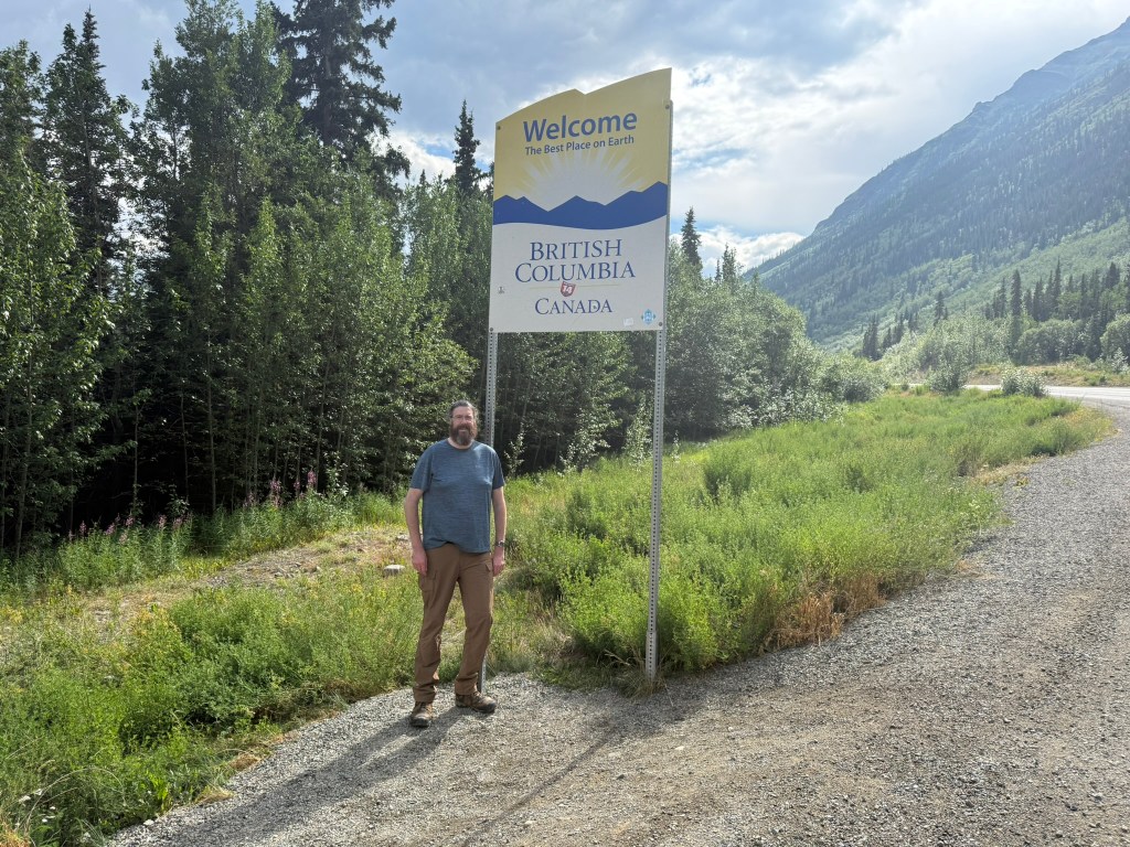
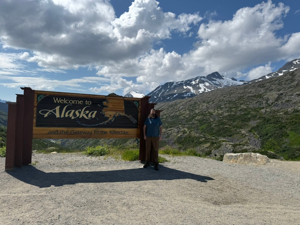
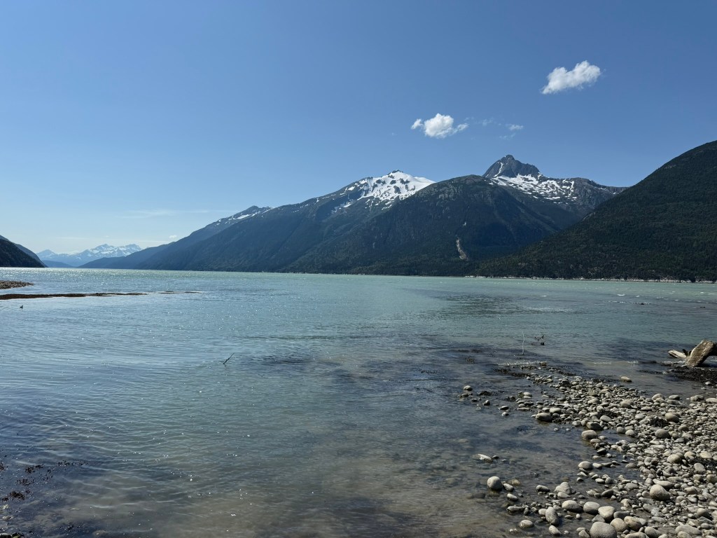
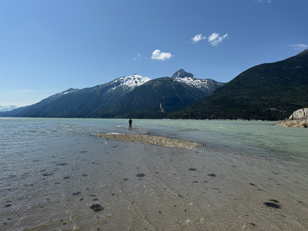
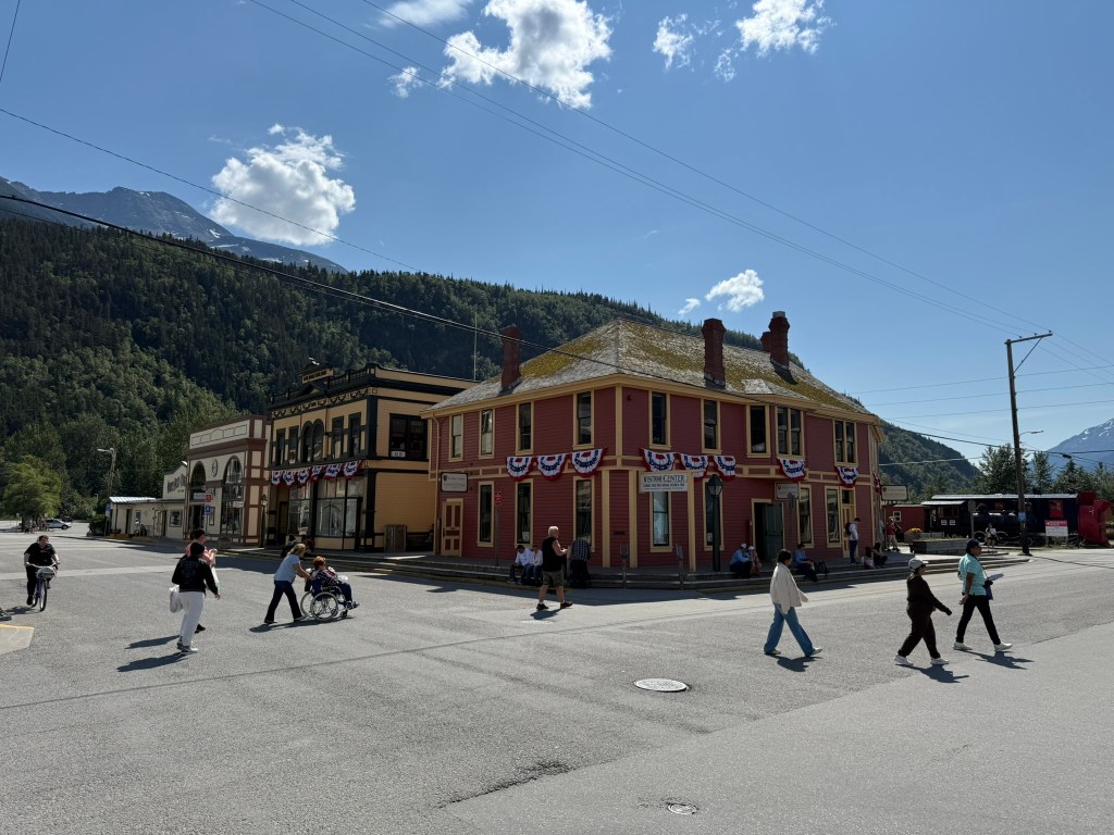
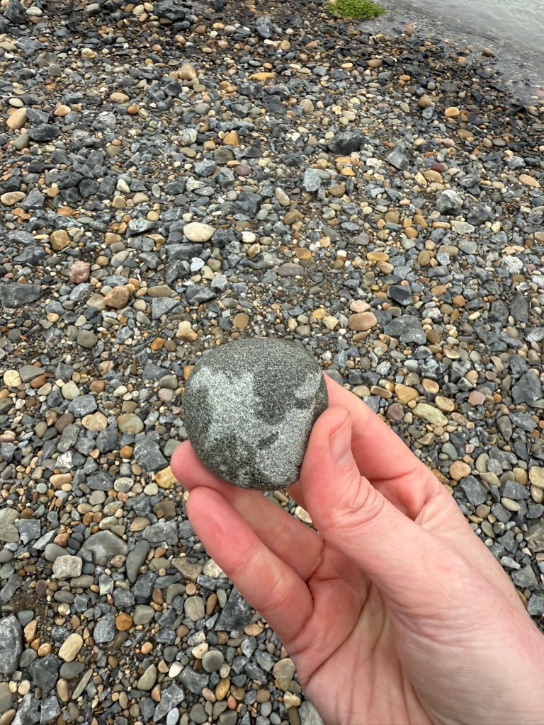
At the US border crossing, we had to get out of the truck while a border patrol officer inspected our food. After closely examining our apples with a flashlight, he allowed us to proceed (with our fruit). We reached Skagway after about a two-hour drive from Whitehorse. We went directly to the water, climbing down some steep rocks to a rocky beach at the mouth of a river. It was clear that at high tide the water comes far in. There is a foot bridge across the river, right next to a small airport and close to two large cruise ships in port. We walked out to the edge of the water to an unbelievable view – with clear blue water against mountains across the bay. I walked through about 6 inches of water out to a sandbar and was able to get pretty far out. I grabbed a small rock and decided that I would transport it on a wild ride with us to the Arctic Ocean.
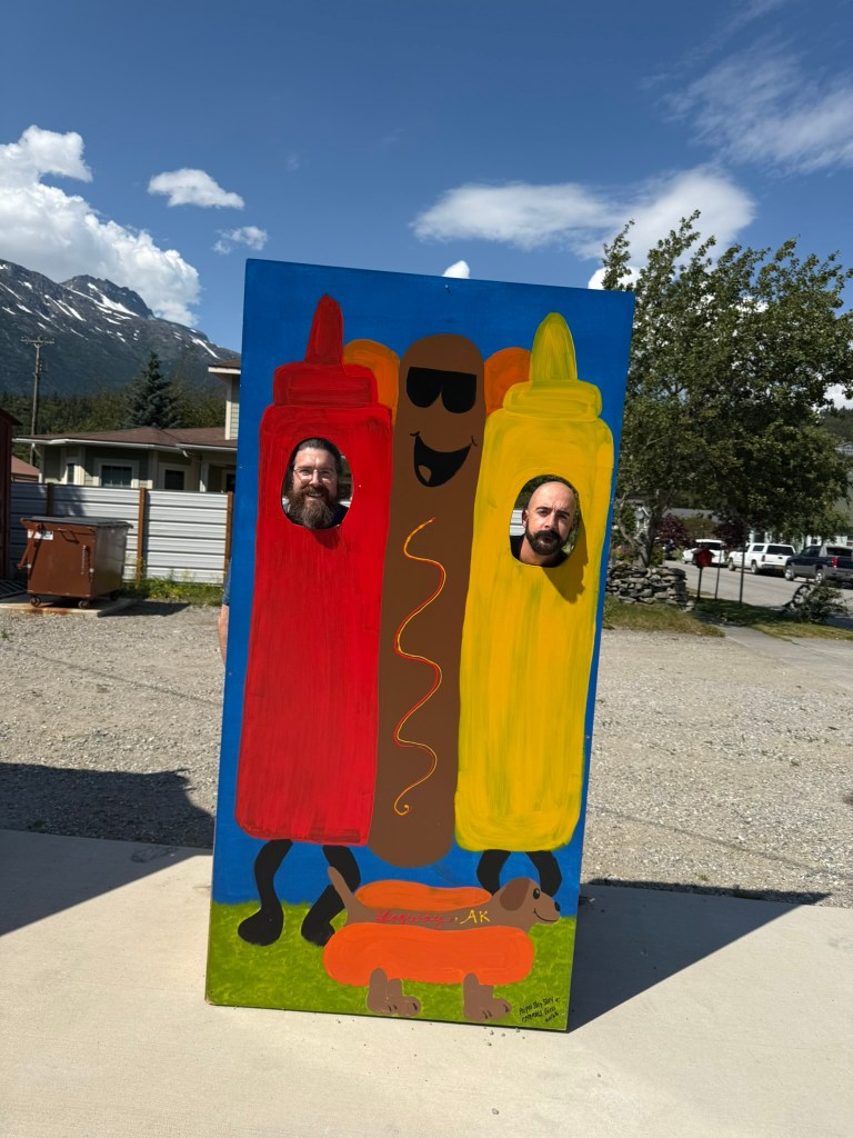
We headed back into town to find some food. We saw a hot dog stand with a large statue of Godzilla made out of painted insulation foam. What led us there was a big sign advertising reindeer sausages. We enjoyed our sausages with mustard and onions, and the nice woman working the stand took a picture of us as hot dogs.
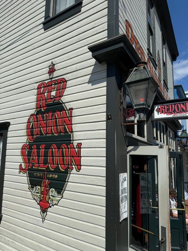
We wanted to visit a frontier saloon, and the hot dog lady recommended the Red Onion, which used to be a brothel in 1898 during the Gold Rush. The lady said she “used to work there,” but we’re not sure in what capacity given its history. We walked down and were lucky enough to get a spot at the bar, seeing how it was packed with cruise-goers. The bartender told us about a bar in Dawson City that has “toe shots” – shots with frostbitten amputated toes in them, and if you let the toe touch your teeth (without swallowing it), you get some sort of recognition. We walked down the main street and visited a couple of shops, and then headed out.
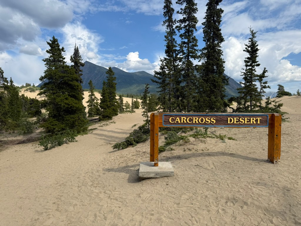
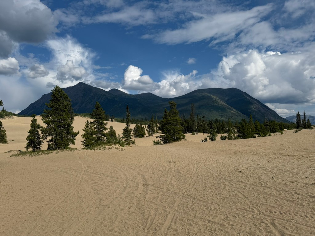
This was the official start of the journey, from sea to (dark, gray) sea. We backtracked to Whitehorse, stopping at Carcross, where there was in fact a tiny desert. It wasn’t actually a desert, but sand dunes from an ancient lake. We walked around a bit. It was very odd and out of place, unlike any of the environment around it.
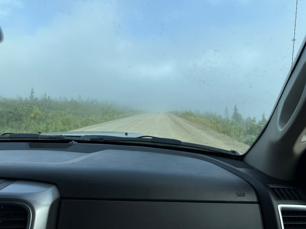
We stopped in Whitehorse for gas and more supplies and continued north. The country was beautiful, with thick pine forests and lakes along the road. It actually reminded me a lot of northern Maine. True to the warning from the guy in the airport, the road was terrible. I thoroughly anticipated the challenges of driving on the gravel Dempster Highway, but completely overlooked that this initial drive was going to be such a challenge. The road would be fine for a stretch and then suddenly have giant potholes or dips that if you were going at full speed would destroy your vehicle.
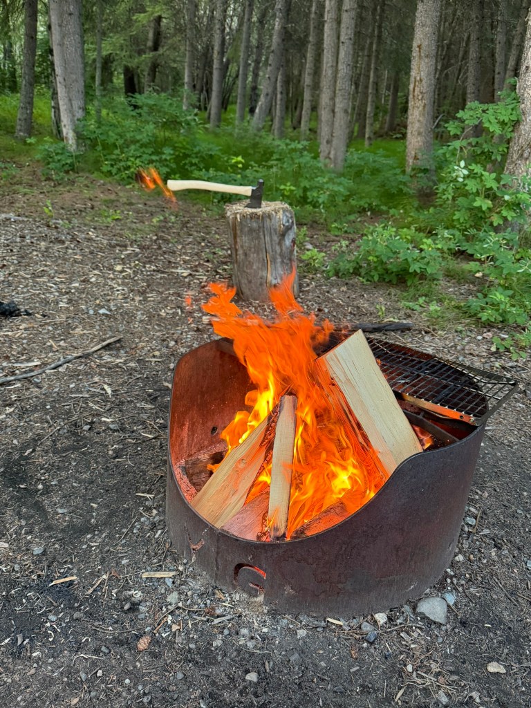
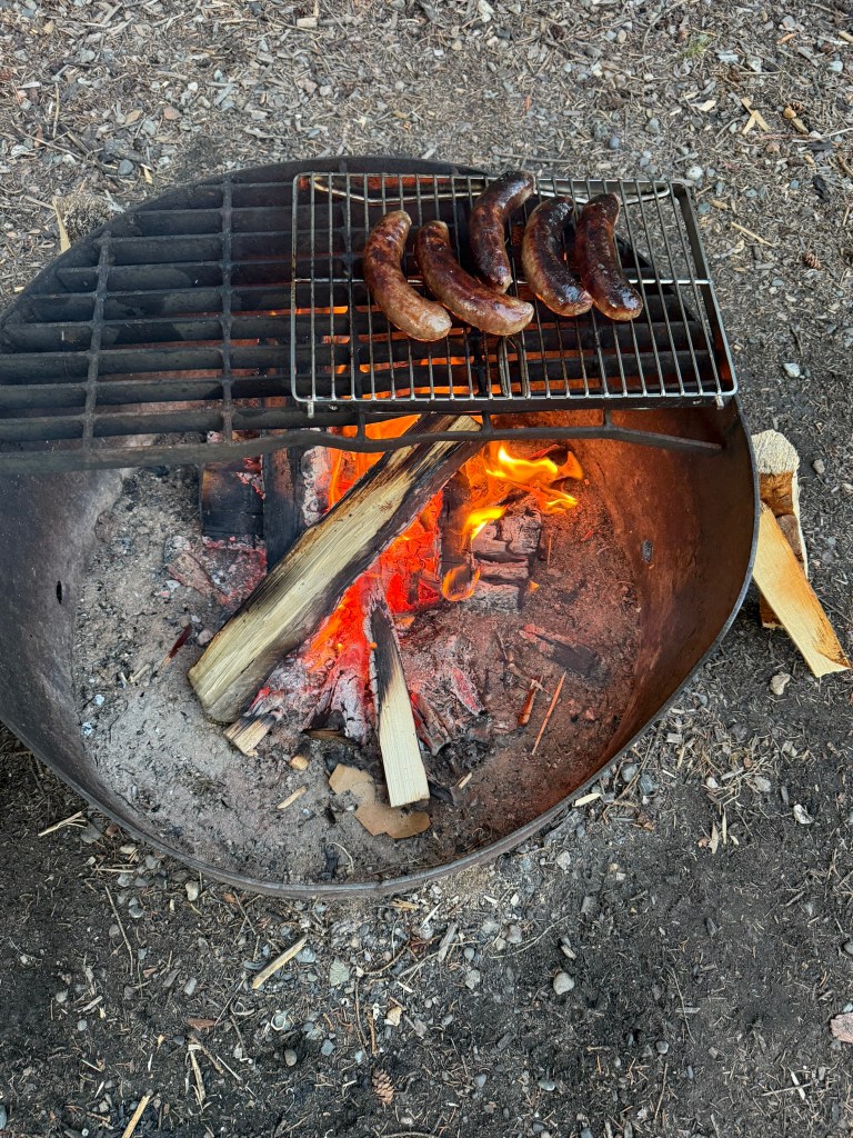
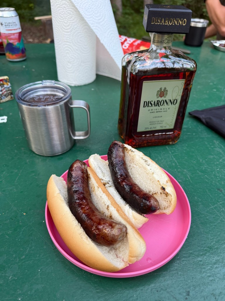
We aimed to get as far north as we could before stopping. We considered just parking at a rest area along the road when we saw a sign that we were approaching a campground – the Tatchum Creek Campground. We found a great spot close to a river, which produced a soothing river soundtrack for our evening. A fire was constructed and we had flame-kissed bratwursts and Disaronno in our camp mugs. Usually when we camp, we always have Skrewball whiskey, based on a tradition that started in the Southwest, when we met someone in the airport who apparently worked for Skrewball, but the only liquor store in Whitehorse didn’t have any. (The store was very unusual, and customers could not handle the products but had to ask for everything at the counter.)
We went to sleep at around 11:30pm, and the sun was still out and bright. We decided to sleep in the camper instead of tents, eager to try out the accommodations.
The Camper
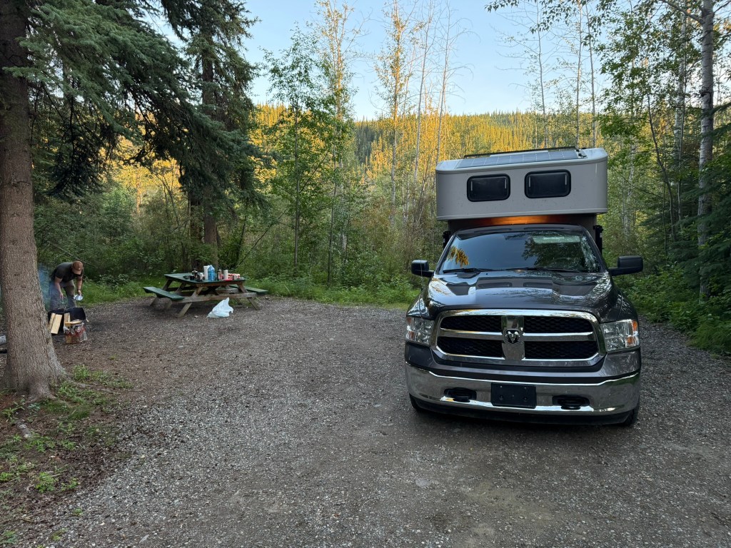
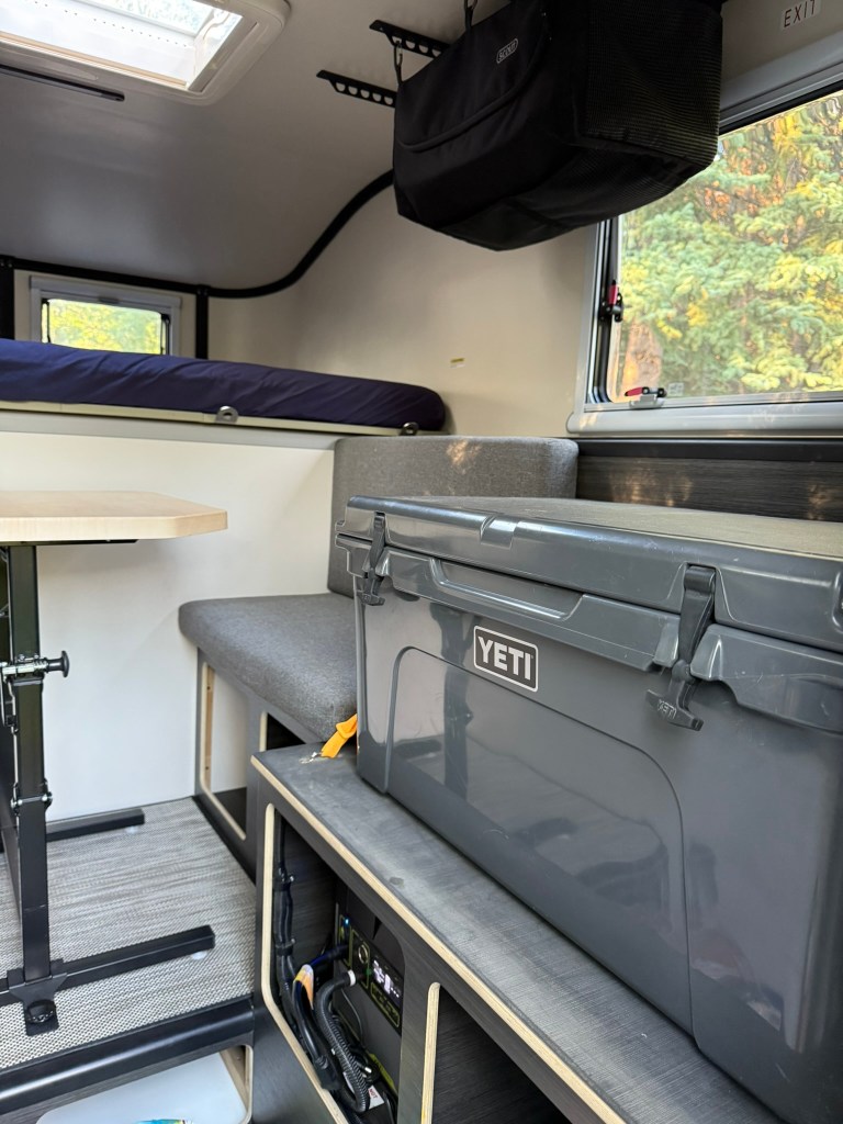
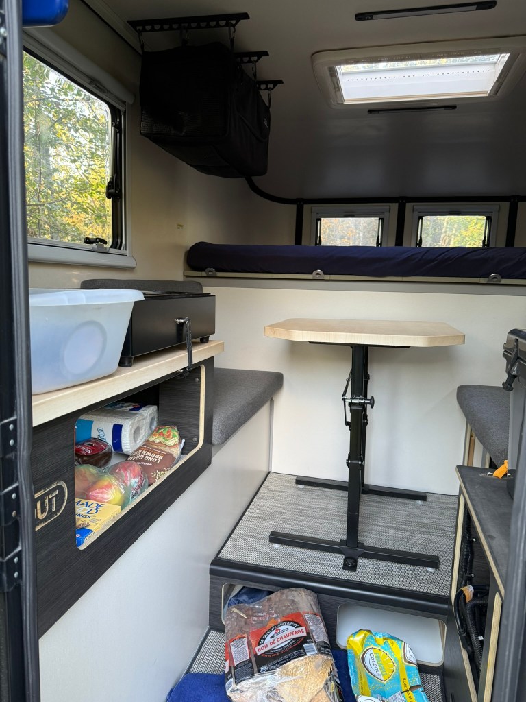
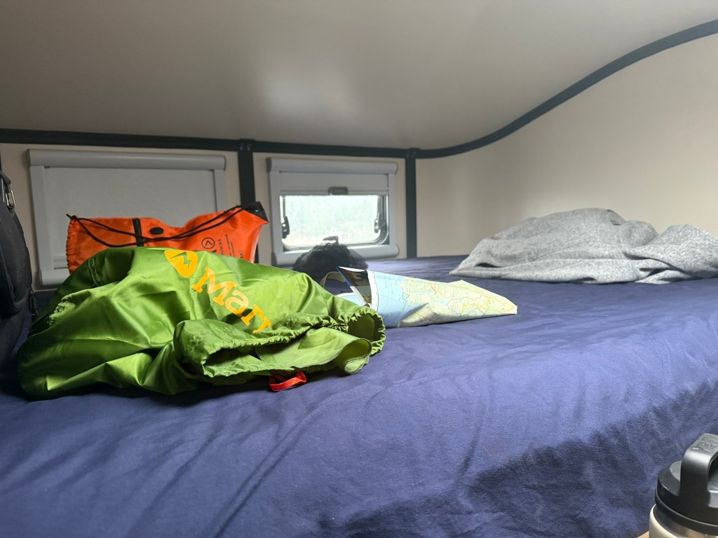
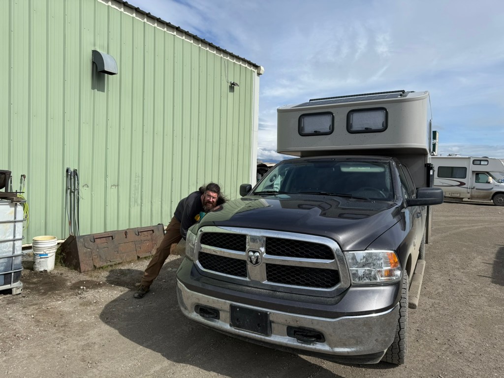
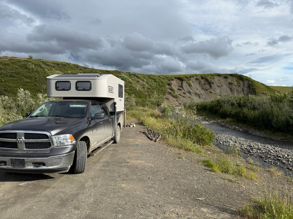
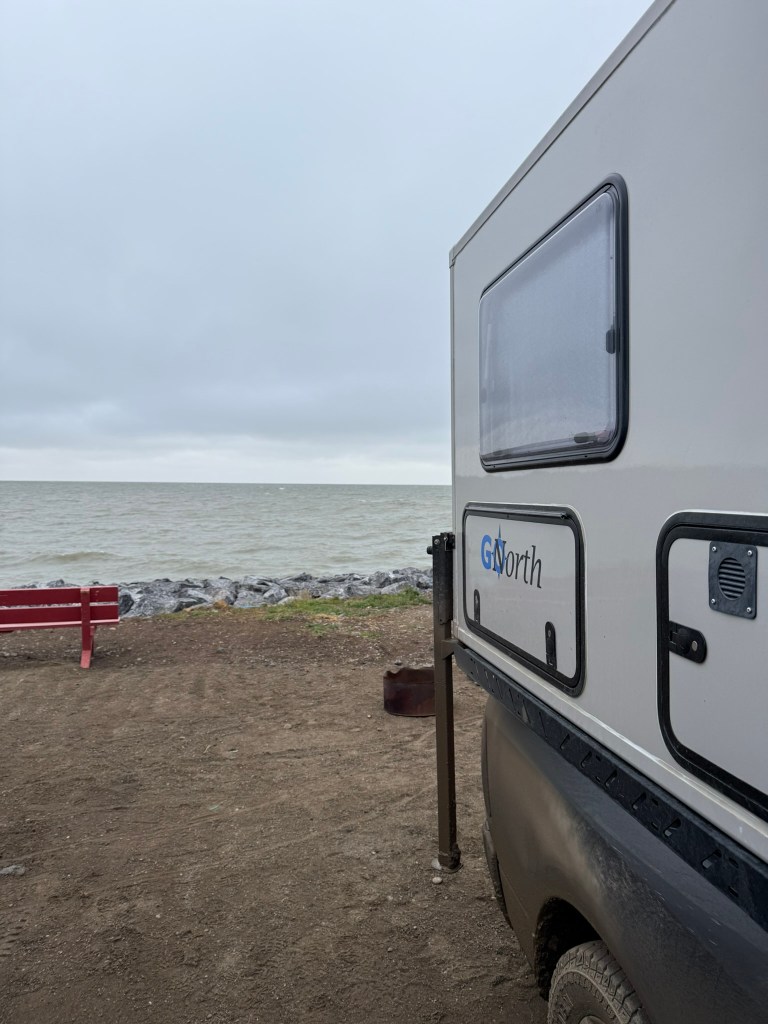
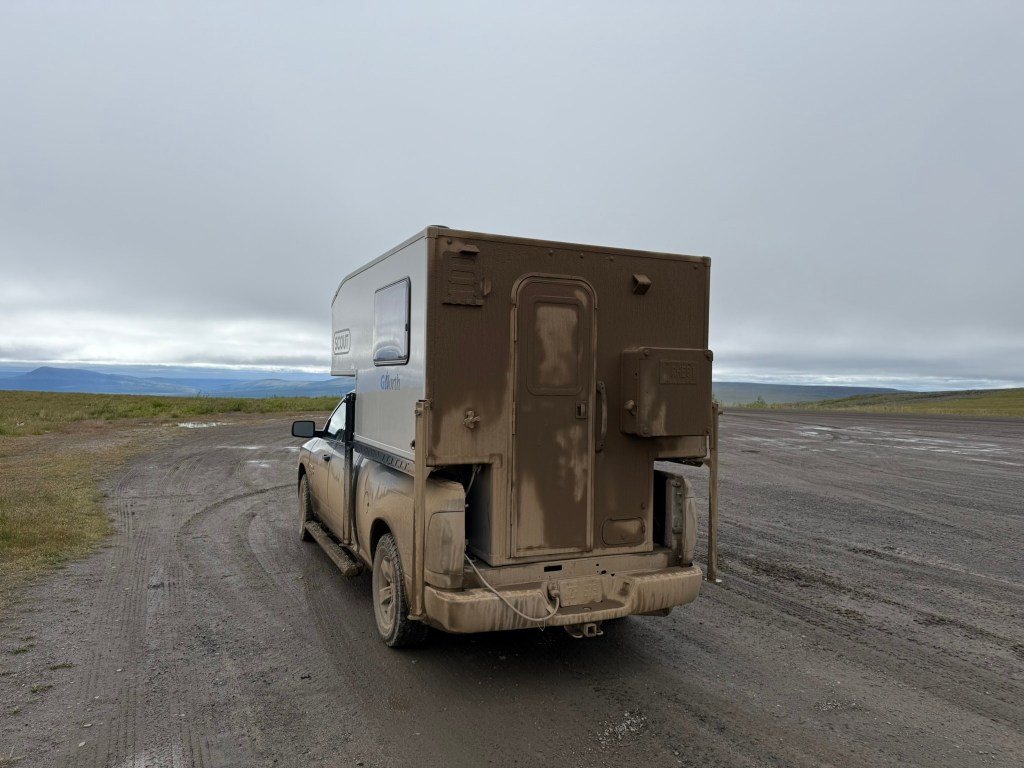
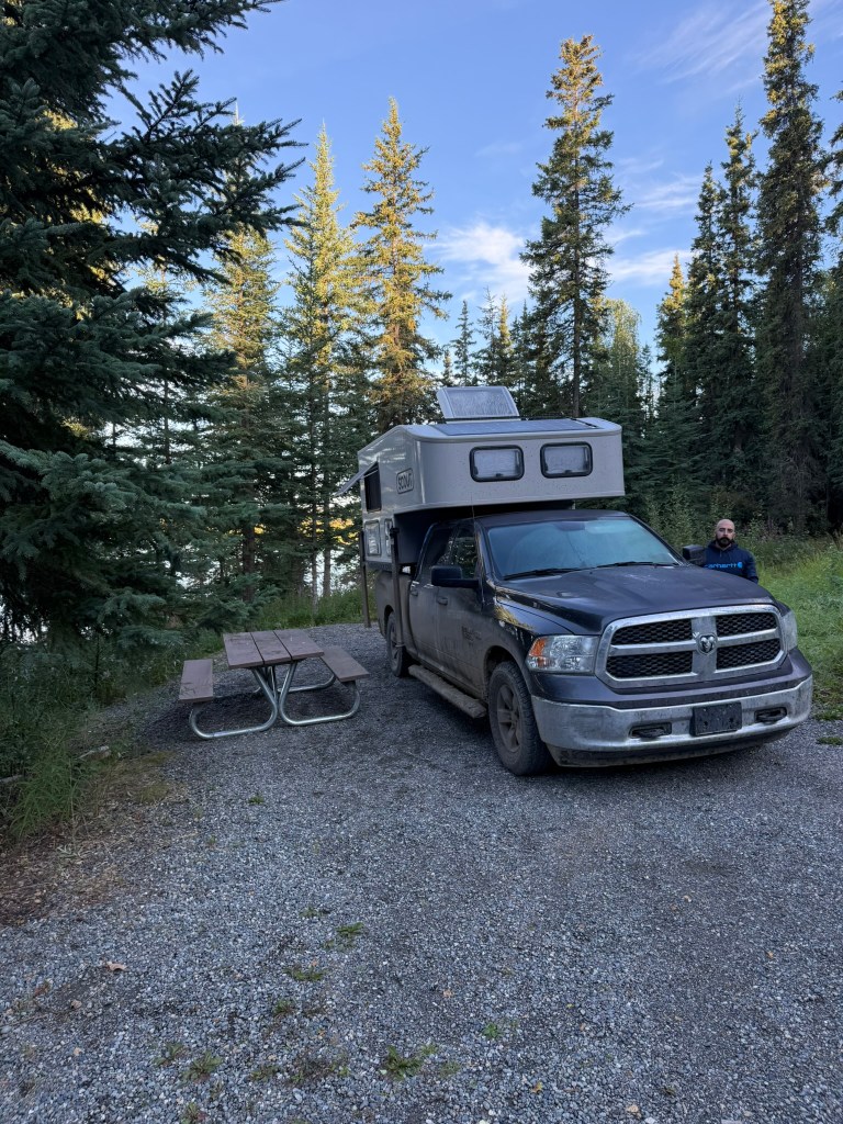
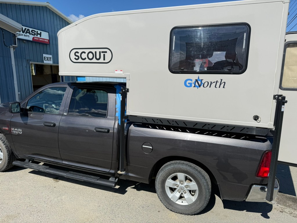
Sage was a champ. The truck was a new Ram 1500 pickup, with no frills. It had an extended cab, with four doors, so we put all of our personal gear in the back seats, mine on the passenger side and Miguel’s on the driver’s side. The camper sat in the bed of the truck, with a door accessing it at the rear. Inside the camper, on the left side, was a two-burner stove supplied by a propane tank and a small sink (water could be deployed from a hanging water tank and faucet) and storage space. On the right side was a large Yeti cooler and the power equipment. The camper had solar power and interior lights, which we never used, and it had a diesel heating system, which we also never used. It had no bathroom.
The camper had a small table with two cushioned chairs on either side, and the table could be folded down and a cushion added over it to create a bed. Above that was a double-sized bed. Any time I slept in the camper, I used the double bed, and Miguel slept in the lower bed. (I offered to trade-off.) We used our own sleeping bags we brought.
Driving Sage was not much different from driving a pickup truck, especially at lower speeds. However, at high speeds you could feel the drag from the camper, and when the road surface was uneven, the camper did rock from side to side a bit. It was clear that the rental place didn’t upgrade the rear suspension of the truck at all, so it was pretty bad, with the camper’s weight compressing the springs. The truck had one full size spare tire, which was essential when travelling on gravel roads due to the risk of punctures. When planning, some people recommended having a second spare, but we didn’t think it was necessary. Flat tires and broken windshields are common on the Dempster.
Day 3: The Adventure Begins (July 29, 2025)
“When the world rang with the tale of Arctic gold, and the lure of the North gripped the heartstrings of men…” – Jack London
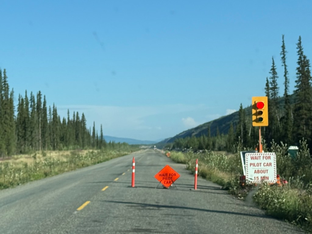
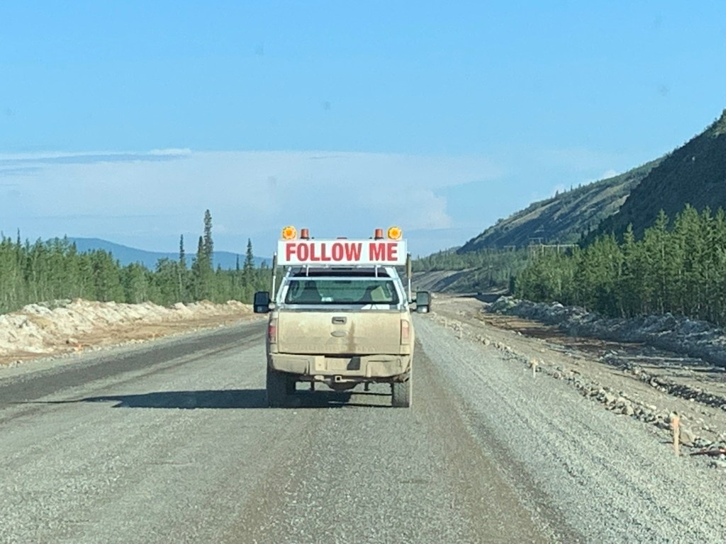
I drove today. After some coffee and oatmeal, we departed early. It was a really long drive to Dawson City, although the scenery was nice, mostly wooded, passing through tiny towns. I’m glad they were working to improve the road, but the construction was awful. We taped up the edges of the back door on the camper with masking tape to prevent dust from entering, upon advice. (We’re not sure if it really helped, but we kept taping up the door most of the trip.) About three sections of road had been torn up, and we had to wait and follow pilot cars through the construction zones. Wherever there wasn’t construction, the road was terrible, and it looked like they were replacing the whole thing. Driving was high stress and you really had to pay close attention.
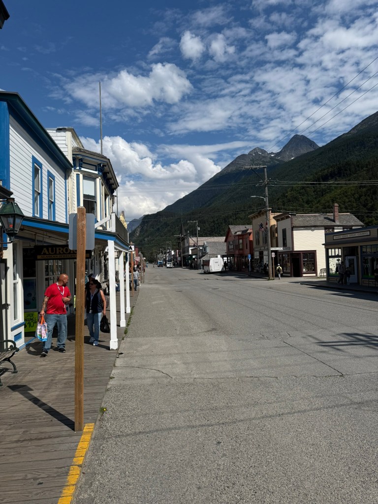
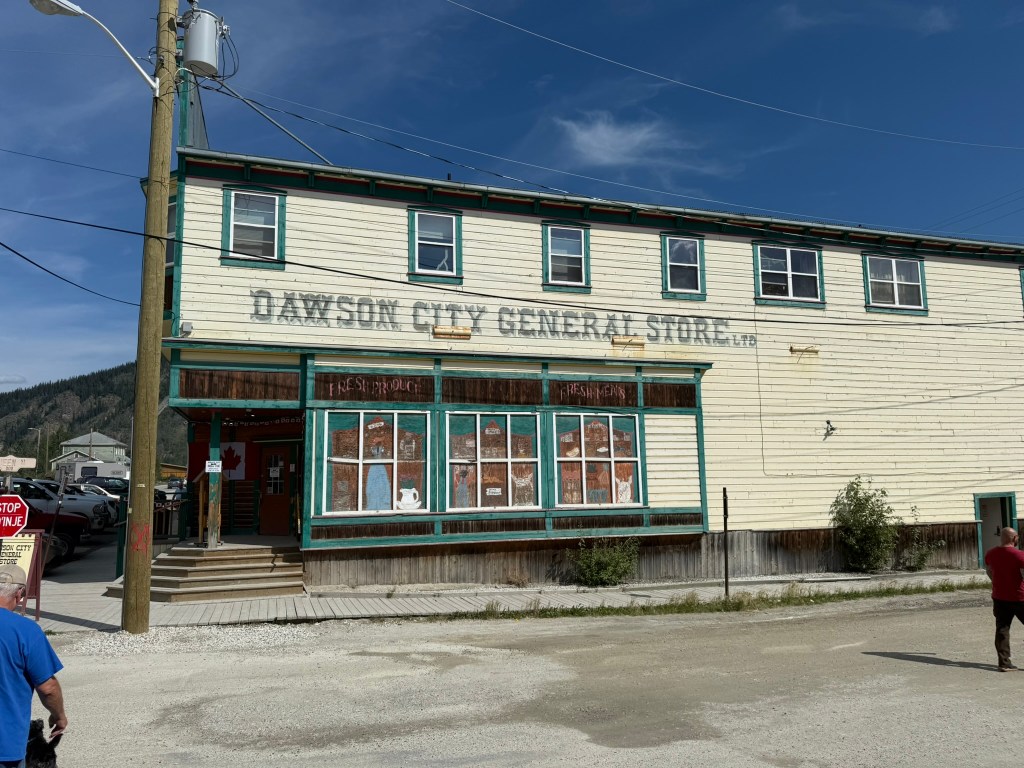
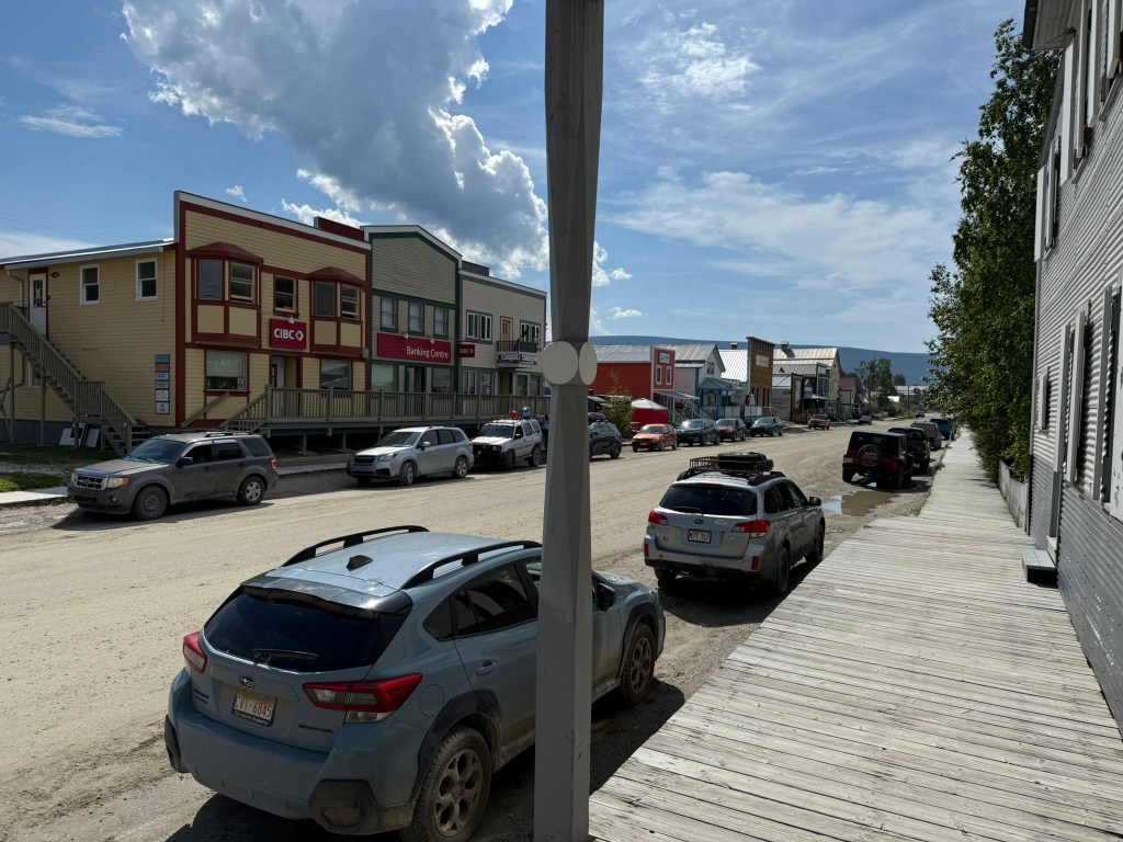
We eventually reached the start of the Dempster Highway, but before turning up it, we had to drive a bit further to Dawson City for supplies. Dawson City seemed like a pretty rough place and still had much the appearance of a frontier town. There was a little tourism, but not nearly as much as I expected. We were looking for a restaurant to have a last good meal for a while, but the selection was pretty slim. We wandered around town and ended up at Sourdough Joe’s, which supposedly is located on the first lot developed in town, by Joseph Ladue, one of the town’s founders. The service was terrible and slow, but the food was decent and it was nice to sit down outside of the truck.
The Gold Rush
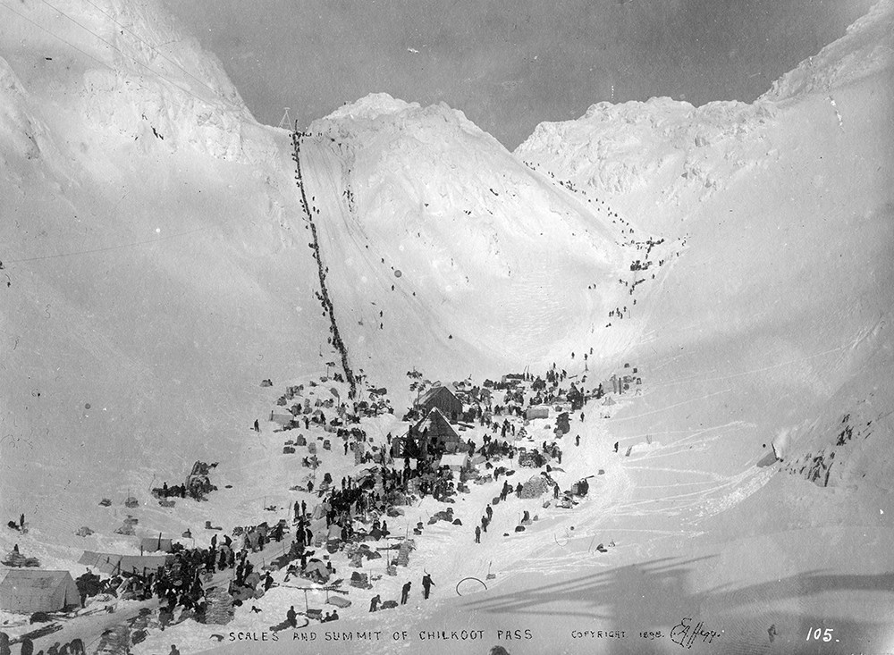
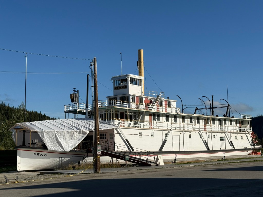
In 1896, gold was discovered along the Klondike River near its confluence with the Yukon River, just east of Dawson City. The strike set off a flood of prospectors travelling to the frontier of Northwestern Canada hoping to strike it rich. Over the next few years, tens of thousands converged on Dawson, many being Americans coming by way of San Francisco or Seattle. Most arrived in Skagway or Dyea, Alaska, which became boom towns, and travelled virtually the same route that we did from Skagway to Dawson. However, while we had the benefit of paved roads and a comfortable camper, the trek for these prospectors was brutal. From the Alaska coast, they had to travel over high passes through the coastal mountains, including the White Pass Trail or the Chilkoot Trail (that latter included a 1,000 foot climb, being cut with a 1,500 step staircase, known as the “Golden Steps”) by foot, and then across the vast, often frozen, landscape by boat (see paddle boat pictured below), wagon, or dog sled almost 500 miles up to Dawson City.
Jack London became famous for his tales of the Yukon, which were based on his firsthand experiences making the trek from San Francisco, to Skagway, to Dawson, and beyond. We retraced his steps – and those of many other gold seekers – that served as the backdrop of his works, including the Call of the Wild and White Fang.
[A picture of Jack London’s grave I took in 2024 in Glen Ellen, CA.]
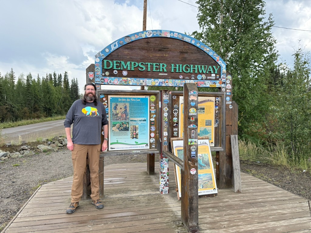
After a visit to the general store to get more food and supplies, we headed back to the Dempster. We got gas at the station right at the turn and stopped to visit the sign for the entrance to the Dempster Highway. It was hard to believe we reached even the start of the Dempster. I had done so much research and read about it for so long, and it was crazy to actually be there. It indeed seems crazy to actually do the things you dream of doing.
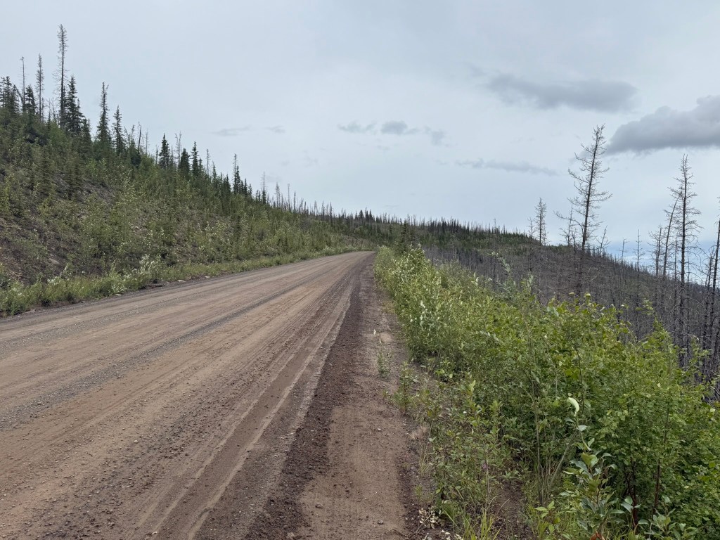
We crossed a bridge over the Klondike River, and the road quickly turned to gravel. I drove very slowly at first, cautious about flat tires and mindful of the warnings to “drive slow and take your time.” The road wasn’t bad, at least at this stage. The scenery was immediately incredible, with mountains ahead and thick pine forests surrounding us. There were a few driveways, apparently with houses in the woods, in the first few miles, then nothing.
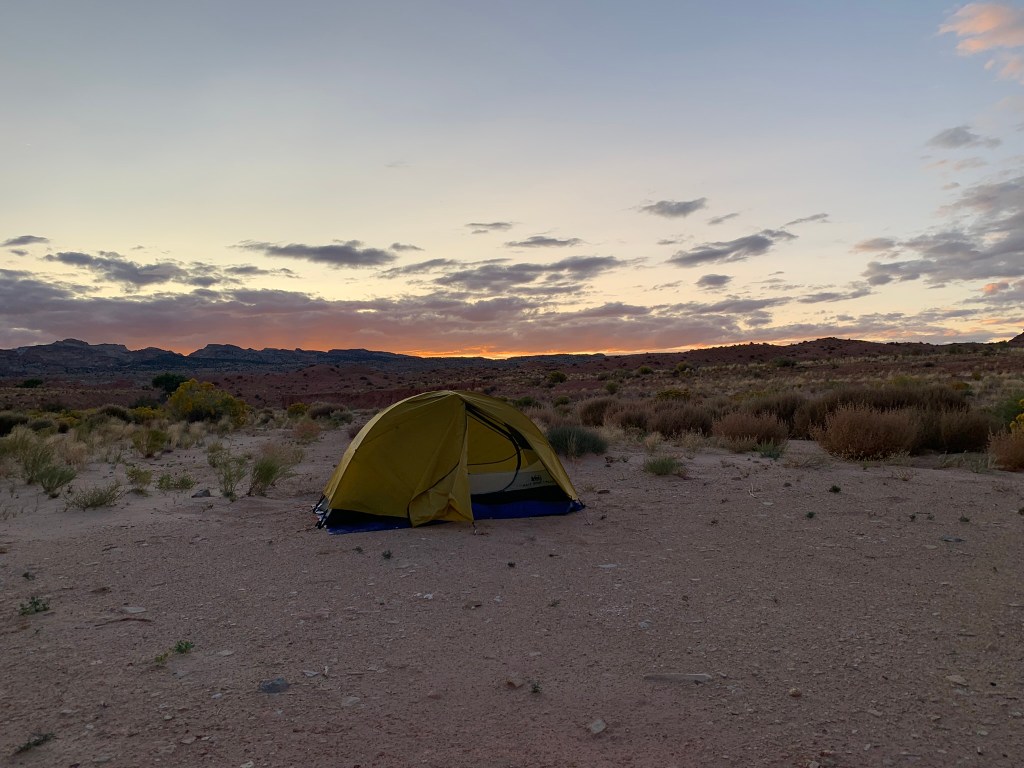
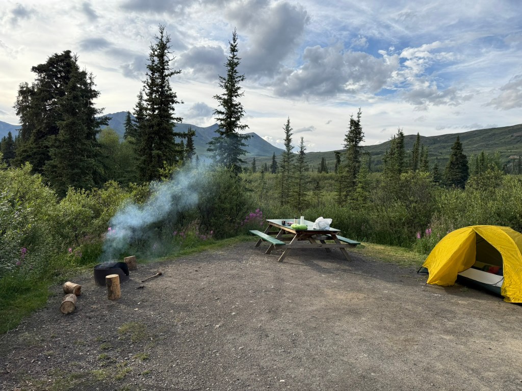
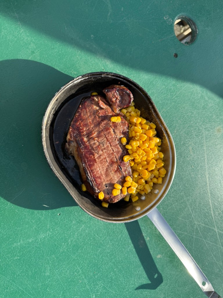
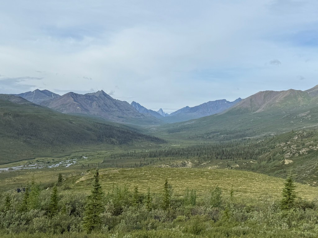
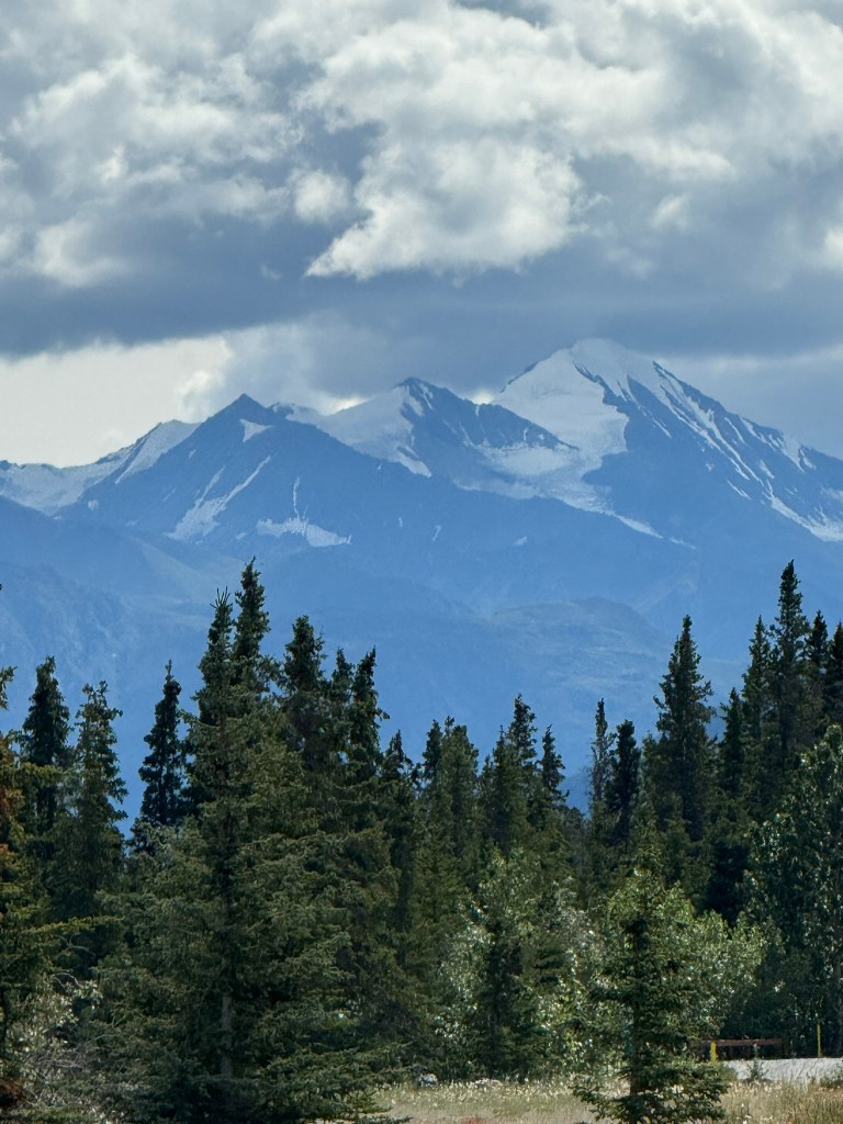
After not too long, about 40km in, we reached the Tombstone Territorial Park. The landscape became very mountainous the further we traveled. At about 72km in, we reached the Tombstone Campground and found our site, number 19. Oddly, we had to go through a complicated check in process online – using the internet – although (of course) there was no cell service. We had to drive up the road to the visitors’ center, where there was WIFI in the parking lot. We cooked steaks and corn over the fire and then walked down to the Klondike River. I decided that if I was going to sleep in my tent, this would be a good location for it. It was surprisingly hot outside, and when I went to sleep at 9pm the sun was still high in the sky as if it was midday. Miguel slept in the camper.
The Food
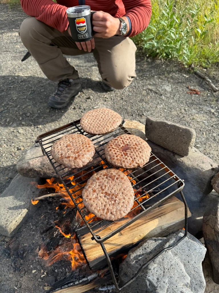
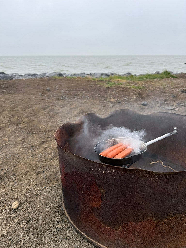
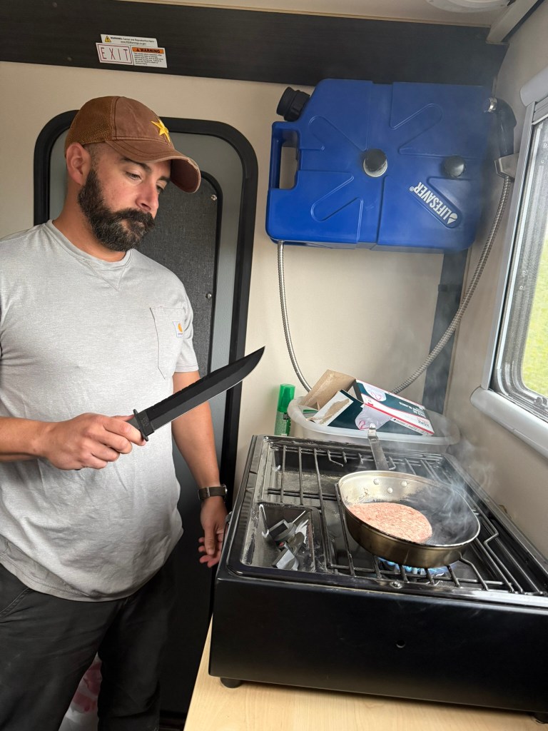
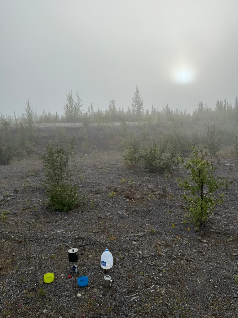
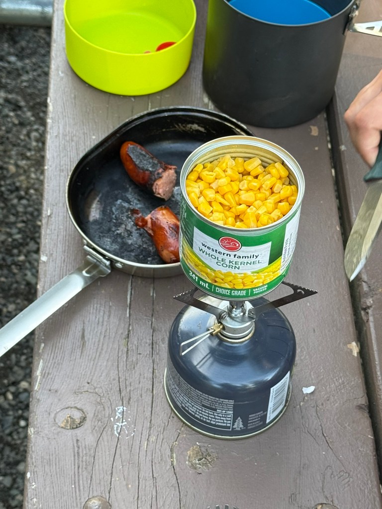
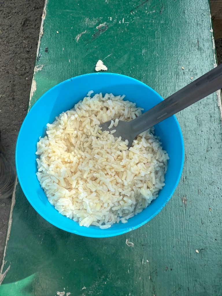
We have a common plan for eating on road trips. Almost always, breakfast consists of instant oatmeal and freeze-dried coffee and maybe some fruit, like a banana or apple. Occasionally, we will cook breakfast – eggs, etc. – but we didn’t on this trip. Lunch is almost always protein bars or other type of bars and maybe fruit, and usually we don’t have a set lunch, but we snack on bars and/or fruit throughout the day. For dinner, we try to always cook meals from scratch, but occasionally eat freeze-dried meals made with boiling water (but not on this trip). During this adventure, we cooked food over the fire (we made fires almost every night) or outside using a small backpacking butane stove – or, on a single occasion, we used the camper stove. We had steaks, burgers, hot dogs, and various sausages. We try to buy sides as well, which on this trip consisted of potato chips, canned corn, and brown rice (for some reason – partially as a good emergency food). Because we only had a cooler, having a good supply of ice is essential, so every time we had the opportunity, we stocked up on ice and filled the cooler. A couple of times, we had to take the cooler out and drain the water from melted ice. Also, because we used a cooler, that could not keep meat cold for very long, we stopped to re-supply whenever we could, every 2 to 3 days (as food was available), and ate pre-cooked meat like hot dogs last. We also try to stock enough dry food so that we have an extra day or so of food in case of an emergency. We carry as much water, in jugs, as we could possibly need.
I woke up in the middle of the night to the sound of rain on my tent fly. I then saw flashes of lightning and heard thunder rumble across the sky. I climbed out of my tent, and despite it being in the early hours of the morning and with black clouds in the sky, it was plenty light enough to see. I stood and watched the lightning flash over the mountains and heard the thunder boom across the open landscape. It was an awesome and even frightening experience. I considered fleeing into the camper, but instead waited out the storm, which passed after about 30 minutes. I laid in my tent thinking about how mind-blowing it was that the next day we have absolutely nothing at all to do other than to make some progress driving up the Dempster and get that much closer to the Arctic.
Day 4: Into the North (July 30, 2025)
“It was the Wild, the savage, frozen-hearted Northland Wild.” – Jack London
Miguel drove today. We made a ton of progress – more than I ever expected in one day. After another breakfast of coffee and oatmeal, we set off. We saw more of Tombstone Park, which was incredible.
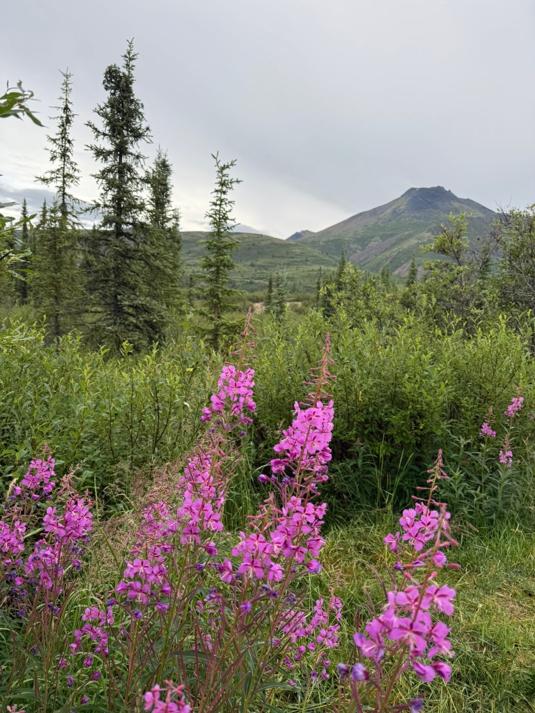
Tombstone Territorial Park is named after Tombstone Mountain and other jagged peaks that supposedly look like grave markers. We didn’t really see a resemblance between the mountains and gravestones.
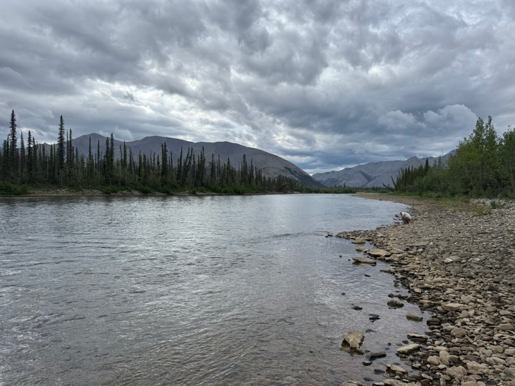
After leaving Tombstone, we soon came across the Peel River and stopped at a rest area alongside it. The river and scenery were beautiful, and it was a good place to take in the environment. A guy pulled up in a Jeep Commander and trailer that was all decked out in overlanding gear. He was from Minnesota and was driving all the way from his home to Tuk and then back to Minnesota through the Canadian Rockies. He was travelling with his 13-year old granddaughter, who he said was (and she looked) very bored. He had satellite internet and she was glued to her tablet watching whatever. We talked for a while and wished him luck on his journey. As we drove, we would catch up to this guy, and then he would stop, and then eventually catch up to us, with us passing each other back and forth along the way.
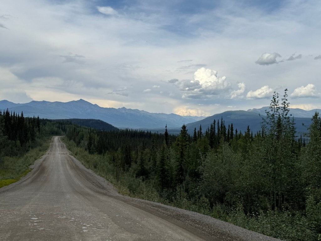
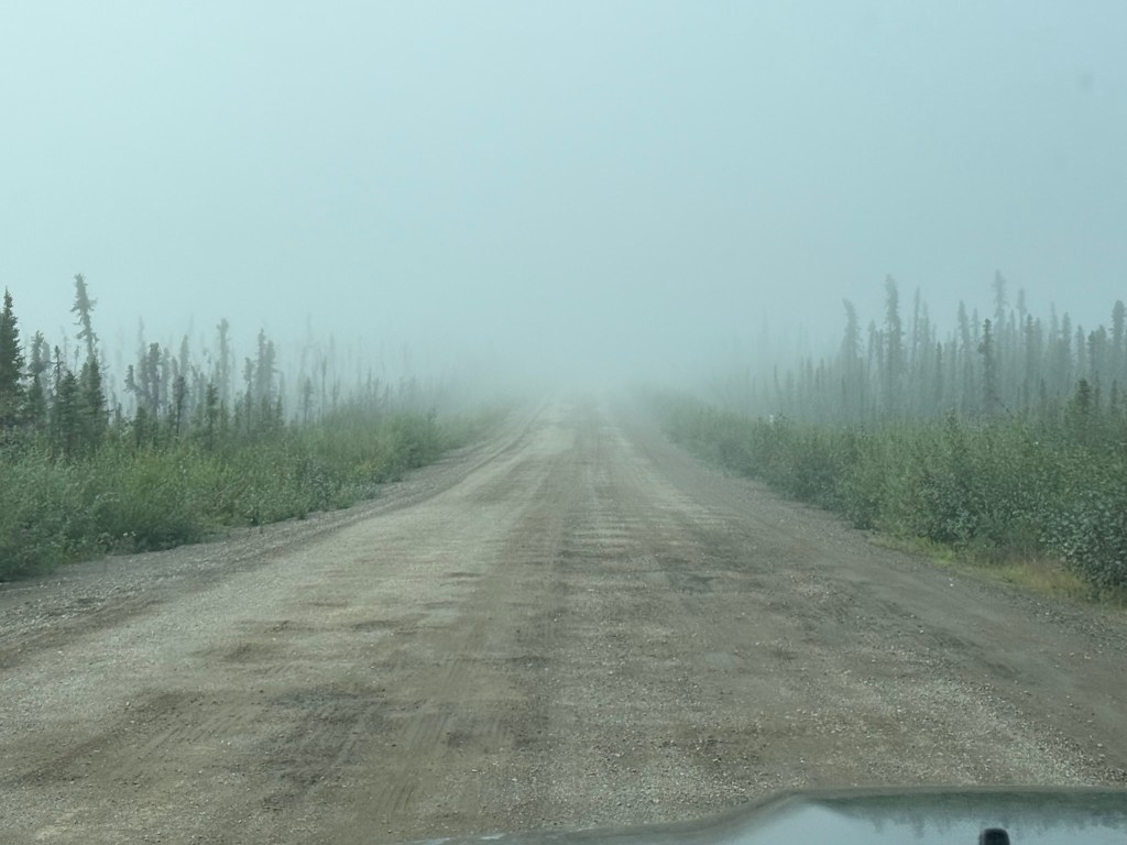
The Road
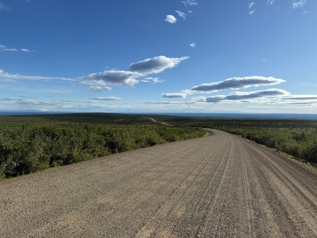
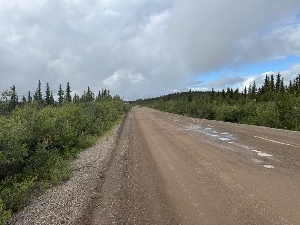
The condition of the 460-mile Dempster Highway varied considerably. Initially, it was very good, and we could drive up to 90km per hour (55mph), but then there were stretches where the road was terrible and we had to go as slow as 20 to 30km per hour (12 to 20mph). There were places along the road that were being re-done and there were grading vehicles and construction equipment working on the road. All along the road were deposits of gravel or places where you could see they were taking gravel out of the hillside to use to re-grade the road. It seemed that during the period that the road was not frozen, they had to constantly re-grade the road to keep it passable. The Dempster Highway is the only road in Canada that goes that far north and is the only road that reaches rather large communities in the Arctic, including Inuvik, which is a decent-sized town. Until recently, the Dempster Highway ended in Inuvik and there was no road that went any further north, leaving Tuk and all points north isolated. The Inuvik-Tuktoyaktuk Highway only officially opened in November 2017, with construction on the 86-mile road beginning in 2014. The traffic on the road included large trucks transporting supplies and provisions between the northern towns and the southern Yukon.
We had to be very alert while driving and be prepared to steer around potholes and slow down rapidly when called for. Sometimes we would hit bumps, dips, or potholes, which caused the camper to shutter with its poor suspension. The truck or passing vehicles would also kick up rocks that are infamous for cracking windshields. Flat tires are also very common along the Dempster. While we knew we had to drive slow, often we did not follow that advice, and if the road conditions were good, we well-exceeded the 40mph we were told to limit ourselves to.
All along the Dempster, there were pullouts and occasionally a more permanent rest area (with no bathrooms or any facilities). This made it very easy to stop and rest, take in the scenery, use the (wilderness) bathroom, or even camp for the night.
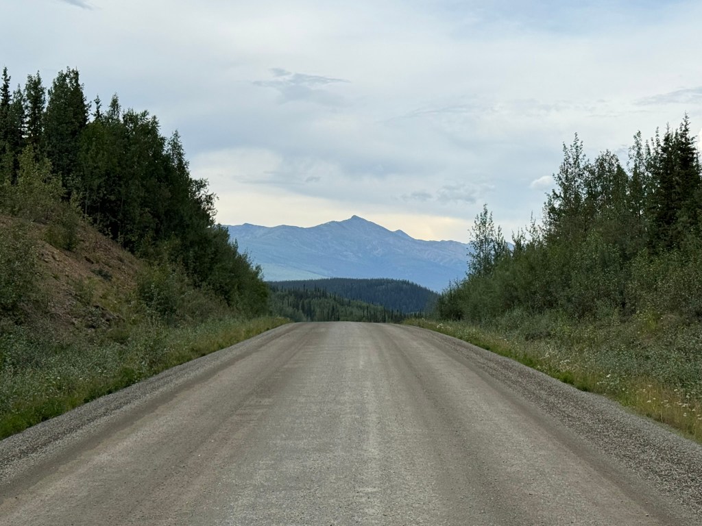
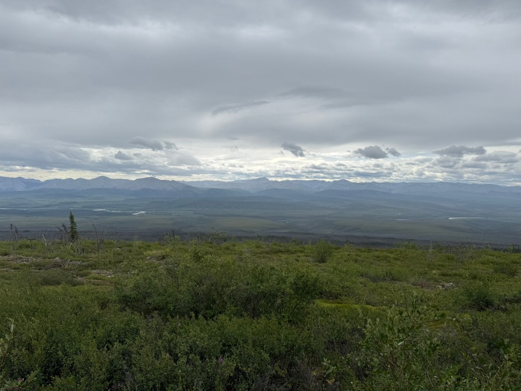
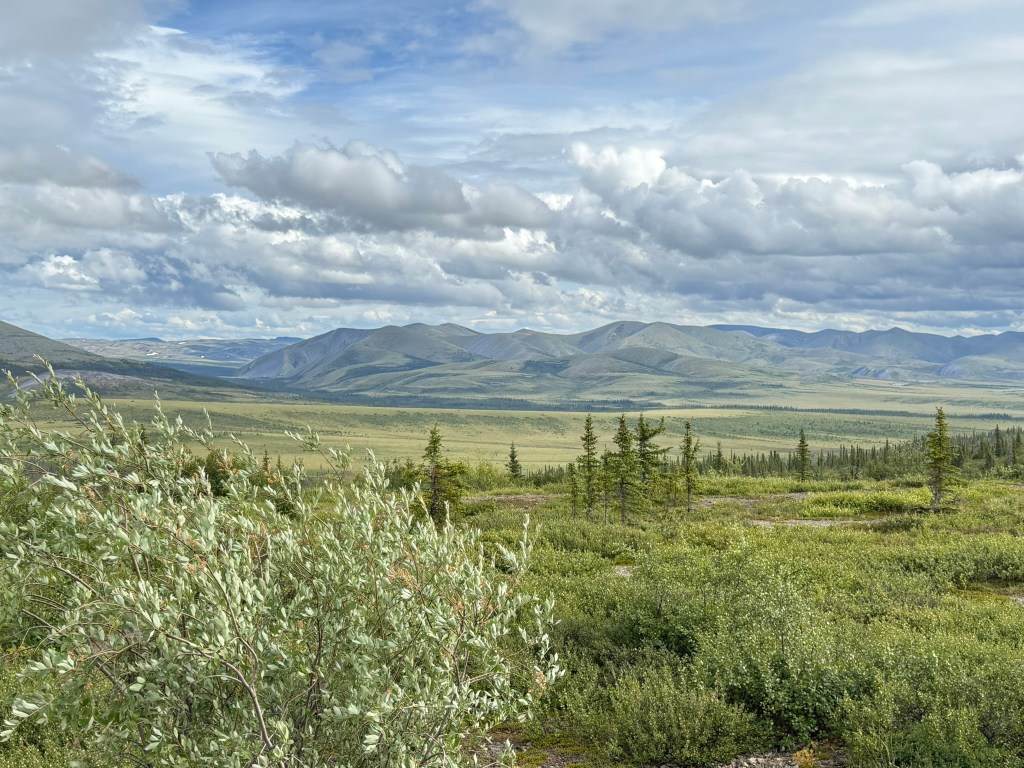
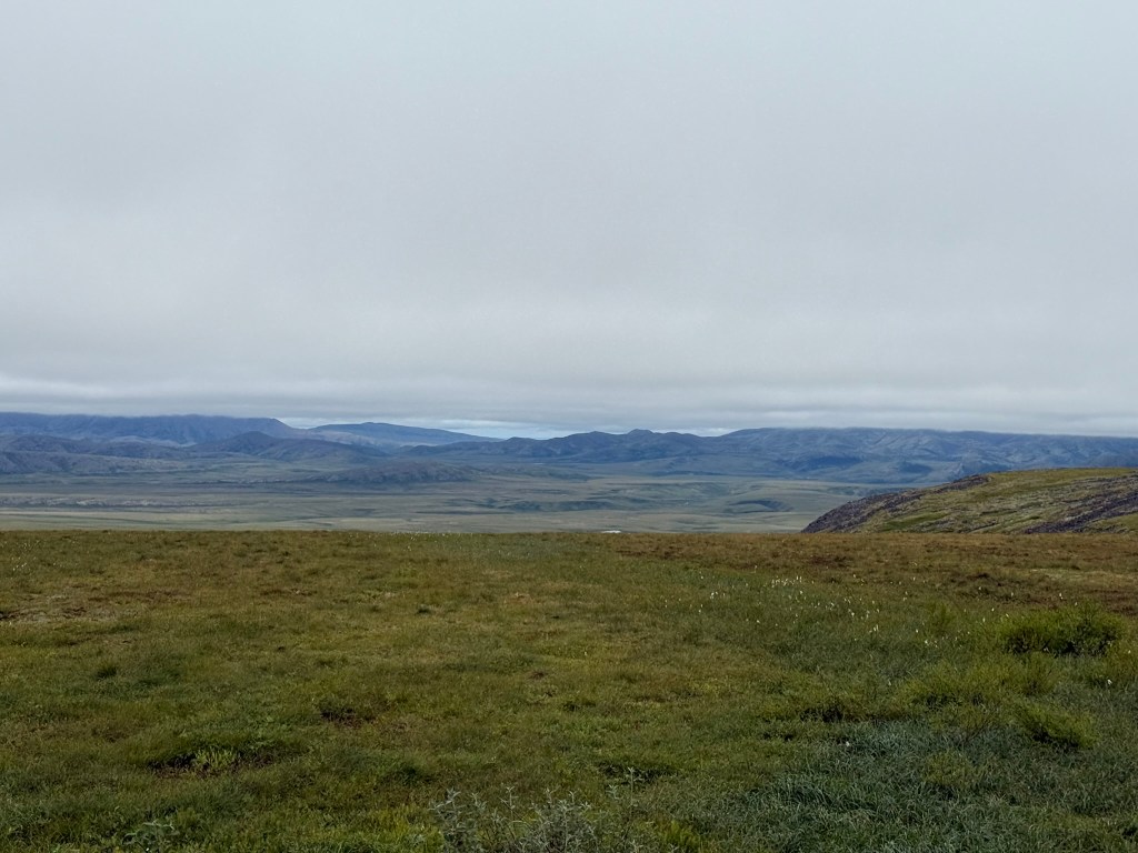
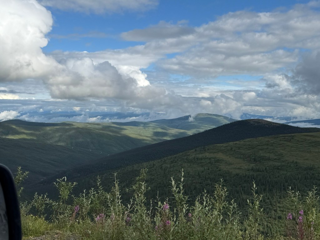
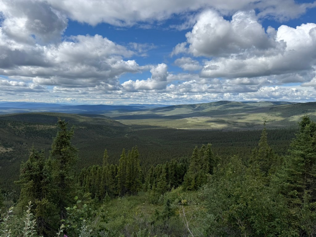
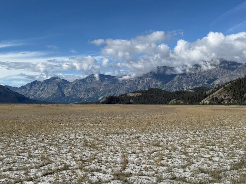
As we travelled further north, we drove a long way through a high plateau – the Porcupine Plateau – where there were panoramic views of the Peel River valley and the mountains to the east. The road was pretty awful in parts.
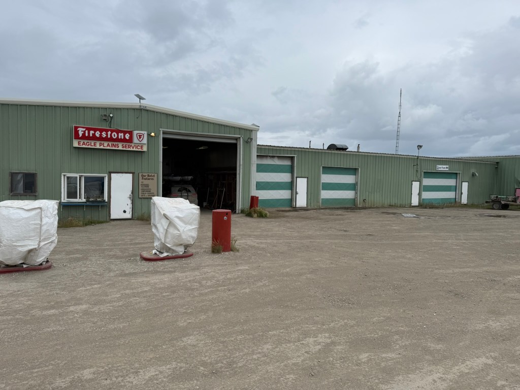
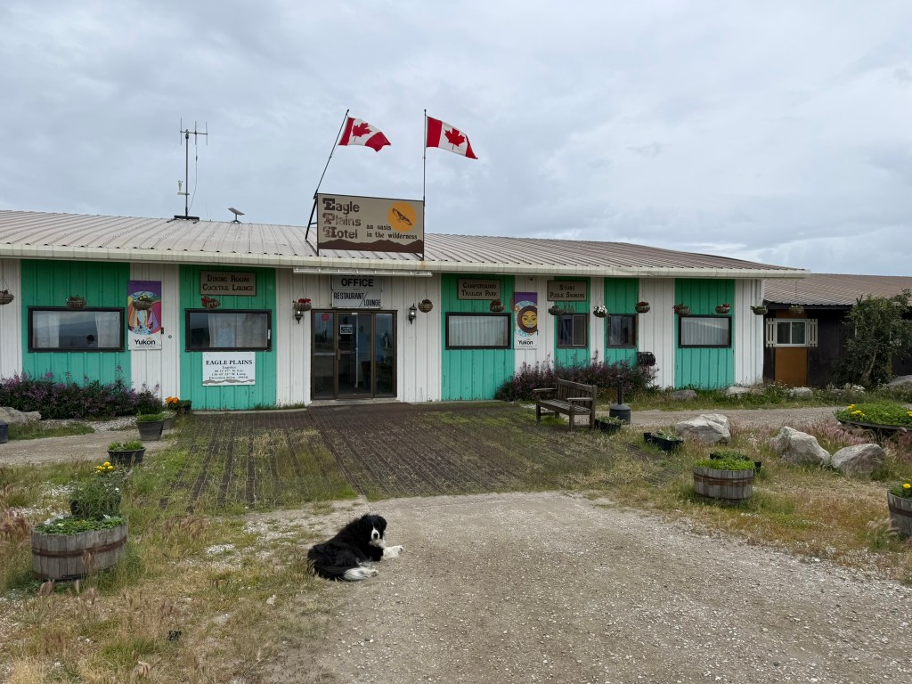
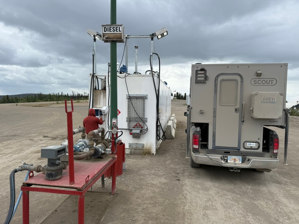
We reached the “town” of Eagle Plains in the afternoon. While planning the trip, it seemed to me that Eagle Plains had a lot more than it did, and I expected more of a town, with a store at least. However, Eagle Plains consisted only of a gas station, a mechanic, and a hotel (with a restaurant inside). (There was a common theme throughout the trip that, while I knew we would be in the middle of nowhere and infrastructure would be limited, it was much less than I had even anticipated.) There was no store of any kind and nowhere to buy food or supplies. The hotel was in poor shape and smelled badly like cigarettes. They did have WIFI, which we got on quickly to check in with the real world. We got gas and put air in the tires. We discovered that the tires had a psi of 50, when they were recommended to be 60-70 psi. We weren’t sure whether the tires were filled with a lower pressure intentionally, but we decided to add some air just in case while we had the chance.
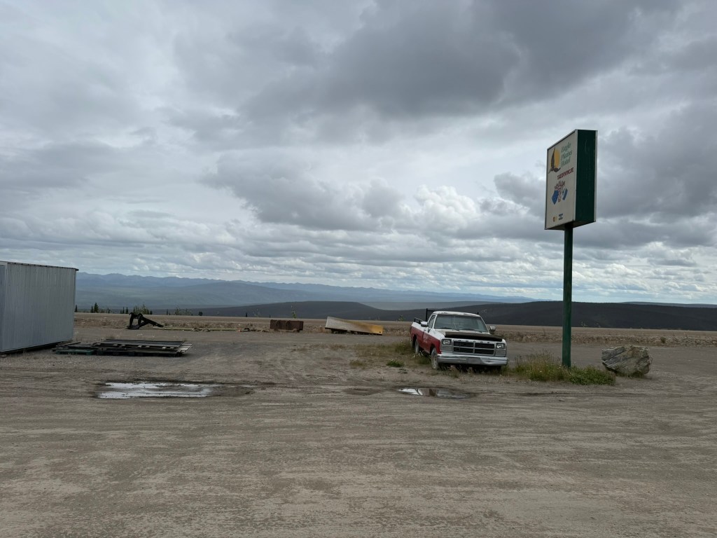
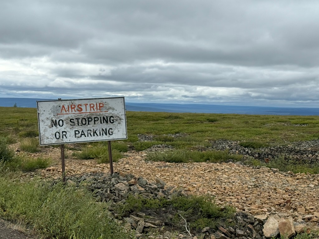
As we drove out, we passed a section of the road that served as an emergency runway for planes. If someone had a medical emergency up that far, a small plane was the only way that person had a chance of getting any help.
The Dempster Highway
The Dempster Highway follows almost the precise route established between Dawson City to Fort McPherson, an old Canadian Northwest Mounted Police outpost on the Peel River near the confluence of the MacKenzie, which – before the road – was traversed by dog sleds in the winter. Following the Gold Rush and the influx of prospectors and adventurers into the region, the Canadian authorities established patrols that would monitor the route and carry mail across the region. In the winter, these patrols to the far north were the only contact and sometimes served as a vital lifeline. The Highway is named after Corporal William Dempster, who led such patrols, including an effort to locate a mail patrol that had been lost in the winter of 1910-1911, with Dempster discovering that all four members had died after encountering severe conditions (heavy snow and -50 degree cold).
After oil was discovered in the region, construction of the road began in 1959, and the last section was completed in 1979.
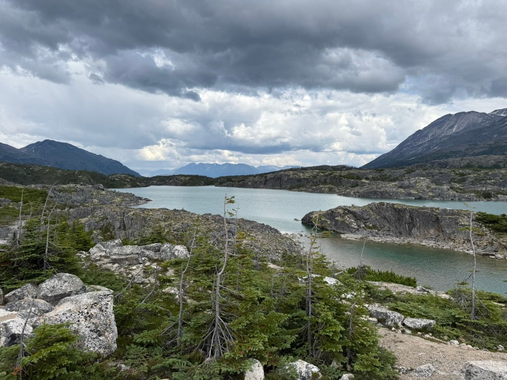
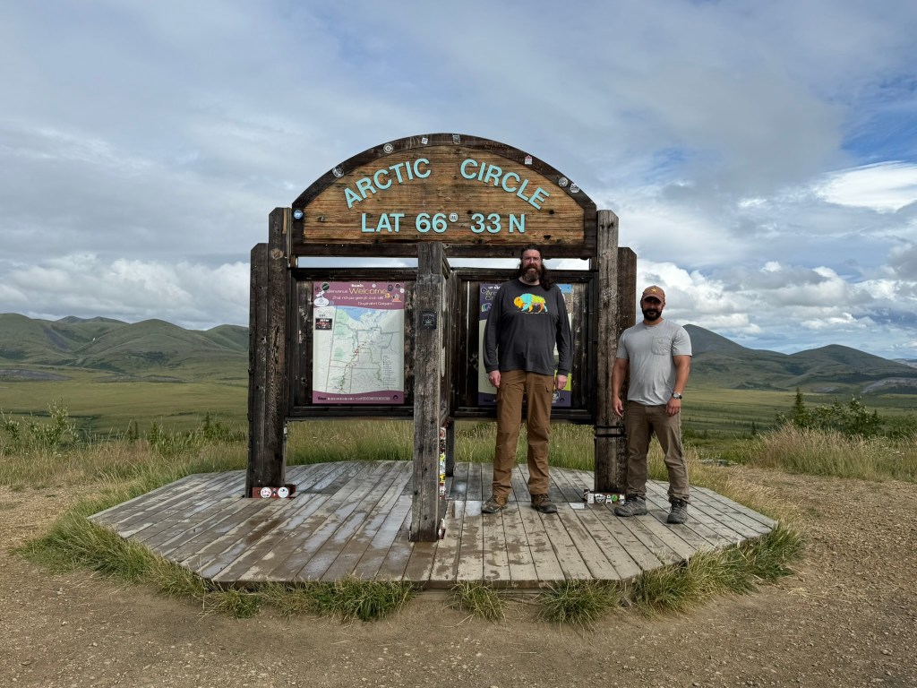
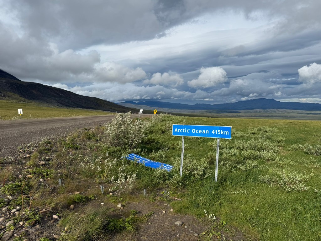
We reached the Arctic Circle! The terrain changed significantly at this point and instead of pines forests and some mountains there were rolling plains and few trees. It got very windy. We stopped to take it all in. It’s hard to describe, but I felt so far from the world.
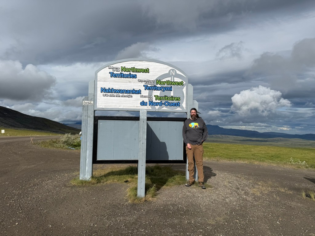
Making good time, we continued on, hoping to get to the Northwest Territories and then find a place to spend the night. The border of the NWT was at a high pass, with extreme winds.
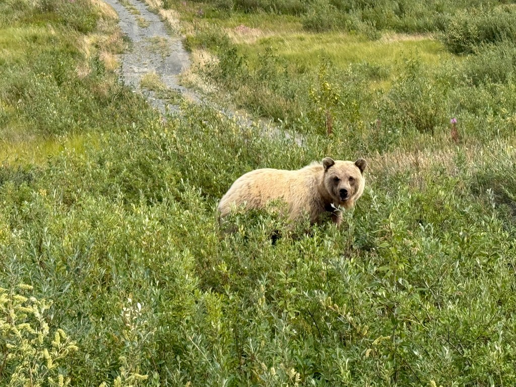
Up until this time, we hadn’t seen much in the way of wildlife, only suicidal ground squirrels all along the road and many grouse, which we called “road chickens.” As we were driving, we spotted a bear crossing the road ahead of us. It started running along the road, until we approached. It was fairly small and black, I assume a black bear.
Our goal was to find a good pull out to camp, but we saw very few options. We were close to giving up and stopping pretty much anywhere, when we saw a great spot right on a small river. I initially thought the entrance off the road and to the site was too steep, but we made it fine. We parked Sage along the river, and cooked burgers in a fire pit made of stones from the river. The burgers had been frozen, but after a couple of days in the cooler became unfrozen and I questioned their freshness (It turned out OK). It was surprisingly warm, but very windy. We both slept in the camper.
Day 5: The Arctic Ocean (July 30, 2025)
“Adventure is just bad planning.” – Roald Amundsen
We woke up positive, as this may be the day we reached the Arctic Ocean. However, before leaving, we had a little mishap. After getting ready to leave, I went to open the truck door, and it was locked. I looked around for the key – I didn’t have it. Miguel was down at the river, and when he came back, I asked him for the key. He didn’t have it. I was puzzled. Living in the modern era, I never considered that a key could be locked in a car, given that they now all have an electronic key fob start, but this one didn’t. In any event, I was sure I (or Miguel) wouldn’t have locked the truck once we had unlocked it in the morning – why would we? So, the key must be in the camper or somewhere else.
Keep in mind that at this point we were in one of the most isolated places in North America. We looked everywhere – inside the camper, outside around the campsite and camper, down by the river – it was nowhere. Then, we checked everywhere again. Nothing. The key had a long blue lanyard attached to it which would have made it easy to spot. At that point, we figured the key must be locked inside the camper. How would we possibly get into the camper? I started to think of contingency plans. The road had trucks occasionally pass by. I assumed we would have to hitchhike either to Tuk or back to Eagle Plains to get a locksmith or tools for breaking in.
Miguel found a branch from a tree that was split with a wedge at the end. He was able to get it jammed into the edge of the driver’s door, between the door and the door frame. He hammered it with a large rock to push it further and increase the gap to try to allow us to reach in to the door lock, several inches away. I started pulling the door away as he hammered, and it created a big gap, but still not big enough to reach our hands in. We looked everywhere for something – anything – that we could reach the lock with. We tried knives, spoons, and pot handles – nothing could bend in there and pull up the lock.
I looked around everywhere and was able to pull a flexible metal bracket off the camper’s propane tank. Miguel slid it in and reached the lock, but I figured there was no way he could get enough friction to push the lock up. After fiddling around for a minute, the lock pushed up! I was in literal shock as the door was unlocked and opened. We then began frantically searching through our gear looking for the key. The anticipation was overwhelming. I was certain that – obviously – Miguel had lost the key. I was about to give up when I checked my shorts and the key was in the pocket! I never felt more relief in my life! We could then have a good laugh about it. (I still don’t know how the doors would have locked if the key was in my shorts – must have locked the doors by accident and then closed the door.)
The door had minor damage. There was a hole in the weatherstripping, a scratch on the door frame, and the door was separated a bit from the frame and wouldn’t sit flush. It was hard to notice. But a couple of days later I worked hard pushing the door and bending it back, and I got it to be unnoticeable unless you were looking for any issues. Tragedy averted!
After that drama, we continued rambling on. I drove. The landscape was something else. Rolling grassy plains for a while. It was incredible how much variation in the landscape there was as we progressed north. And it changed back to woods as we approached the Peel River crossing (just south of Fort McPherson).

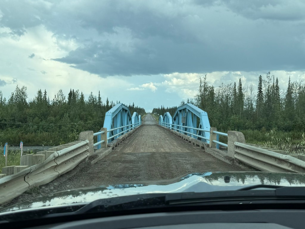
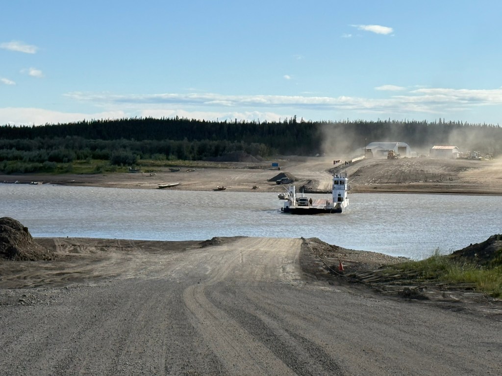
We had to take a ferry across the river, which during the day goes back and forth constantly. In the winter when the river is frozen, vehicles can simply drive across the river. During the shoulder seasons when the river is freezing or thawing, you can neither drive across nor take a ferry, and you’re out of luck. We were the first in line, and when the ferry arrived, we drove on board. The guy who worked the ferry – a native – chatted with us through our window and told us there was a big earthquake in Russian and a possible tsunami headed toward Alaska, BC, and Hawaii. Without access to the news, we had no idea. Beginning at this point, the vast majority of folks were native indigenous people from the area.
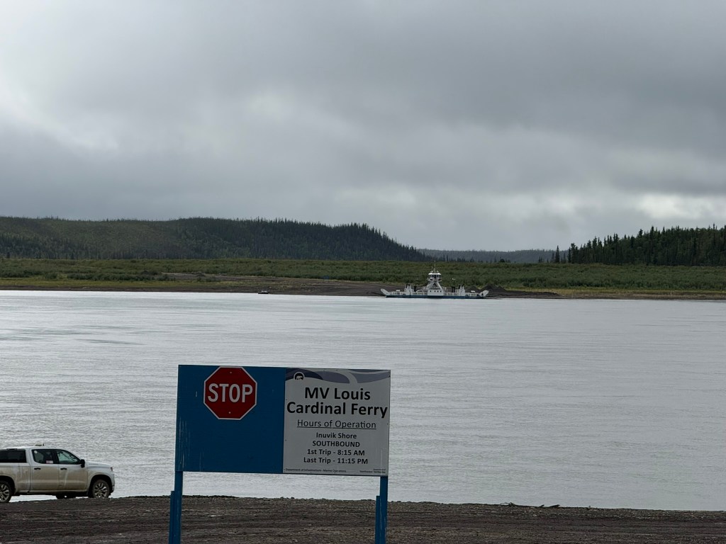
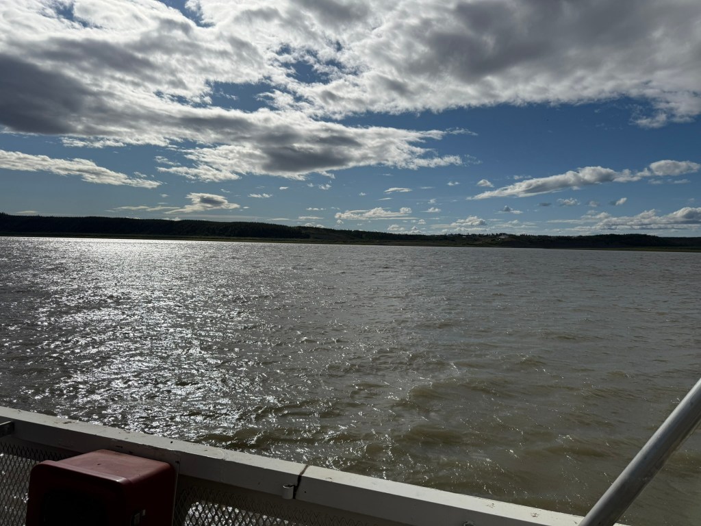
We soon reached the MacKenzie River, which was much larger than the Peel, and we had to take a bigger ferry across. From here, the environment became very flat and there were few pullouts in which to stop. During most of the day it was raining and drizzling, but it never rained hard.
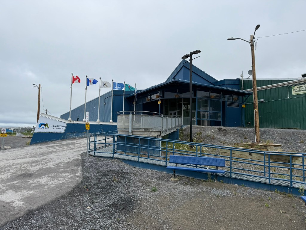
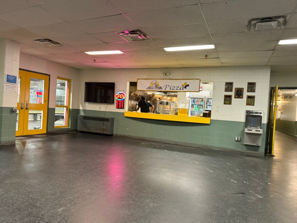
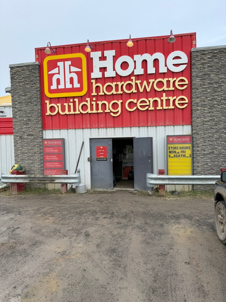
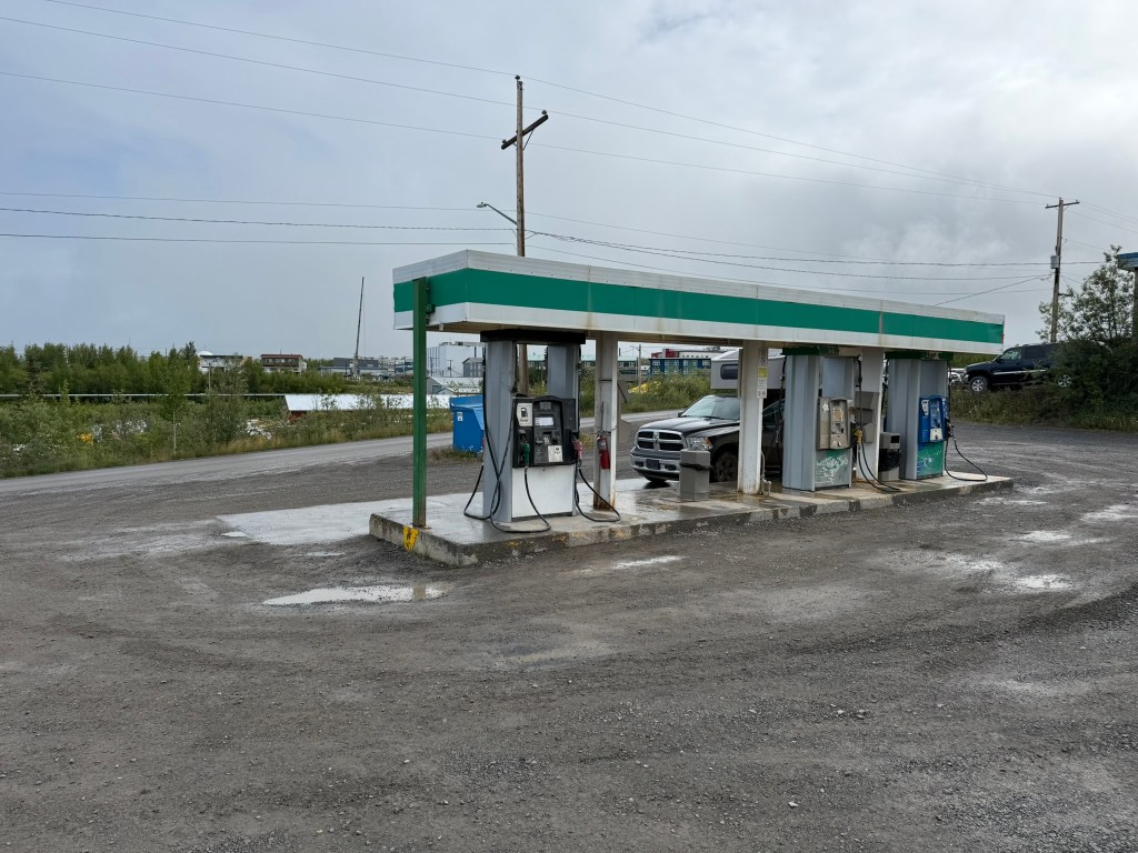
Inuvik is a very small town, but it is by far the biggest town within hundreds of miles (3-3,500 residents). It seemed like a metropolis compared to what we drove through the past couple of days. It was a little rough and run down, which is understandable given the location. We went to the only grocery store and got what supplies we could, although there was a very limited selection. (In fact, we had to ask to get any water, which they had to find in the back.) We got gas at the only gas station in town, and asked for recommendations for a restaurant, hoping to get some good food. After stopping for beer and masking tape (at the one liquor store and one hardware store), we drove around looking for an open restaurant. A second person recommended Ava’s, which was located in the rec center complex. The Midnight Sun Recreation Complex was huge, and it was clearly a center of activity for the town, with curling courts, a gym, hockey rink, and other facilities. We found the restaurant deep in the complex next to the ice rink, which had a variety of food. It was staffed by all Indians (from India), which was very common up there. It seems that Indian immigrants came to the Yukon and Northwest Territories to work in the service industry. There were also women from the Caribbean working the checkouts at the grocery store. Anyway, we ordered a pepperoni and ham pizza. I wandered the halls of the rec center while waiting, exhausted and starving. The pizza was great, and we ate it outside while fighting off the seagulls. We flirted with the idea of getting a hotel in town for the night, but decided we’d be better off continuing.
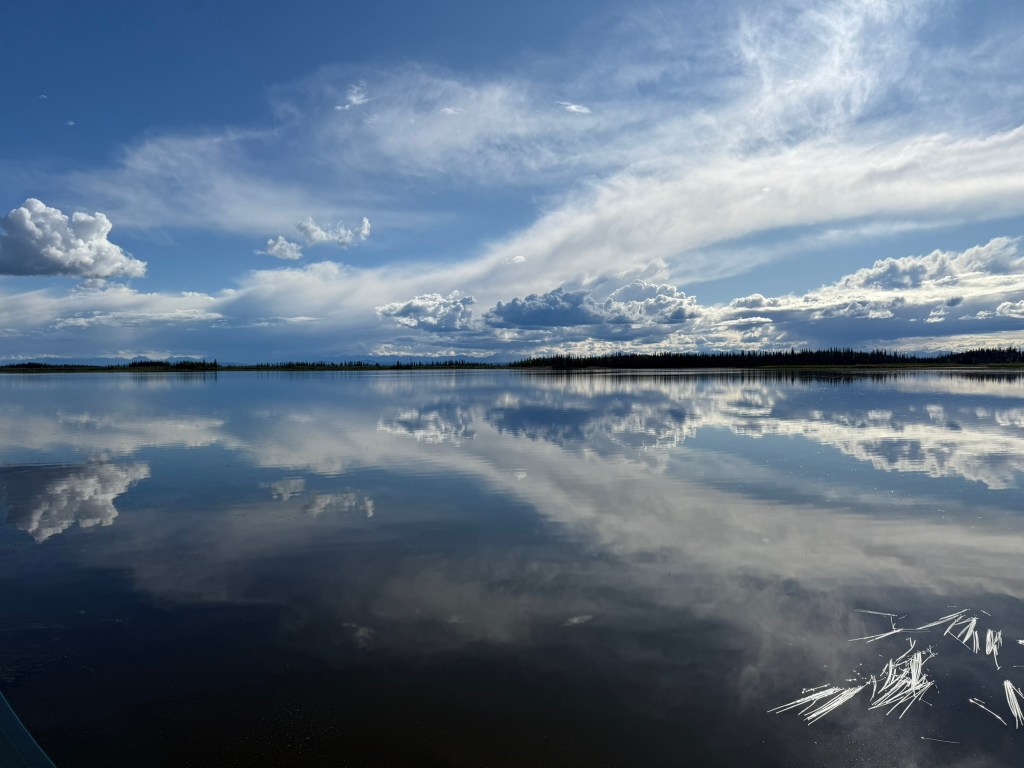
Fueled by pizza, it was time to make our final push north. The Dempster Highway had ended, and we started up the Road to Tuk. It was drizzling rain, which kept up for most of the rest of the day. The landscape was very interesting, with rolling hills and many little lakes on both sides of the road. The road was in very good shape, probably because it was fairly new. As we got further north, there were more and more lakes. We drove through the MacKenzie River delta until we reached the end of our journey – Tuktoyaktuk.
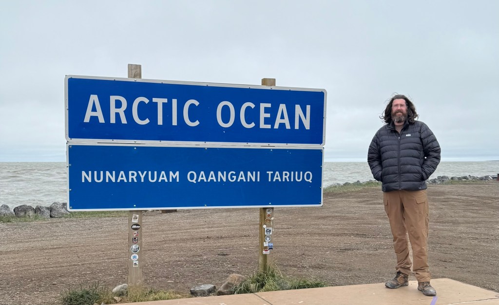
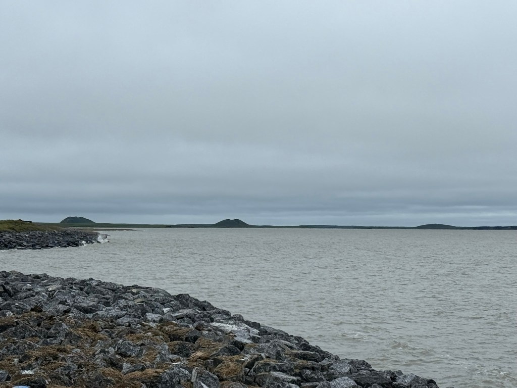
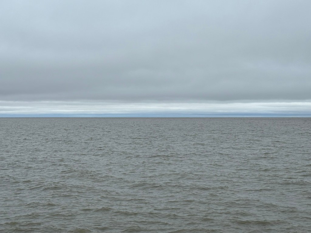
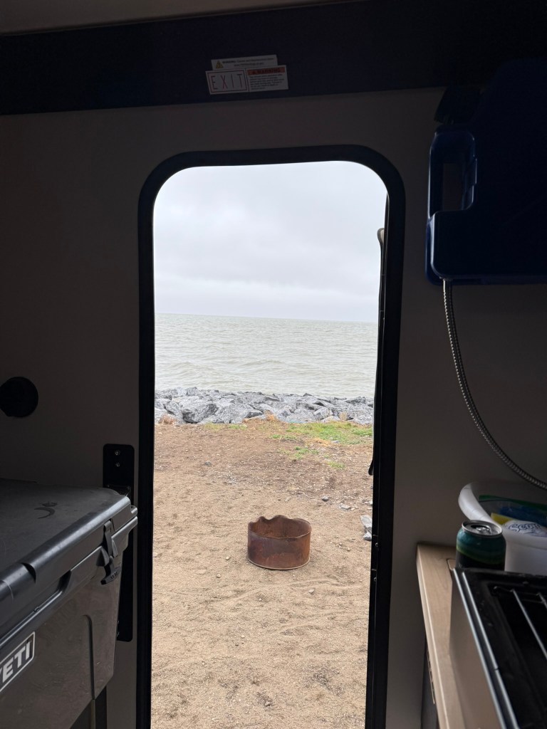
Tuk was small and there was a lot of industrial infrastructure (population about 1,000). It also seemed to be a very poor community. We drove all the way through town to “the Point” – the furthest point in town north, with a panoramic view of the Arctic Ocean. The ocean was extremely gray, and the sky was overcast in a similar gray. It was very windy, and the water was rough. We were thrilled to reach the Arctic, but tired.
Along the shore and a large rock wall made of boulders was a row of campers where you could park and camp for the night. It turns out we needed to register for a spot at the visitors’ center which was at the opposite end of town. We “reserved” a camping spot in the interim with a metal fire ring and drove to the visitors’ center. The center advertised laundry and showers, which we could really use, but we were told “they hadn’t arrived by ferry yet.” Our friend with the Commander and granddaughter was at the visitors’ center when we arrived – we had beat him to the Arctic! We had set out at almost the exact same time and arrived at almost the exact same time. We shook hands and exchanged congratulations.
After registering for a camping spot, we headed back to the shore. Due to the wind, we parked between two larger campers as a wind break, and we then walked down to the beach. The water wasn’t nearly as cold as I expected. There was a sad moment when it was time to throw my rock – which took on the name “Stoney” – into the ocean. He had traveled the whole way with us, from ocean to ocean.
We cooked some “sizzling smokies” (sausages) next to the ocean. Having reached the Arctic Ocean a full two days ahead of the expected schedule, we had to plan our route back. Initially, we intended to simply backtrack, but with the extra time, we had flexibility to explore. We reviewed the map and decided that we would aim to drive back to Dawson City in two days and possibly go a different route back to Whitehorse, through Alaska. We would have to see how we did on time.
We went to sleep around 9pm and it was still completely light out. We both slept in the camper, as it was extremely windy. I woke up at 1:30am and walked to the bathroom, and I swear it was exactly the same level of light out. The sun never set.
So, the whole time leading up to the trip I boldly announced to everyone that I would be swimming in the Arctic Ocean. It sounded like a bad ass thing to say. And I really had every intention to do so. But, there really weren’t any good areas to get in the water. At the Point, there is a beach area where one could easily wade in, but there were signs saying people were not allowed to go in the water because it was a traditional native fishing area. I didn’t see any signs of fishing, and, honestly, I think the restriction was largely to prevent outsiders from causing a scene. There were a few other areas we saw outside of town where it looked like one could enter the water, but there was another problem. Nearby to these areas were wastewater pipes pumping questionable water into the bay as well as a large dump with mounds of trash right on the water. And that’s not to mention the industrial infrastructure along the water. In any event, swimming in these areas did not seem appealing. We were also tired and eager to get going, and getting in the water just didn’t hold my interest. So, I am sad to say, I did not swim in the Arctic Ocean after all.
The Northwest Passage
Ever since Europeans arrived in North America (and indeed from the very first contact with the Americas), they searched for a passage through the continent to the Pacific Ocean and the riches of Asia. These efforts took the form of expeditions by river and land from the St. Lawrence River into Western Canada, as with Alexander MacKenzie and many others, as well as by sea. This sought after route was dubbed the Northwest Passage. In the 19th century, attempts were made to traverse the icy waters of the Arctic in an attempt to travel above North America to reach the Pacific. Initial efforts failed, including notably John Franklin’s expedition of 1845 that saw his two ships become trapped in the ice and eventually crushed and sunk, resulting in the eventual deaths of all involved (and suspected cannibalism of the dead).
In 1903, Norwegian polar explorer Roald Amundsen, in his ship the Gjøa, set out to accomplish the feat. His ship became iced in not far from where Franklin met his demise, and where Amundsen and his crew spent two winters, until in the spring of 1905 he was able to continue westward. Winter set in again before he could complete the passage, and the Gjøa was frozen for a third winter, near Herschel Island off the northern coast of the Yukon. This was not far from where we spent the night in Tuk, on the other side of the MacKenzie River delta. When the ice broke up the next year, in 1906, Amundsen completed the Northwest Passage, being the first to do so. Years later, Amundsen was also the first to reach the South Pole in Antarctica, and he was also one of the first to reach the North Pole (by blimp) and to complete the Northeast Passage, sailing from Norway east and north of Siberia into the Pacific.
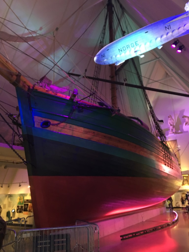
[Actual picture of the real Gjøa that I took in Olso in 2017.]
Day 6: The Return (July 31, 2025)
“Rise free from care before the dawn and seek adventures.” – Henry David Thoreau
Miguel drove today. We left early, without even making oatmeal and coffee. We were motivated to get going so we would have time to add on to the adventure, potentially back to Alaska. It was very cold this morning, by far the coldest of the trip – probably 40 degrees.
Our goal was to make it back across the two river crossings, through Inuvik, across the Arctic Circle, back into the Yukon, and all the way back to Eagle Plains by the end of the day, which was extremely ambitious. We saw several foxes along the way, one which was very young and curious, and there were also a lot of ground squirrels on the drive.
We stopped in Inuvik and did pretty much the identical activities as the day before – We got gas, went to the hardware store and the grocery store, and then went back to the rec center for pizza. This time we took the pizza for the road – not a moment to lose.
When we stopped at the Yukon-NWT border, a weird thing happened that gave us PTSD flashbacks. The truck’s automatic door locks wouldn’t work, either with the key fob or inside on the doors. Perplexed, we made sure that the key fob had an actual key inside of it to use in case we were locked out (again). But, when we stopped later, the locks suddenly worked again.
It rained most of the day. We made excellent time and flew back, even though the road was muddy from the rain. The truck was completely caked in mud at this point, especially the back, so every time we had to open the camper, we had to access the muddy handle. At Eagle Plains, we were dying for a shower and laundry. Even though both were advertised, the showers looked in very poor condition and we couldn’t even find the laundry. The customer service at the hotel was not ideal and we weren’t able to get much information. We considered getting a hotel room, but ultimately we decided that without good showers and laundry, we were better off just sleeping in the camper that night and getting a better hotel in Dawson City where we could do a full refit. I used the spotty WIFI in the hotel lobby to book a hotel in Dawson for the following night.
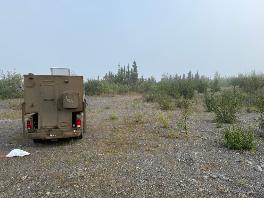
We drove for a while longer looking for a good pullout to spend the night. After checking out a few, we found a decent spot at the end of a road into the woods. We had avoided many bugs up until this point, but at the spot we chose there were swarms of millions of mosquitos. Bug spray and headnets helped, but we retreated into the camper to make food on the camper stove for the first time – burgers. The camper filled with meat-smelling smoke, even with the windows open (with screens) and the exhaust fan on.
It had stayed cold all day, into the low 50s. The weather was very different from the drive up, when it was pretty warm. It was now cold, overcast, and drizzling rain.
The Music
While driving dozens of hours, one can listen to a lot of music. In preparation for the trip, I had downloaded an enormous amount. The primary source was a long playlist – 169 songs and 13 hours – of 80s and 90s music that I put together for a drive to Montreal a couple weeks before. I also came with three ITunes playlists: Outlaw Country, 70s Country, and Johnny Cash Essentials.
We ran through the country and Johnny Cash quickly, and I discovered a deep love for John Denver. We also stumbled upon one of the greatest songwriters of all time – Kinky Friedman. We switched to the 80s/90s playlist and listened to it for literally days. I don’t know how ITunes “shuffle” works, but we learned it is far from random. It would play a certain set of songs frequently and never play others. It was odd.
When we got sick of that, whenever we hit WIFI I downloaded some more music. We ultimately listened to the following in addition to the above: Bad Company Essentials, Foreigner Essentials, 311 – Music, INXS Essentials, Depeche Mode Essentials, Hall and Oates Essentials, John Denver Essentials, Pet Shop Boys Essentials, Europe Essentials, Tone Lōc – Lōc-ed After Dark, Kinky Friedman – Sold American. Ultimately, we went back to the 80s/90s playlist again and again.
Day 7: The Incident (August 1, 2025)
“Difficulties are just things to overcome, after all.” – Ernest Shackleton
The mosquitos got much better overnight. In the morning, we made oatmeal and coffee outside. The camper reeked of meat smell. We headed out, south on the Dempster, with the goal of Dawson City. It was extremely foggy and sometimes hard to see much in front of us. I drove. We wound through the Porcupine Plateau, backtracking and making good time.
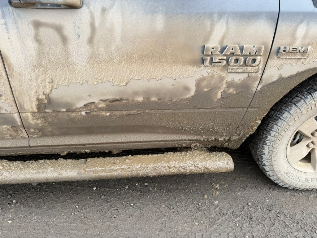
By this point, Sage was absolutely filthy.
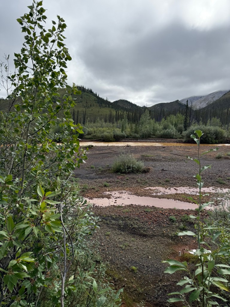
The weather cleared and it turned into a very nice day, with the first blue skies in days. It started cool, but got up into the 60s. We passed rivers that were clear and rivers that were dark copper red, and where they merged, the red mixed with the clear to make an interesting sight. We saw a few snowshoe hares hopping across the road.
As we were about 30km from the end of the Dempster, we heard a loud bang that sounded like it came from above and behind the cab of the truck. I assumed a rock had kicked up and hit the front of the camper. No big deal – We pressed on.
We reached the end of the Dempster and pulled into the gas station. Miguel said he heard a strange noise, but I didn’t. As I reversed the truck to pull into a pump, there was a crash behind us. We turned around to look, and the rear windshield of the truck was shattered, with a gaping hole in the middle.
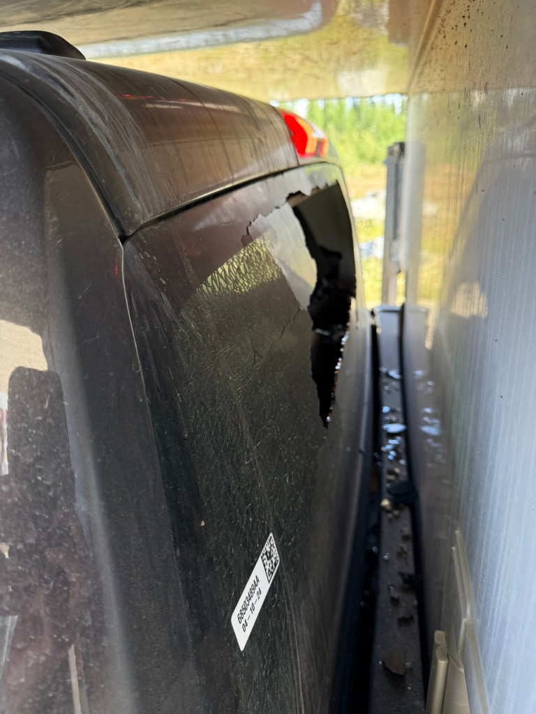
We put on gloves and carefully broke the rest of the windshield and pushed out all the jagged glass, and carefully tried to clean out the glass shards from the backseat that covered all of our gear. We figured the windshield must have been broken by a rock that kicked up between it and the front of the camper or a crack was caused by going over a pothole that then shattered. We considered calling the rental company to report it but decided against that idea. There was nothing they would be able to do, and we didn’t want them to do anything that would cause us to cut the trip short. Miguel called around to a couple of places to see if by any chance we could get the windshield replaced locally, but there was just not enough in the area to support that – one would have to go all the way to Whitehorse for such luxuries.
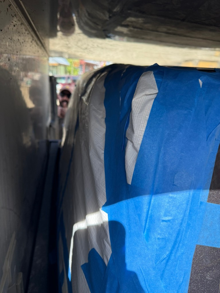
We drove to Dawson City, with the wind whipping through the truck. Miguel went to the hardware store and bought a tarp and some masking tape, while I carefully removed more glass and scrubbed clean all the surfaces around the windshield so the tape would adhere well. We taped the tarp on as best and as tightly as we could. I had very little confidence, because it still had some play that I knew would not stand up well to the wind while driving.
We hit up the general store for some items and checked in to the hotel, “The Downtown Hotel.” We took showers for the first time in several days, which was great. There were laundry machines (one washer and one dryer) right down the hall, but they were in use so we had to wait a while, staking them out, until they were free. It was great to be able to have clean clothes.
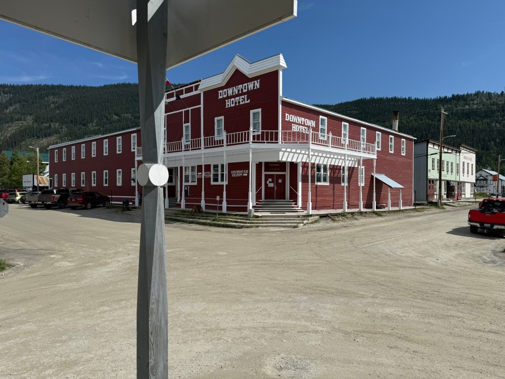
There was a restaurant in the hotel – the Sourdough Saloon (sourdough was a big thing around here). We had dinner, and discovered that this was the saloon we had heard about with the toe shots! Our enthusiasm waned when we saw that it was a touristy gimmick. People would sign up and then when it was their turn would go visit “the captain” who was an old guy who was the keeper of the toes. After giving him a tip, he would put a toe into the shot and people would drink them, while photos were snapped. We thought it would be more of a shady saloon where after several drinks a drunk person would work up the courage to have a toe shot. Instead, it seemed somewhat lame, and we did not partake. (Of course, our decision had nothing to do with not wanting to drink a toe.)
After dinner, we went to sleep early. I, for one, was exhausted.
Day 8: Side Quest (August 2, 2025)
“Nothing behind me, everything ahead of me, as is ever so on the road.” – Jack Kerouac
We woke up and took showers, again! I walked down to the general store, and it was a beautiful morning. Freshy showered, with clean clothes, walking through the quiet town sure was nice. We later got breakfast sandwiches and coffee at the Riverwalk Bistro. It was great to have my first real coffee in a while. I met a woman who was a missionary, originally from Michigan, and she has been in Whitehorse and Carmacks for the past eight years. She was very nice and we had a long conversation about how tall I was.
We had decided that instead of heading back the way we came, we would go west into Alaska and loop back around back to Whitehorse, as we had a few days to spare. Miguel drove. We had to immediately cross the Yukon River by ferry to get to the road that would take us to Alaska – the Top of the World Highway. We knew very little about the road or what we would find along the way, as this was way off script.
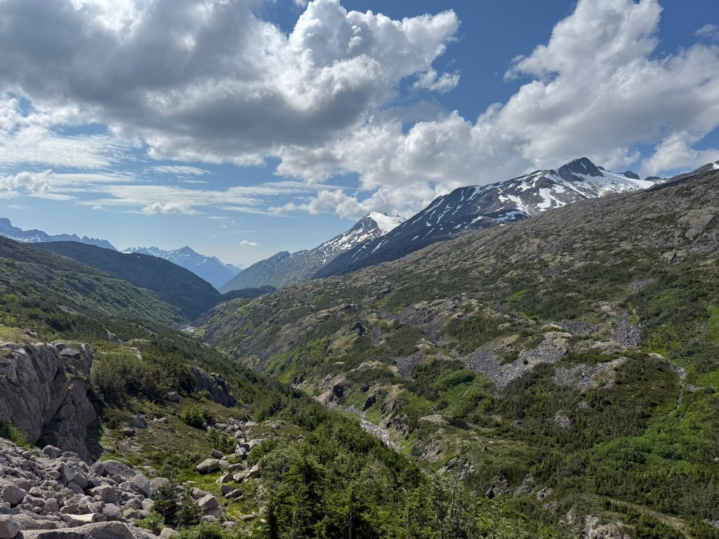
We soon learned where the road got its name. It was very foggy as we climbed up very high along a ridge. The views were obscured with fog for a while, but once it lifted, we could see incredible views of the mountains on either side and thick forests as far as the eye could see. The road was in pretty good shape, paved for a while, but mostly gravel.
Eventually, we reached the US border. The officers wouldn’t let us bring in firewood, so we had to discard it in a pile. Supposedly, someone comes from a campground and collects the free wood. We chatted with Officer Turney for a while outside. He told us that this was the most remote border crossing of any US border, including anywhere in Canada or Mexico. It is a five-hour drive from any healthcare at all on the US side, and they bring people to Dawson (2.5 hours away) in emergencies. He told us it can get very stormy up there. The American border officers live in cabins next to the guard station and the Canadians live upstairs in the station building. All of the Americans this year were from Anchorage. It seemed like a plum assignment.
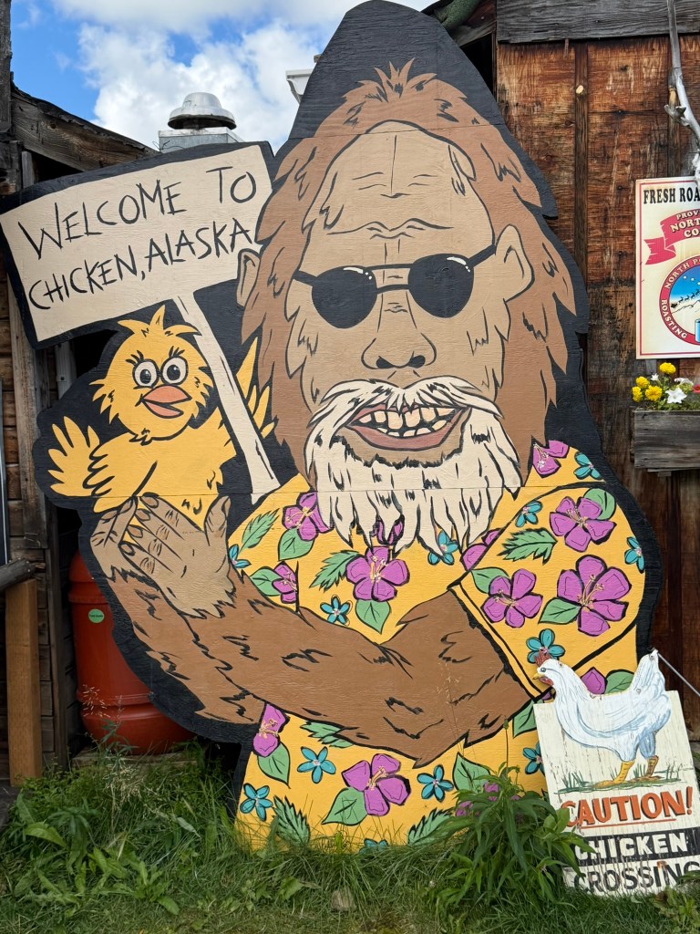
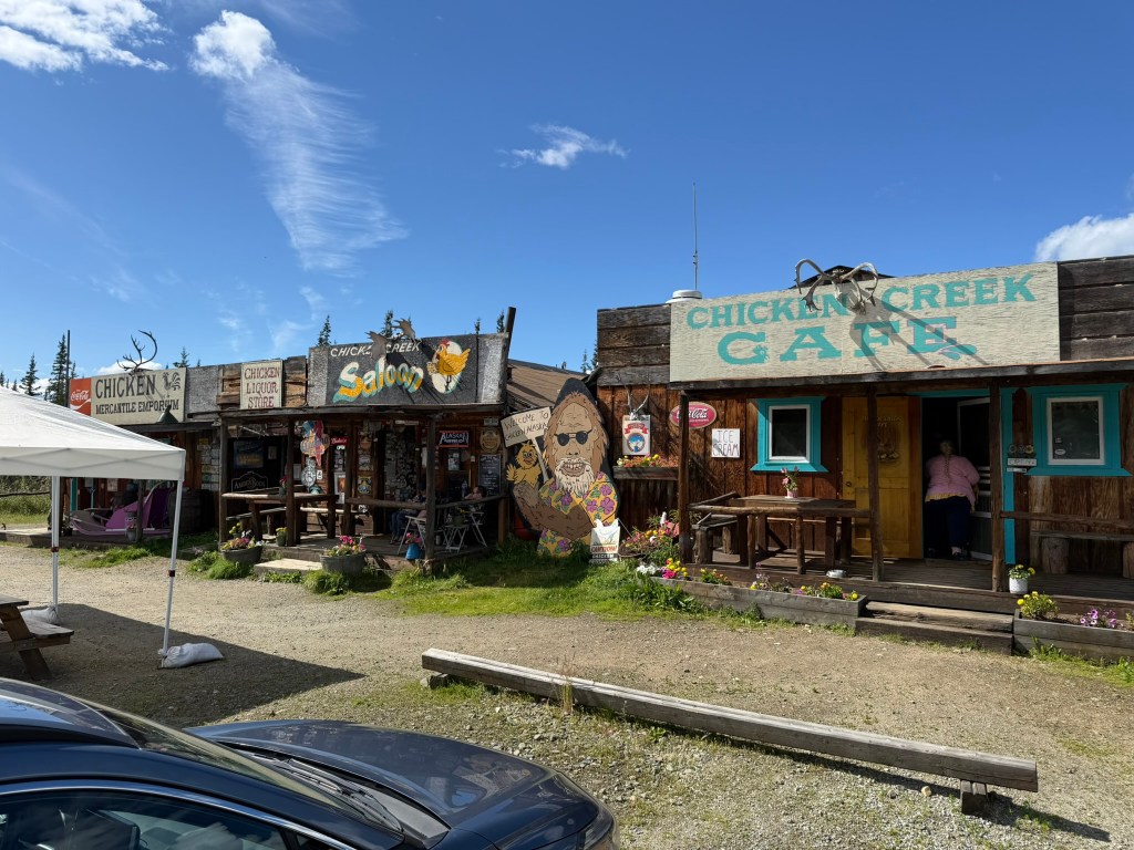
We continued on. All of the signs turned to miles just as we had gotten used to navigating by kilometers. There was amazing scenery all along the road. We eventually reached Chicken, Alaska. I expected it to be a dead, tiny town with very little. It was nothing like we expected. We went to a big shop with souvenirs and supplies. Everything was chicken themed and over the top. We were definitely in the United States. Down the road was the “town,” which was a row consisting of a café, saloon, and a store. It was really something, in good shape, and was clearly a thriving business. Apparently, the “town” is owned by a woman who bought it years ago to run, with a lot of success it seemed.
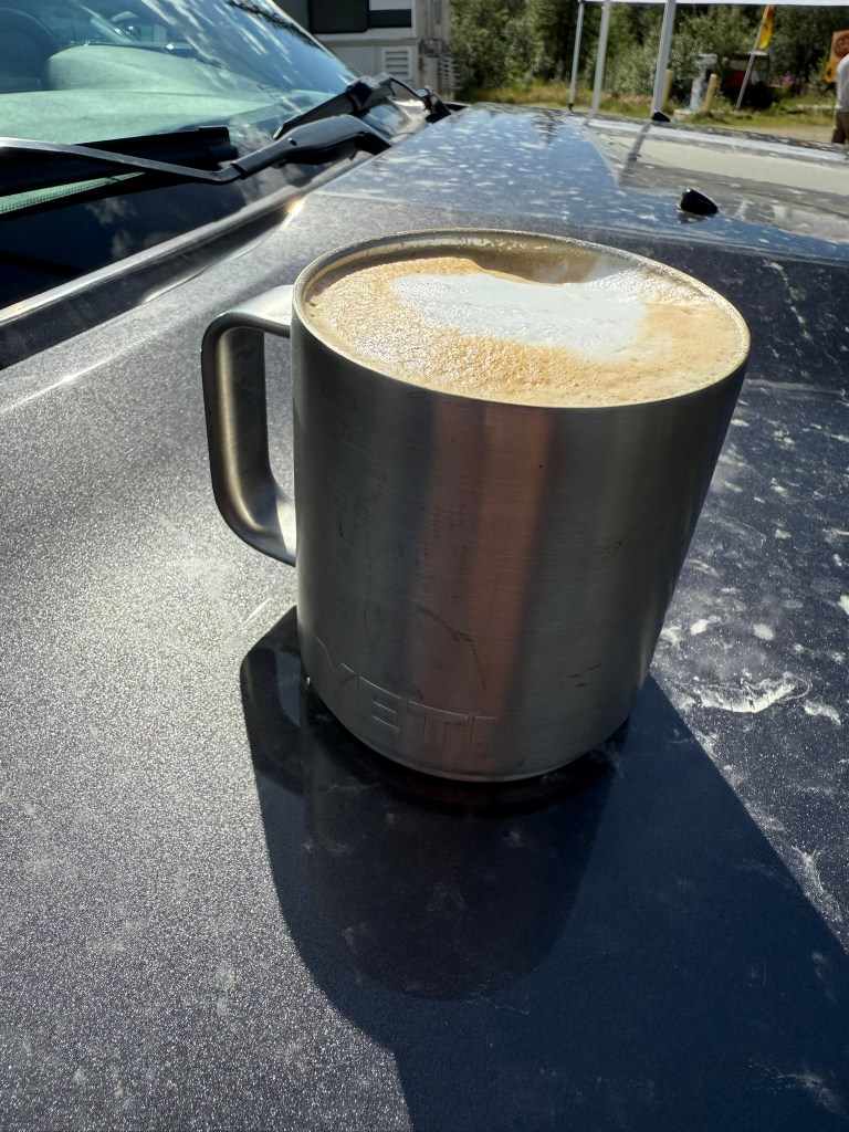
We ate a hearty lunch at the great restaurant, staffed by very nice and hard-working kids. I got the reindeer sausage and Miguel got the chicken pot pie. I ordered a cappuccino to go, and they asked me to bring a to-go cup. I didn’t have much, so they filled my Yeti mug. It was delightful. I also got a fresh-baked chocolate chip cookie. The weather was beautiful, sunny and up to 70 degrees.
It’s hard to explain but it felt so good to be in the US. The difference between coming from small towns in Canada to this tiny American outpost could not have shown more of a contrast. There was a positive spirit everywhere in Alaska. I felt at home. (The improved weather may have had something to do with it.)
Because the road is closed in the winter, Chicken is only open from May to September. There are very few locals. The population of Chicken ranges from about 12 in the winter to 50 in the summer.
We continued down the gravel road, the Taylor Highway, until we reached the paved Alaska Highway. Enormous mountains came within view in the distance – about the highest on the continent – and were quite a sight. We went west about 12 miles to Tok, Alaska, a small town but considerably larger than Chicken. We stopped for gas. At the gas station was an “outpost” with outdoor and hunting supplies, with a large range of guns for sale, including a full complement of assault rifles. We visited a great souvenir shop, and the owner had lived in Tok her life. She was very happy to be there, away from all the noise of the world.
We had a lot of time until we had to return to Whitehorse. We considered staying at a campground in Tok along a river, but after driving through, we figured we were better off driving a while further and looking for a better spot.
The road was being re-paved, which was a good thing because it was in abysmal shape. The Alaska Highway is extremely dangerous with its huge potholes and random dips. You need to really be on your toes. Traffic got very backed up, as we had to repeatedly wait for pilot cars to lead us through the construction. One time, traffic stopped for a very long time while we waited for a pilot car.
The tarp on the window held up pretty well. However, once we got to the Alaska Highway and got up to 60mph, the tarp made a lot of noise and it was clear the airflow was putting much stress on it.
Eventually, we reached the first of two campgrounds in the Tetlin National Wildlife Refuge. We were shocked to find that almost no spots were taken, and we got a great campsite next to a large lake. Looking over the mirrored water, there were large mountains in the distance. The mountains were in St. Elias-Wrangell National Park, the biggest national park in the US. We were really glad to have pushed on to find this place. (We thought at the time that this was the best lakeside campground one could find, but we discovered over the next couple of days how wrong we were.) Even crazier, the campground was free!
We inspected the tarp and saw that the tape had come off along the bottom. I re-taped it, but it was far from perfect.
We made smokies and corn for dinner. There were two squirrels chasing each other around making chit-chit-chit sounds and generally causing trouble. The weather was perfect – sunny and 60s – so I decided to sleep in my tent. I figured it might be the last chance I have. Miguel slept in the camper. In fact, he slept in the camper every night, and while he brought his tent, it became apparent that he never had any intention of using it. (After all, I only slept in a tent two nights.) I made the right decision. I woke up in the middle of the night and could hear an owl hooting and geese honking down at the lake. It was 2am and had gotten pretty dark at that low latitude, but I could still see some sun over the horizon. It was comforting to think that we had absolutely nothing to do the next day and plenty of time to get to Whitehorse.
Day 9: Vacation (August 3, 2025)
I had a good night in the tent. After getting up, I spent a lot of time at the lake staring in peace and quiet. We made oatmeal and coffee and took our time. As soon as we got on the road, there was more construction for a while. I drove.
We soon reached the border and crossed back into Canada. The scenery was amazing, with high mountains to the south and a wide river valley (White River) to the north, and more mountains.
The road was in terrible shape. Sometimes it was nice and then suddenly there was a deep dip or a large hole, or a random stretch of unpaved gravel, all without warning. You had to stay vigilant. Our rear camper door kept opening with the jostling and we had to stop to close it. Multiple times nice people would pull alongside us and tell us it was open. At one point we thought a car was trying to race us, until we realized they were just trying to warn us.
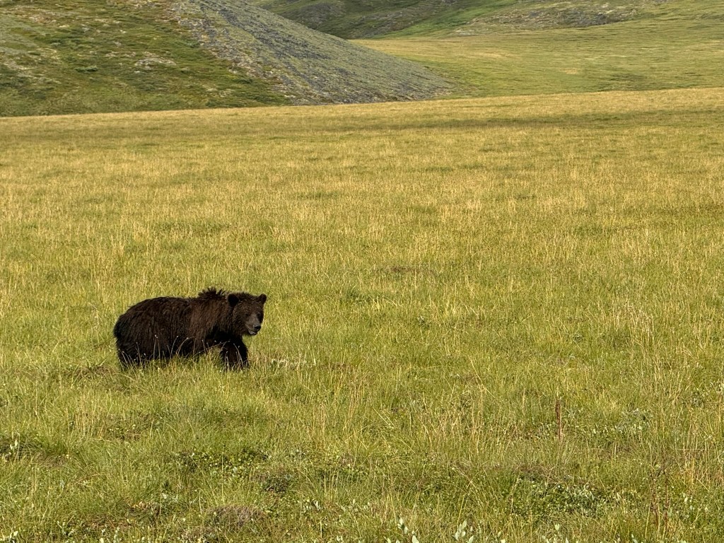
As we were driving, we spotted a big bear on the side of the road, and pulled in to get a closer look.
We stopped at Destruction Bay, which is a tiny town on Kluane Lake, got gas, and had bison burgers at the one restaurant. A ground squirrel got into the restaurant and was running around chitting. It was pretty hilarious, and no one who worked there seemed to care.
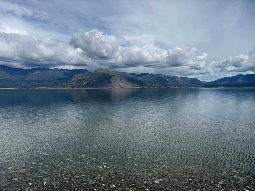
Our plan was to find a good campground early and just take it easy for the day – vacation after a long and arduous journey. Not far from Destruction Bay we found Congdon Creek Campground, right on Kluane Lake. To the south was Kluane National Park, and we could start to see very high mountains covered in snow and even one with a glacier. When we entered the campground, there was a sign announcing that a bear was in the area and tent camping was not allowed outside of an enclosure surrounded by an electric fence.
We were able to find a camping spot on the lake, although the best ones were taken. Shortly after, a German family parked their large RV right next to us, which limited privacy, but the easy lake access was worth it. There was a short path that led to the lake and a wide beach. I waded into the lake up to my knees. The water was crystal clear and cold. The lake was enormous. It was a stunning spot. This lakeside camp definitely surpassed the previous night.
We started an early fire, and we had a ton of time to do nothing. A storm started developing over the mountains across the lake, quickly changing the lake from very calm to extremely rough. The skies darkened and we expected the storm would hit with rain soon. But it never really reached us.
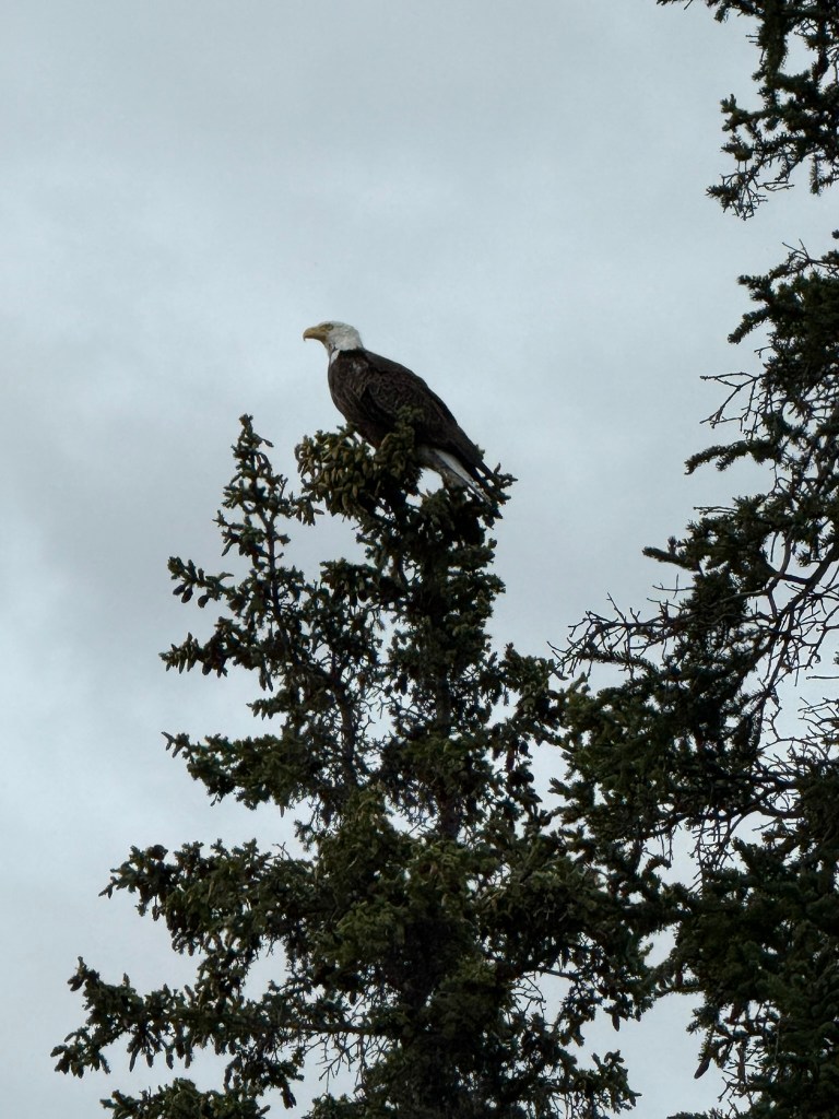
We watched a couple of bald eagles fly around us, and one perched on a treetop for a while right next to our campsite. We cooked sausages over the fire for dinner and sat outside for a while. We had no beer left and drank the last of the bottle of Disaronno. It was at this time that I was able to straighten out the truck door that we had bent, and it looked pretty good.
Day 10: Another Lazy Day (August 4, 2025)
“[N]ature is satisfied, and it satisfies nature, in all moments alike. There is not time to it. But man postpones or remembers; he does not live in the present, but with reverted eye laments the past, or, heedless of the riches that surround him, stands on tiptoe to foresee the future. He cannot be happy and strong until he too lives with nature in the present, above time.” – Ralph Waldo Emerson
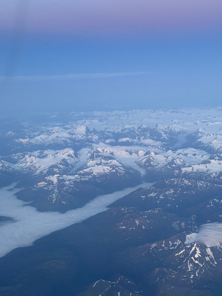
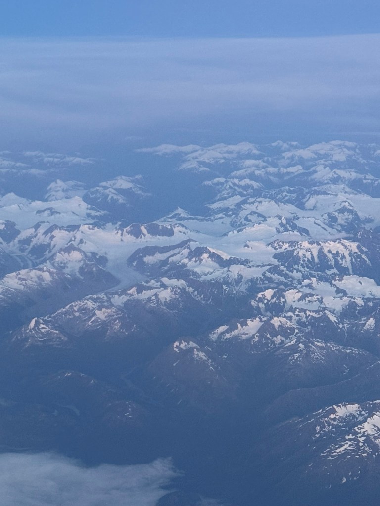
I slept for over 12 hours (in the camper), going to sleep at 8:30pm and waking up at 9am. We made oatmeal and coffee and took our time getting ready. We had nowhere to be. We headed out going east toward Whitehorse. Miguel drove. The mountains to our right got even taller and we could see more glaciers. This was part of Kluane National Park. There are no roads into the park, so it is not accessible except by bush plane or by foot. It is an enormous preserved wilderness, with the tallest mountains in all of Canada (18 out of 20 of the highest in Canada, including the highest point, Mt. Logan). Because there are no roads and we were driving alongside the first ridge of mountains, we could not see beyond. But not much further, over those mountains, are gigantic glaciers filling entire valleys. (I was able to get some pictures when flying over the area from Whitehorse to Vancouver, below.) The National Park includes 8,500 square miles of pure wilderness.
We stopped for lunch at Frosty’s in Haynes Junction and sat outside eating pizza. We went to the Kluane National Park visitors center down the road.
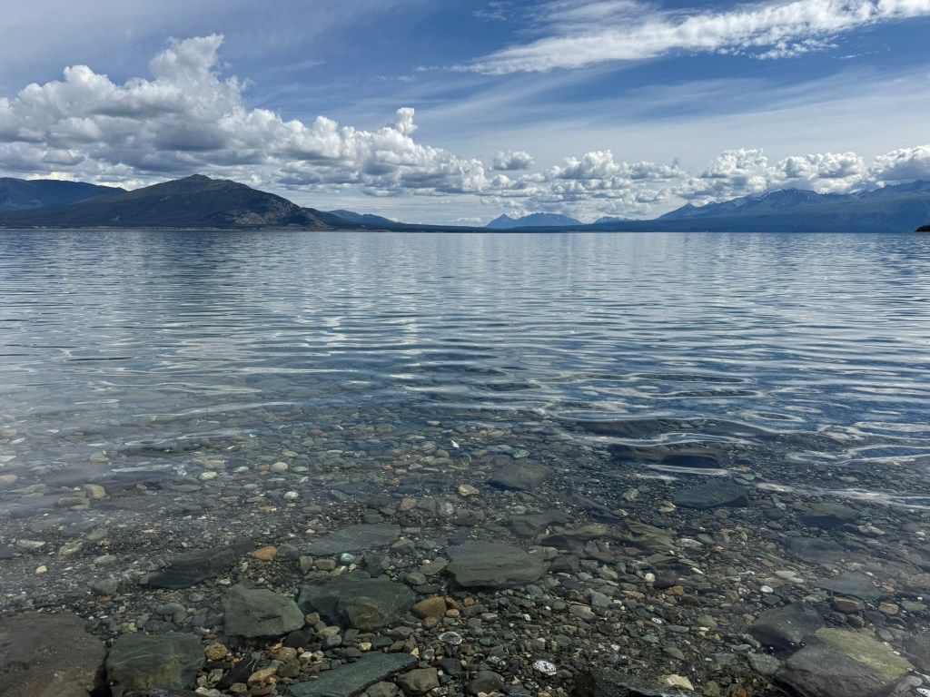
We had to decide where to aim to stay the night, as we were rapidly approaching Whitehorse and had another night to get there, where we had reserved for our last night the same hotel we stayed the first night. After driving for a while, we took a gravel road south to the Kusawa Environmental Park. There were two campgrounds, and we drove 23km to the furthest – the Kusawa Lake Campground. We found a spot right on the lake.
This lake was even more incredible than the last two, and it was absolutely stunning. The water was a clear blue and the lake was surrounded by low mountains. Our campsite abutted a beach stretching along the lake. We took out our camp chairs and sat on the beach awhile. I took a walk a long way along the lake, going in and out of the woods. Back at the site, we made an early fire.
Note that while all the lakeside sites were eventually taken, this campground was otherwise mostly empty, at the height of the summer season. As with the previous two nights.
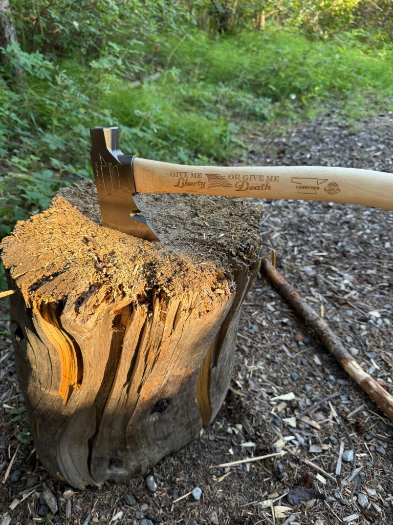
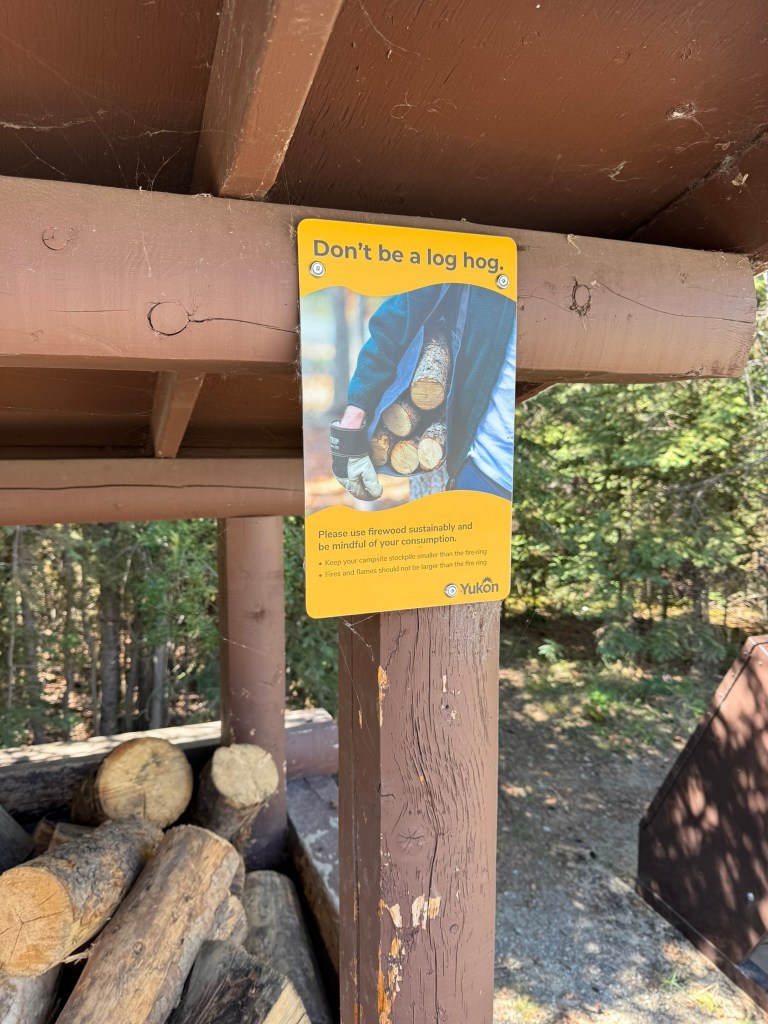
The great thing about campgrounds in the Yukon is there is a ton of free firewood in caches all over the place. The problem is that it is only in large logs, so you need to chop it down into smaller pieces and kindling. My hatchet was solid and the MVP of the trip (after Sage perhaps).
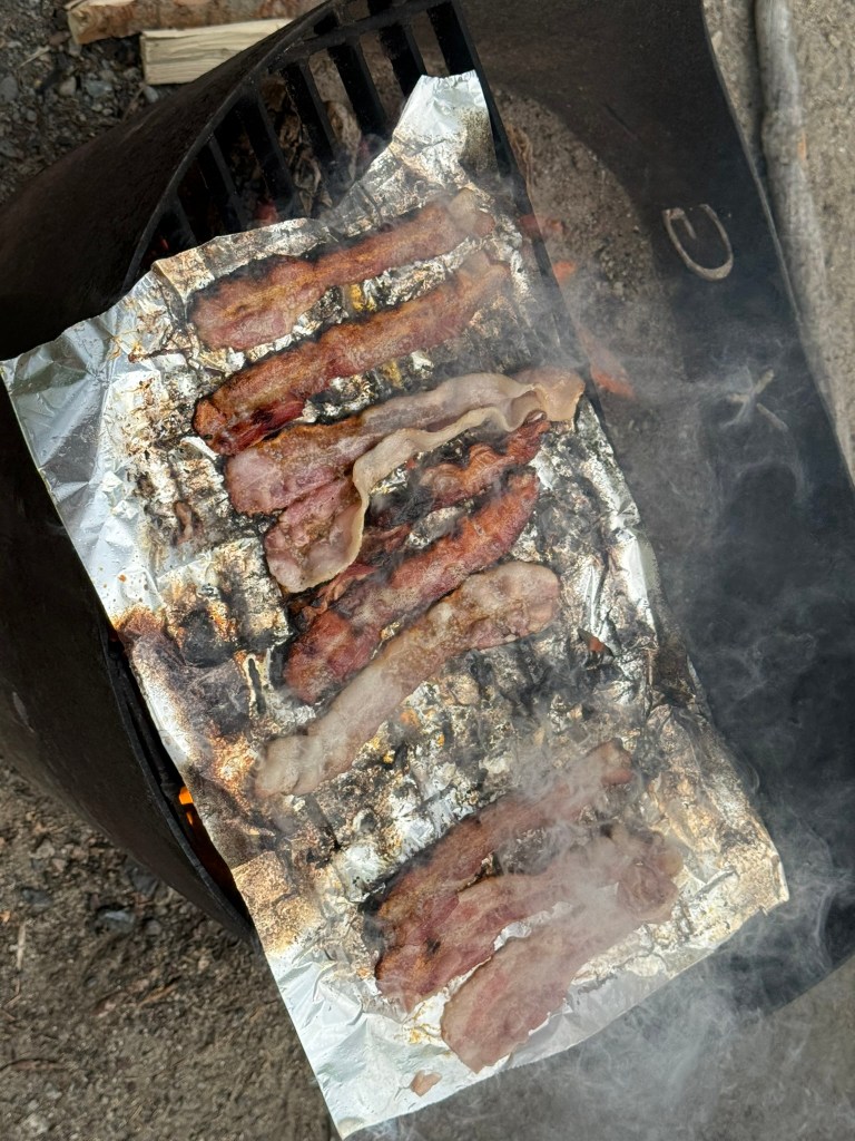
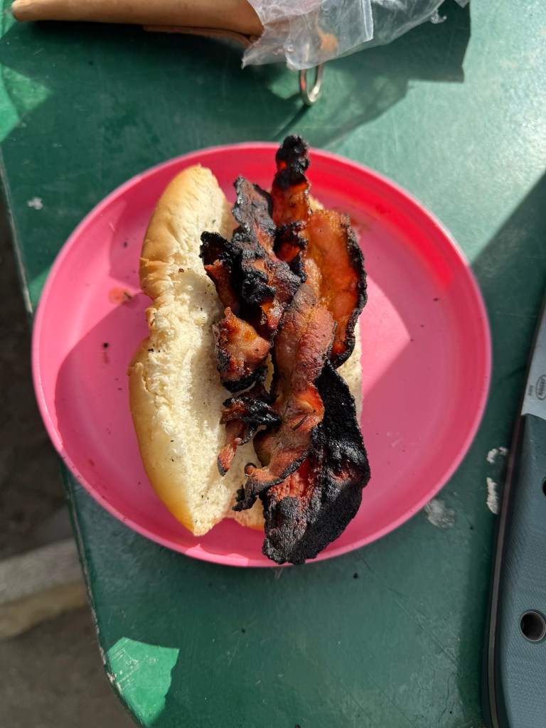
We had reached the end of our food supplies. We finished the chips and had no alcohol. We had bought a packet of bacon, which we cooked over the fire. We laid some aluminum foil over a grill, with the bacon on top. However, when it came time to flip the bacon over, using a small knife as we didn’t have a lot of better options, the grease on the foil caught fire. We desperately tried to pull the bacon off, but the fire became intense. A few of the pieces of bacon completely melted – I didn’t know bacon could be completely obliterated like that. The rest of the bacon was pretty charred.
The only food we had left was a bag of brown rice. Why we bought a bag of brown rice, I have no idea, but we avoided eating it the entire trip. We finally cooked it up. We put some bacon in leftover hot dog buns and other bacon we mashed up into the rice to make it palatable. We drank our last cans of seltzer water. We were left with one protein bar each and no more oatmeal.
It was another beautiful day out, with sunny blue skies. Except, like the previous day, a storm did threaten from over the mountains, and while it got windy and sprinkled a bit of rain, the storm never really reached us.
I organized all of my stuff for the end of our adventure, and in the process, we cleaned out as many glass shards as we could, which were still everywhere.
We went to sleep early. I considered setting up my tent – even right on the beach – but I was just too lazy.
Day 11: Back to Civilization (August 5, 2025)
We set out early, without breakfast or coffee, to Whitehorse. I drove, and we got in about 10am. The road from Haynes Junction to Whitehorse was easily the worst of the trip. The tarp came undone at the bottom of the rear windshield and was pretty loud, but at that point we didn’t care.
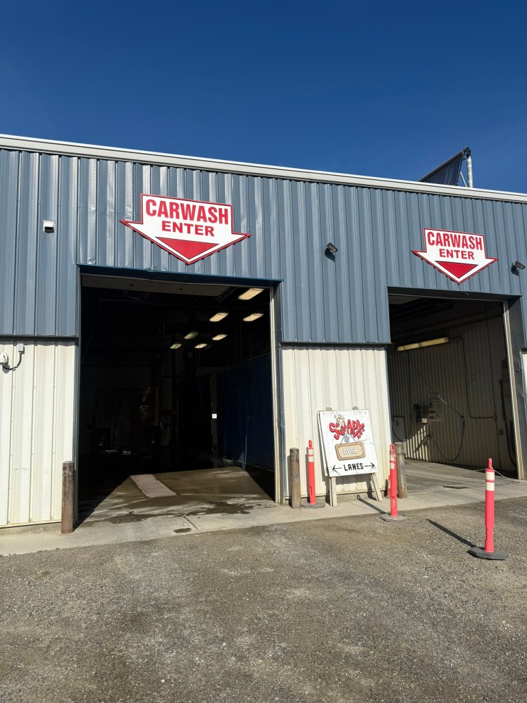
Our goal was to complete all of our errands to close out our trip. We went to Soapy’s to get a wash for Sage, who looked like a cube of dirt – I’ve never seen anything dirtier. When we drove up to the bay, the guy working there let out a “wow.” We opted to pay him to wash it versus us doing it ourselves, which was an excellent decision. We watched him take over 30 minutes to wash it, blasting a shocking amount of dirt and mud off it on to the ground. It was like an archeology dig uncovering the camper beneath. When it was done, Sage was almost unrecognizable – she was beautiful.
The vacuum was broken, so we had to drive around looking for another one. We ended up at Mighty Wash, where we thoroughly vacuumed and wiped down the interior, getting up the rest of the glass. It was a high priority for us to make sure we returned the camper in perfect shape, to mitigate the reaction to the missing rear windshield. We were pretty sure the meat smell had dissipated, but it was hard to tell. We filled up the tank with gas, and when we tried to top off the propane tank, the guy said it was full enough and not to worry about it. (We only used it to cook one meal.)
We stopped downtown and walked around. We had lunch at The Burnt Toast, and I finally got some desperately needed coffee. We visited a few shops. In the light of day, Whitehorse revelead itself to be a very nice little town. It seemed to have everything one would need, was largely walkable in the center, had good infrastructure, and there were a lot of people out and about. It was also another beautiful, warm day.
We decided to then call Beatrice at GoNorth to confess to the windshield issue. She took it pretty well, and was more concerned that we were OK. She didn’t ask when it happened, and we didn’t have to tell her it broke days earlier. She was appreciative of the call.
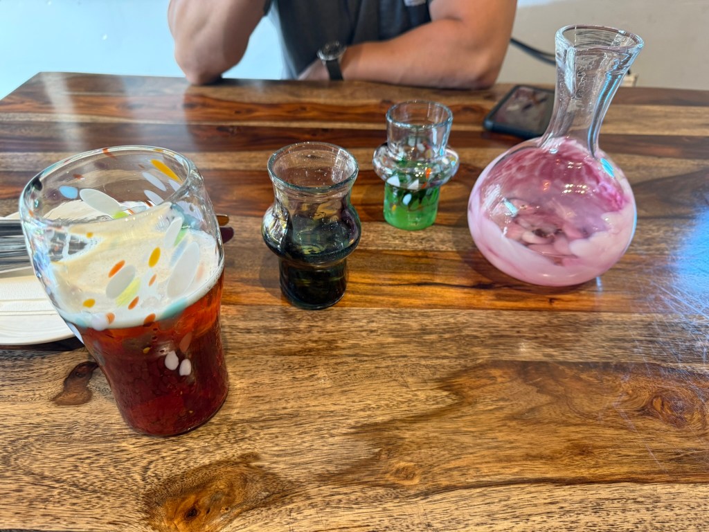
We arrived at the hotel and checked in. I took a much needed shower. We didn’t feel like driving anymore, so we found an excellent restaurant right across the street – Gather Café & Taphouse. It was attached to a glass-blowing studio, and they used beautiful glassware at the restaurant. Their primary food was tacos, and they were fantastic – one of the best meals I had in a while.
After dinner, we then went to the bar at the hotel (the Railwork Lounge) and had some drinks and sourdough waffle sticks for desert. We talked to the bartender who told us a lot about the area and how great Whitehorse is – and how the winters aren’t really that bad.
After vegging out in the hotel for a bit, I went to sleep early, as I had a very early morning the next day. My flight was at 5am. I called to order a taxi to pick me up at 3:30am.
Day 12: The Long Journey Home (August 6, 2025)
I woke up at midnight in a panic that the taxi was not coming early enough to make my flight. I called the taxi place and moved my pick up to 3am. He assured me they would arrive at 2:50am and not to worry. I couldn’t fall back to sleep, and I was downstairs at 2:45. I got a ride to the airport with a very friendly taxi driver. He had lived in Whitehorse for over 30 years and loved it. He also said the winters were fine and you get used to it.
I had nothing to worry about in not being on time. I arrived at the airport at 3am (10 minutes from the hotel), and security was not even open yet. I waited a long time for my flight, zoned out and exhausted. I had a long layover in Vancouver, which was an OK airport to be stuck in – not nearly as good as Denver.
While my flight left at 5am, Miguel’s flight wasn’t until 5:30pm, so he stayed and returned the truck and then hung out around Whitehorse for the day. He informed me of the unfortunate news that we had to pay $750 CAD ($550ish USD) to replace the rear windshield (as well as another chunk of money to pay for the additional miles for our unplanned jaunt to Alaska).
I arrived in Denver on time, but my flight to Billings was delayed by about 7 hours. Just as it was about to be cancelled, in the middle of the night, they were able to leave. I arrived in Billings at about 2am MT, having been awake for over 24 hours. It was a long day to end a long trip. I was glad to be home – except, I wasn’t home. I stayed in a hotel in Billings, and the next morning drove to Cody, WY, heading back to Massachusetts a week later.
It was quite an adventure.
Now, what’s next?
“Why don’t we go to North America?”
“North America? But how?”
“On La Poderosa, man.”
“The trip was decided just like that, and it never erred from the basic principle laid down in that moment: improvisation.” – Che Guevara

Leave a comment